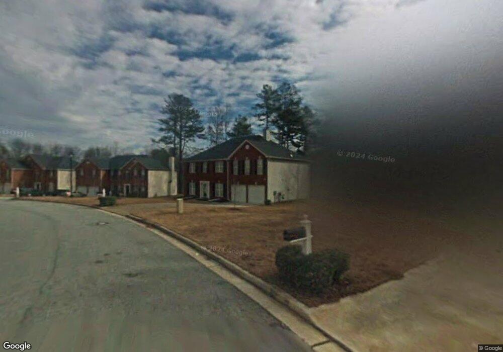
1919 Waterfront Way Conley, GA 30288
Southwest DeKalb NeighborhoodEstimated Value: $354,000 - $387,000
4
Beds
3
Baths
3,310
Sq Ft
$110/Sq Ft
Est. Value
About This Home
This home is located at 1919 Waterfront Way, Conley, GA 30288 and is currently estimated at $364,587, approximately $110 per square foot. 1919 Waterfront Way is a home located in DeKalb County with nearby schools including Cedar Grove Elementary School, Cedar Grove Middle School, and Cedar Grove High School.
Ownership History
Date
Name
Owned For
Owner Type
Purchase Details
Closed on
Oct 8, 2004
Sold by
Eastland Homes Inc
Bought by
Neal Anthony B
Current Estimated Value
Home Financials for this Owner
Home Financials are based on the most recent Mortgage that was taken out on this home.
Original Mortgage
$38,100
Interest Rate
5.72%
Mortgage Type
New Conventional
Purchase Details
Closed on
Jul 7, 2004
Sold by
Dozier Dev Co Llc
Bought by
Eastland Homes Inc
Home Financials for this Owner
Home Financials are based on the most recent Mortgage that was taken out on this home.
Original Mortgage
$136,800
Interest Rate
5.91%
Create a Home Valuation Report for This Property
The Home Valuation Report is an in-depth analysis detailing your home's value as well as a comparison with similar homes in the area
Home Values in the Area
Average Home Value in this Area
Purchase History
| Date | Buyer | Sale Price | Title Company |
|---|---|---|---|
| Neal Anthony B | $190,300 | -- | |
| Eastland Homes Inc | $8,000 | -- |
Source: Public Records
Mortgage History
| Date | Status | Borrower | Loan Amount |
|---|---|---|---|
| Previous Owner | Neal Anthony B | $38,100 | |
| Previous Owner | Eastland Homes Inc | $136,800 |
Source: Public Records
Tax History Compared to Growth
Tax History
| Year | Tax Paid | Tax Assessment Tax Assessment Total Assessment is a certain percentage of the fair market value that is determined by local assessors to be the total taxable value of land and additions on the property. | Land | Improvement |
|---|---|---|---|---|
| 2025 | $4,001 | $137,280 | $24,360 | $112,920 |
| 2024 | $3,847 | $125,080 | $24,360 | $100,720 |
| 2023 | $3,847 | $146,280 | $24,360 | $121,920 |
| 2022 | $3,713 | $121,320 | $24,360 | $96,960 |
| 2021 | $3,091 | $94,400 | $17,960 | $76,440 |
| 2020 | $2,195 | $64,960 | $17,960 | $47,000 |
| 2019 | $2,445 | $81,080 | $17,960 | $63,120 |
| 2018 | $1,300 | $64,960 | $17,960 | $47,000 |
| 2017 | $1,434 | $42,000 | $18,060 | $23,940 |
| 2016 | $1,401 | $42,000 | $18,060 | $23,940 |
| 2014 | $1,397 | $42,000 | $17,960 | $24,040 |
Source: Public Records
Map
Nearby Homes
- 1816 Cedar Walk Ln
- 4414 Parmalee Path
- 2373 Brookgate Way
- 2614 Brookgate Crossing
- 1905 Cedar Walk Ln
- 1775 Cedar Grove Rd
- Everest III Plan at Cedar Grove Commons
- Westin Plan at Cedar Grove Commons
- Oakmont Plan at Cedar Grove Commons
- Zoey II Plan at Cedar Grove Commons
- 2029 Cedar Grove Rd
- 3819 Village Crossing Ln
- 2264 Silver Maple Cir Unit 176
- 4205 Old House Dr
- 4134 James Lake Dr
- 1677 Cedar Grove Rd
- 3891 Village Crossing Ln
- 4329 Cedar Valley Ln
- 2146 Silva Ct
- 4179 Williamson Rd
- 1913 Waterfront Way
- 1925 Waterfront Way
- 1907 Waterfront Way
- 1931 Waterfront Way
- 1924 Waterfront Way
- 1908 Waterfront Way
- 1937 Waterfront Way
- 1937 Waterfront Way Unit 86
- 4540 Parmalee Path
- 4502 Parmalee Path Unit 78
- 4502 Parmalee Path
- 1900 Waterfront Way
- 4546 Parmalee Path
- 4506 Parmalee Path
- 4516 Parmalee Path
- 4498 Parmalee Path
- 1943 Waterfront Way
- 1944 Waterfront Way
- 4494 Parmalee Path
- 4552 Parmalee Path