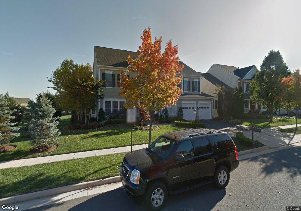
19194 Burnt Bridge Dr Leesburg, VA 20176
Estimated Value: $1,158,000 - $1,417,000
5
Beds
5
Baths
4,325
Sq Ft
$306/Sq Ft
Est. Value
About This Home
This home is located at 19194 Burnt Bridge Dr, Leesburg, VA 20176 and is currently estimated at $1,325,505, approximately $306 per square foot. 19194 Burnt Bridge Dr is a home located in Loudoun County with nearby schools including Steuart W. Weller Elementary School, Belmont Ridge Middle, and Riverside High.
Ownership History
Date
Name
Owned For
Owner Type
Purchase Details
Closed on
Sep 8, 2025
Sold by
Bancroft Kenneth D and Bancroft Diane L
Bought by
Bancroft Family Revocable Joint Trust and Bancroft
Current Estimated Value
Purchase Details
Closed on
Dec 15, 2010
Sold by
Huber Karl B
Bought by
Bancroft Kenneth D
Home Financials for this Owner
Home Financials are based on the most recent Mortgage that was taken out on this home.
Original Mortgage
$616,000
Interest Rate
4.23%
Mortgage Type
New Conventional
Purchase Details
Closed on
Dec 2, 2003
Sold by
Van Metre Homes Llc
Bought by
Sabatini Yvonne
Home Financials for this Owner
Home Financials are based on the most recent Mortgage that was taken out on this home.
Original Mortgage
$544,300
Interest Rate
6.09%
Mortgage Type
New Conventional
Create a Home Valuation Report for This Property
The Home Valuation Report is an in-depth analysis detailing your home's value as well as a comparison with similar homes in the area
Home Values in the Area
Average Home Value in this Area
Purchase History
| Date | Buyer | Sale Price | Title Company |
|---|---|---|---|
| Bancroft Family Revocable Joint Trust | -- | None Listed On Document | |
| Bancroft Kenneth D | $770,000 | -- | |
| Sabatini Yvonne | $680,385 | -- |
Source: Public Records
Mortgage History
| Date | Status | Borrower | Loan Amount |
|---|---|---|---|
| Previous Owner | Bancroft Kenneth D | $616,000 | |
| Previous Owner | Sabatini Yvonne | $544,300 |
Source: Public Records
Tax History Compared to Growth
Tax History
| Year | Tax Paid | Tax Assessment Tax Assessment Total Assessment is a certain percentage of the fair market value that is determined by local assessors to be the total taxable value of land and additions on the property. | Land | Improvement |
|---|---|---|---|---|
| 2025 | $10,598 | $1,316,500 | $338,500 | $978,000 |
| 2024 | $10,051 | $1,161,910 | $298,500 | $863,410 |
| 2023 | $9,053 | $1,034,590 | $298,500 | $736,090 |
| 2022 | $8,727 | $980,560 | $258,500 | $722,060 |
| 2021 | $8,328 | $849,810 | $228,500 | $621,310 |
| 2020 | $8,276 | $799,600 | $228,500 | $571,100 |
| 2019 | $8,243 | $788,810 | $228,500 | $560,310 |
| 2018 | $8,101 | $746,680 | $228,500 | $518,180 |
| 2017 | $8,218 | $730,470 | $228,500 | $501,970 |
| 2016 | $8,219 | $717,780 | $0 | $0 |
| 2015 | $8,072 | $482,650 | $0 | $482,650 |
| 2014 | $7,982 | $482,540 | $0 | $482,540 |
Source: Public Records
Map
Nearby Homes
- 43802 Lees Mill Square
- 19296 Creek Field Cir
- 43915 Kittiwake Dr
- 19111 Chartier Dr
- 19121 Eagle Mine Terrace
- 19059 Coral Reef Square
- 43899 Siren Song Terrace
- 43919 Maritime Song Terrace
- 18989 Coral Reef Square
- 19272 Koslowski Square
- 19264 Koslowski Square
- 19060 Arroyo Terrace
- 19408 Susquehanna Square
- 19293 Harlow Square
- 43613 Mcdowell Square
- 19365 Cypress Ridge Terrace Unit 1102
- 19355 Cypress Ridge Terrace Unit 114
- 19355 Cypress Ridge Terrace Unit 406
- 19355 Cypress Ridge Terrace Unit 509
- 19355 Cypress Ridge Terrace Unit 423
- 19198 Burnt Bridge Dr
- 19202 Burnt Bridge Dr
- 19227 Coton Hall St
- 19195 Burnt Bridge Dr
- 19231 Coton Hall St
- 19199 Burnt Bridge Dr
- 19219 Coton Hall St
- 19203 Burnt Bridge Dr
- 19245 Creek Field Cir
- 19235 Coton Hall St
- 19215 Coton Hall St
- 19253 Creek Field Cir
- 43474 Riverpoint Dr
- 43470 Riverpoint Dr
- 19111 Peaceful Stream Dr
- 19211 Coton Hall St
- 19239 Coton Hall St
- 19107 Peaceful Stream Dr
- 43466 Riverpoint Dr
- 19226 Coton Hall St