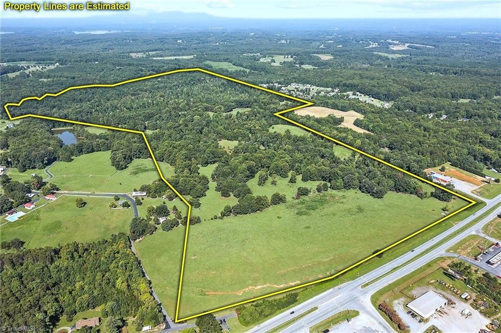
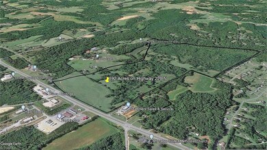
192.74 AC Us Highway 220 Stokesdale, NC 27357
Estimated payment $29,770/month
Highlights
- Home fronts a pond
- Pond
- No HOA
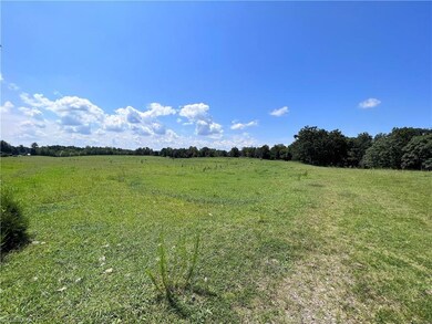
- 192.74 Acre Lot
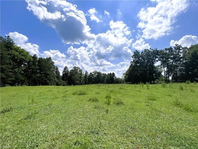
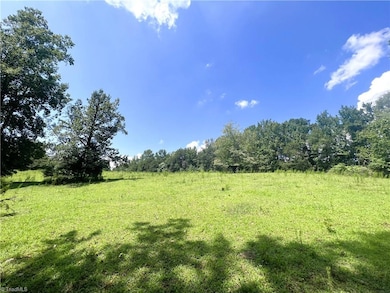
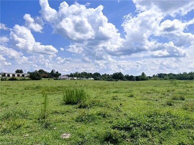
- Partially Wooded Lot
- Pasture
About This Lot
One of the last large parcels in expanding SW Rockingham County,along Highway 220/I-73. Unlimited Possibilities.Great Commercial Potential within the Rock Co "Economic Development" land use plan for future growth.Road frontage on Highway 220 (I-73 Corridor) & Ram Loop.Rolling acreage.Public Water On-Site and public sewer lines across Hwy 220.Located 2 miles north of Hwy 68/Hwy 220 interchange and South Rockingham Corporate Park.Less than 30 minutes to PTI airport, FED-EX Hub, VA border, & multiple Triad NC cities.
Property Details
Property Type
- Land
Est. Annual Taxes
- $402
Lot Details
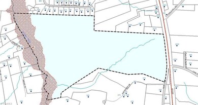
- 192.74 Acre Lot
- Home fronts a pond
- Home fronts a stream
- Property fronts an interstate
- Partially Fenced Property
- Level Lot
- Cleared Lot
- Partially Wooded Lot
- Property is zoned RA
Schools
- Western Rockingham Middle School
- Mcmichael High School
Farming
- Pasture
Listing and Financial Details
- Assessor Parcel Number 179781
Community Details
Overview
- No Home Owners Association
Recreation
- Pond
- Stream or River on Lot
Map
Home Values in the Area
Average Home Value in this Area
Tax History
| Year | Tax Paid | Tax Assessment Tax Assessment Total Assessment is a certain percentage of the fair market value that is determined by local assessors to be the total taxable value of land and additions on the property. | Land | Improvement |
|---|---|---|---|---|
| 2025 | $402 | $2,046,608 | $2,046,608 | $0 |
| 2024 | $382 | $2,046,608 | $2,046,608 | $0 |
| 2023 | $436 | $779,975 | $779,975 | $0 |
| 2022 | $423 | $779,975 | $779,975 | $0 |
| 2021 | $423 | $779,975 | $779,975 | $0 |
| 2020 | $423 | $779,975 | $779,975 | $0 |
| 2019 | $423 | $779,975 | $779,975 | $0 |
| 2018 | $363 | $616,087 | $616,087 | $0 |
Property History
| Date | Event | Price | Change | Sq Ft Price |
|---|---|---|---|---|
| 05/19/2023 05/19/23 | Pending | -- | -- | -- |
| 08/29/2022 08/29/22 | For Sale | $5,500,000 | -- | -- |
Purchase History
| Date | Type | Sale Price | Title Company |
|---|---|---|---|
| Interfamily Deed Transfer | -- | None Available |
Source: Triad MLS
MLS Number: 1081531
APN: 79130093821200
Disclaimer: Certain information contained herein is derived from information provided by parties other than Homes.com. All information provided is deemed reliable, but is not guaranteed to be accurate and should be independently verified.
![]() Copyright 2025 Triad MLS, Inc. All rights reserved. IDX information is provided exclusively for personal, non-commercial use, and may not be used for any purpose other than to identify prospective properties consumers may be interested in purchasing. Information is deemed reliable but not guaranteed. This site will be monitored for ‘scraping’ and any use of search facilities of data on the site other than by potential buyers/sellers is prohibited. All Sale data is for informational purposes only and is not an indication of a market analysis or appraisal. Properties marked with the Triad MLS, Inc. icon are provided courtesy of the Triad MLS, Inc.’s, Internet Data Exchange Database.
Copyright 2025 Triad MLS, Inc. All rights reserved. IDX information is provided exclusively for personal, non-commercial use, and may not be used for any purpose other than to identify prospective properties consumers may be interested in purchasing. Information is deemed reliable but not guaranteed. This site will be monitored for ‘scraping’ and any use of search facilities of data on the site other than by potential buyers/sellers is prohibited. All Sale data is for informational purposes only and is not an indication of a market analysis or appraisal. Properties marked with the Triad MLS, Inc. icon are provided courtesy of the Triad MLS, Inc.’s, Internet Data Exchange Database.
- 173 Carlton Rd
- 105 Levington Way
- 110 Levington Way
- 505 Dogwood Acres Ln
- 184 Providence Trail
- 183 Providence Trail
- 460 Gold Hill Rd
- 126 Scenic View Trail
- 120 Scenic View Trail
- 1264 Washburn Rd
- 1510 Griffin Rd
- Belhaven Plan at Neal Farm
- Freeport Plan at Neal Farm
- Penwell Plan at Neal Farm
- Taylor Plan at Neal Farm
- 158 W Farm Loop
- 190 E Farm Loop
- 173 E Farm Loop
- 177 E Farm Loop
- 844 Gideon Grove Church Rd
