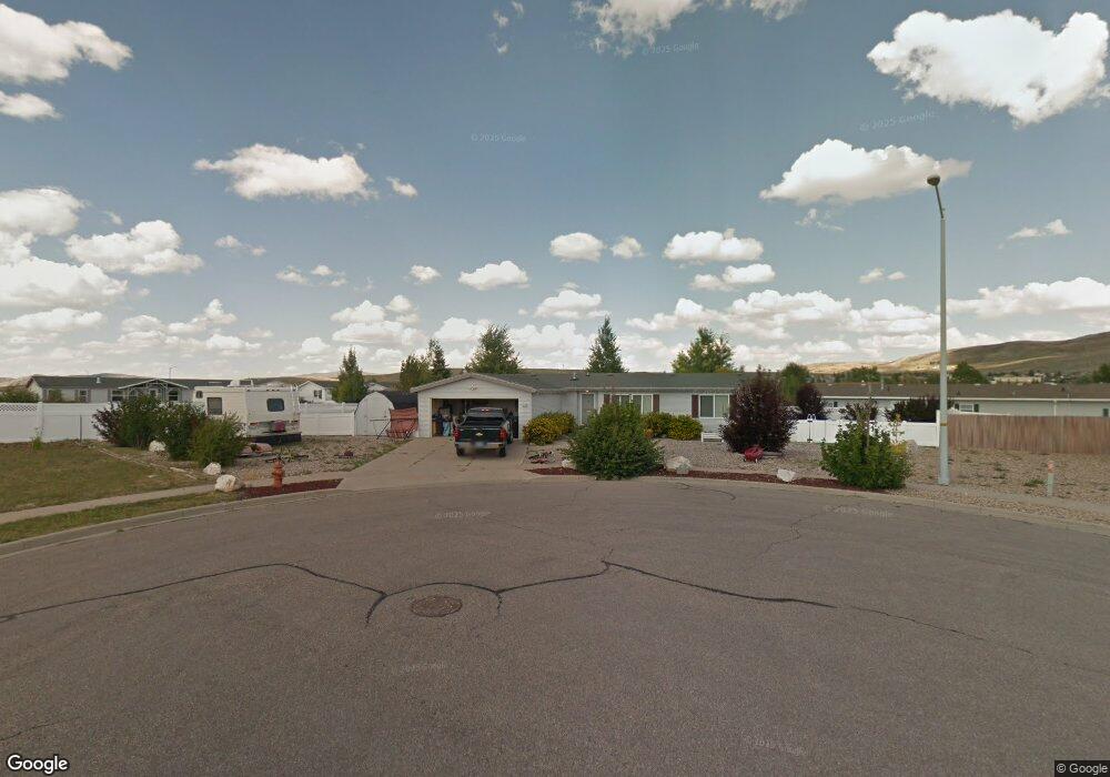
192 Arrowhead Cir Evanston, WY 82930
Estimated Value: $269,000 - $364,000
3
Beds
2
Baths
1,876
Sq Ft
$167/Sq Ft
Est. Value
About This Home
This home is located at 192 Arrowhead Cir, Evanston, WY 82930 and is currently estimated at $313,725, approximately $167 per square foot. 192 Arrowhead Cir is a home located in Uinta County with nearby schools including Evanston High School and Evanston Child Development Center.
Ownership History
Date
Name
Owned For
Owner Type
Purchase Details
Closed on
Jul 10, 2013
Sold by
Cullum George R
Bought by
Brown Jerry A and Brown Kelly L
Current Estimated Value
Home Financials for this Owner
Home Financials are based on the most recent Mortgage that was taken out on this home.
Original Mortgage
$120,000
Outstanding Balance
$86,925
Interest Rate
3.83%
Mortgage Type
New Conventional
Estimated Equity
$226,800
Create a Home Valuation Report for This Property
The Home Valuation Report is an in-depth analysis detailing your home's value as well as a comparison with similar homes in the area
Purchase History
| Date | Buyer | Sale Price | Title Company |
|---|---|---|---|
| Brown Jerry A | -- | None Available |
Source: Public Records
Mortgage History
| Date | Status | Borrower | Loan Amount |
|---|---|---|---|
| Open | Brown Jerry A | $120,000 |
Source: Public Records
Tax History
| Year | Tax Paid | Tax Assessment Tax Assessment Total Assessment is a certain percentage of the fair market value that is determined by local assessors to be the total taxable value of land and additions on the property. | Land | Improvement |
|---|---|---|---|---|
| 2025 | $1,608 | $12,188 | $3,233 | $8,955 |
| 2024 | $1,608 | $23,656 | $6,466 | $17,190 |
| 2023 | $1,629 | $24,083 | $5,138 | $18,945 |
| 2022 | $1,674 | $24,588 | $5,089 | $19,499 |
| 2021 | $1,368 | $20,072 | $4,002 | $16,070 |
| 2020 | $1,161 | $17,046 | $2,225 | $14,821 |
| 2019 | $1,164 | $17,122 | $2,225 | $14,897 |
| 2018 | $0 | $16,236 | $1,777 | $14,459 |
| 2017 | $975 | $14,356 | $1,968 | $12,388 |
| 2016 | $984 | $14,472 | $1,968 | $12,504 |
| 2015 | -- | $14,631 | $1,968 | $12,663 |
| 2014 | -- | $14,911 | $0 | $0 |
Source: Public Records
Map
Nearby Homes
- 313 Wright Way
- 326 Wright Way
- 233 Tomahawk Dr
- 310 Ottley Dr
- 325 Davis Dr
- .24 acres Davis Dr
- 115 Kachina Dr
- 91 Lodgepole Dr
- 3893 Yellow Creek Rd
- 3925 Yellow Creek Rd
- 3827 Yellow Creek Rd
- 3861 Yellow Creek Rd
- 342 Alpine Cir
- 338 Alpine Cir
- 2884 lot #1119 Yellowcreek Rd
- 631 Stahley Ave
- 479 Twin Ridge Ave
- 223 Barber Ave
- 221 Barber Ave
- 427 Thayer Cir
- 188 Arrowhead Cir Unit Arrowhead Drive
- 191 Gannett Dr
- 193 Arrowhead Cir
- 193 Arrowhead Cir
- 197 Gannett Dr
- 321 Gannett Dr
- 312 Arrowhead Dr
- 324 Arrowhead Dr
- 316 Gannett Dr
- 194 Gannett Dr
- 188 Gannett Dr
- 322 Gannett Dr
- 190 Elliot Dr
- 312 Gannett Dr
- 186 Elliot Dr
- 200 Gannett Dr
- 184 Gannett Dr
- 184 Gannett Dr Unit Arrowhead
- 328 Gannett Dr
- 328 Gannett Dr Unit Elliot
Your Personal Tour Guide
Ask me questions while you tour the home.