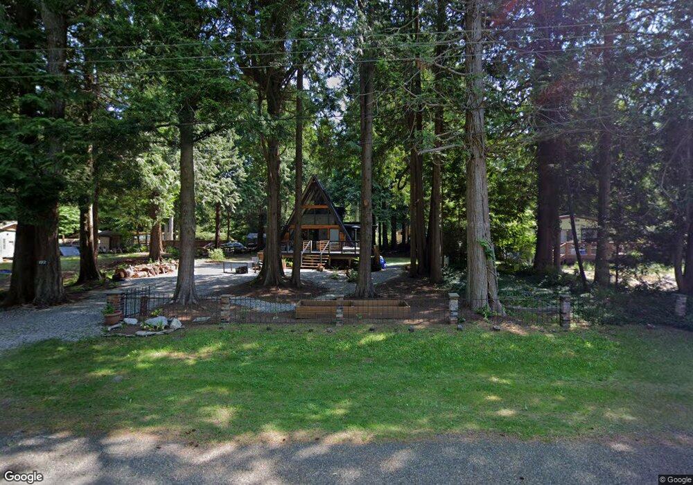
192 Burns Way Point Roberts, WA 98281
Estimated Value: $296,000 - $340,000
2
Beds
1
Bath
1,088
Sq Ft
$291/Sq Ft
Est. Value
About This Home
This home is located at 192 Burns Way, Point Roberts, WA 98281 and is currently estimated at $316,624, approximately $291 per square foot. 192 Burns Way is a home located in Whatcom County with nearby schools including Point Roberts Primary School, Blaine Middle School, and Blaine High School.
Ownership History
Date
Name
Owned For
Owner Type
Purchase Details
Closed on
Oct 7, 2016
Sold by
Lang Vivian Joan
Bought by
Dockery Edward and Dockery Laurie
Current Estimated Value
Home Financials for this Owner
Home Financials are based on the most recent Mortgage that was taken out on this home.
Original Mortgage
$156,000
Outstanding Balance
$125,222
Interest Rate
3.5%
Mortgage Type
New Conventional
Estimated Equity
$191,402
Purchase Details
Closed on
Aug 7, 2013
Sold by
Ehlig Ruth W
Bought by
Lang Christopher Michael and Lang Vivian Joan
Create a Home Valuation Report for This Property
The Home Valuation Report is an in-depth analysis detailing your home's value as well as a comparison with similar homes in the area
Home Values in the Area
Average Home Value in this Area
Purchase History
| Date | Buyer | Sale Price | Title Company |
|---|---|---|---|
| Dockery Edward | $156,000 | Whatcom Land Title | |
| Lang Christopher Michael | $120,280 | Chicago Title Insurance |
Source: Public Records
Mortgage History
| Date | Status | Borrower | Loan Amount |
|---|---|---|---|
| Open | Dockery Edward | $156,000 |
Source: Public Records
Tax History Compared to Growth
Tax History
| Year | Tax Paid | Tax Assessment Tax Assessment Total Assessment is a certain percentage of the fair market value that is determined by local assessors to be the total taxable value of land and additions on the property. | Land | Improvement |
|---|---|---|---|---|
| 2024 | $2,046 | $244,894 | $102,383 | $142,511 |
| 2023 | $2,046 | $235,586 | $93,075 | $142,511 |
| 2022 | $1,306 | $215,147 | $85,000 | $130,147 |
| 2021 | $1,301 | $118,068 | $32,102 | $85,966 |
| 2020 | $1,300 | $109,321 | $29,724 | $79,597 |
| 2019 | $1,215 | $104,864 | $28,512 | $76,352 |
| 2018 | $1,048 | $94,271 | $25,632 | $68,639 |
| 2017 | $910 | $90,034 | $24,480 | $65,554 |
| 2016 | $1,010 | $88,269 | $24,000 | $64,269 |
| 2015 | $1,074 | $95,472 | $32,847 | $62,625 |
| 2014 | -- | $99,808 | $34,340 | $65,468 |
| 2013 | -- | $95,455 | $32,980 | $62,475 |
Source: Public Records
Map
Nearby Homes
- 1871 Johnson Rd
- 1 Mill Rd
- 2 Mill Rd
- 245 Shady Glen Ave
- 1931 Sanders Ct Unit 11
- 8 Heather Way
- 125 Park Dr
- 25 Roosevelt Way
- 2 Benson Rd
- 0 3 73 Acres Derby Ave
- 0 6 39 Acres South Beach Rd
- 168 Tyee Dr
- 158 Tyee Dr
- Lot 2 Greenwood Dr
- 17 Lot Massey Way
- lot 14 Cedar Park Dr Unit 14
- 103 Goodman Rd
- 2138 Benson Rd
- 2145 Fir St
- 1976 Cedar Park Dr
- 198 Burns Way
- 186 Burns Way
- 1842 Washington Dr
- 180 Burns Way
- 1840 Washington Dr
- 1846 Washington Dr
- 1831 Johnson Rd
- 173 Burns Way
- 1850 Washington Dr
- 1843 Washington Dr
- 1845 Washington Dr
- 192 Mill Rd
- 190 Mill Rd
- 196 Mill Rd
- 25 Burns Way
- 1847 Washington Dr
- 1852 Washington Dr
- 1815 Johnson Rd
- 1849 Washington Dr
- 156 Burns Way