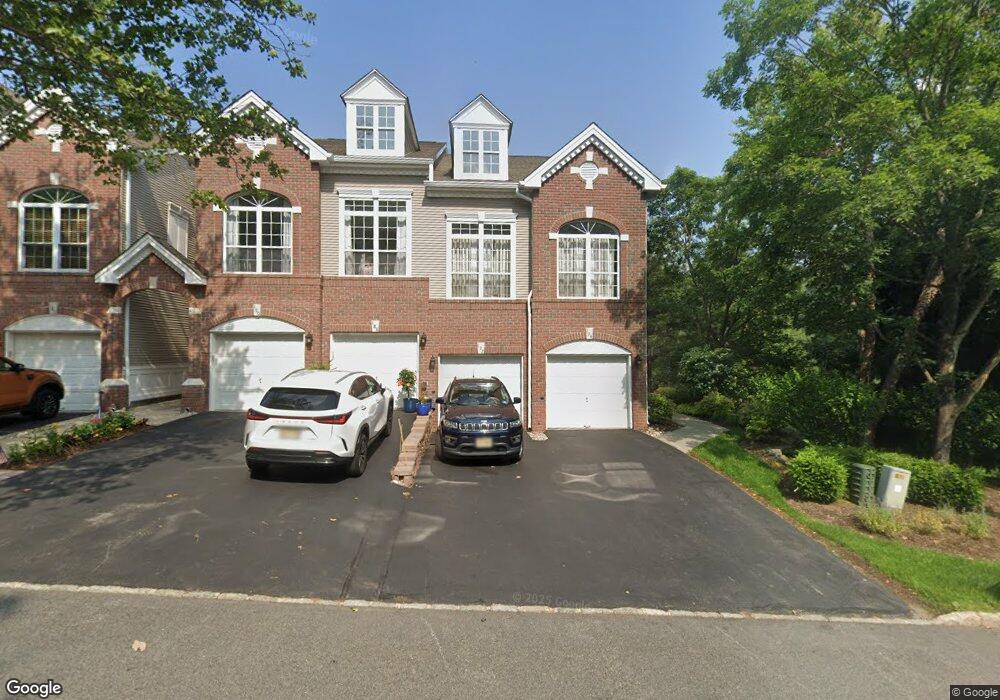
192 Carter Rd Haskell, NJ 07420
Estimated Value: $458,000 - $653,000
Studio
--
Bath
1,473
Sq Ft
$360/Sq Ft
Est. Value
About This Home
This home is located at 192 Carter Rd, Haskell, NJ 07420 and is currently estimated at $530,249, approximately $359 per square foot. 192 Carter Rd is a home located in Passaic County with nearby schools including Lakeland Reg High School and St Marys School.
Ownership History
Date
Name
Owned For
Owner Type
Purchase Details
Closed on
Nov 29, 2011
Sold by
Cheng Andrew A and Lim Lindawati
Bought by
Federico Joseph and Federico Milissa
Current Estimated Value
Home Financials for this Owner
Home Financials are based on the most recent Mortgage that was taken out on this home.
Original Mortgage
$210,000
Outstanding Balance
$143,516
Interest Rate
3.99%
Mortgage Type
Purchase Money Mortgage
Estimated Equity
$386,733
Purchase Details
Closed on
Oct 29, 2009
Sold by
Alur Hemant H and Kulkarni She
Bought by
Cheng Andrew A and Lim Lindawati
Home Financials for this Owner
Home Financials are based on the most recent Mortgage that was taken out on this home.
Original Mortgage
$287,693
Interest Rate
5.01%
Mortgage Type
FHA
Purchase Details
Closed on
Aug 20, 2004
Sold by
Carroll Charles
Bought by
Alur Hemant and Kulkarni She
Home Financials for this Owner
Home Financials are based on the most recent Mortgage that was taken out on this home.
Original Mortgage
$256,000
Interest Rate
6.01%
Create a Home Valuation Report for This Property
The Home Valuation Report is an in-depth analysis detailing your home's value as well as a comparison with similar homes in the area
Home Values in the Area
Average Home Value in this Area
Purchase History
| Date | Buyer | Sale Price | Title Company |
|---|---|---|---|
| Federico Joseph | $280,000 | -- | |
| Cheng Andrew A | $293,000 | -- | |
| Alur Hemant | $320,000 | -- |
Source: Public Records
Mortgage History
| Date | Status | Borrower | Loan Amount |
|---|---|---|---|
| Open | Federico Joseph | $210,000 | |
| Previous Owner | Cheng Andrew A | $287,693 | |
| Previous Owner | Alur Hemant | $256,000 |
Source: Public Records
Tax History
| Year | Tax Paid | Tax Assessment Tax Assessment Total Assessment is a certain percentage of the fair market value that is determined by local assessors to be the total taxable value of land and additions on the property. | Land | Improvement |
|---|---|---|---|---|
| 2025 | $10,817 | $250,800 | $65,000 | $185,800 |
| 2024 | $10,601 | $250,800 | $65,000 | $185,800 |
| 2022 | $10,378 | $250,800 | $65,000 | $185,800 |
| 2021 | $10,152 | $250,800 | $65,000 | $185,800 |
| 2020 | $10,040 | $250,800 | $65,000 | $185,800 |
| 2019 | $9,799 | $250,800 | $65,000 | $185,800 |
| 2018 | $9,606 | $250,800 | $65,000 | $185,800 |
| 2017 | $9,380 | $250,800 | $65,000 | $185,800 |
| 2016 | $9,149 | $250,800 | $65,000 | $185,800 |
| 2015 | $9,019 | $250,800 | $65,000 | $185,800 |
| 2014 | $8,841 | $250,800 | $65,000 | $185,800 |
Source: Public Records
Map
Nearby Homes
- 59 Carter Rd Unit A2
- 30 Decker Rd
- 19 Dogwood Ln Unit 19
- 19 Dogwood Ln Unit U9F
- 72 Burnside Place
- 23 Dogwood Ln
- 36 Elston Ct
- 22 Wanaque Ave
- 1025 Ringwood Ave
- 5 Storms Place
- 9116 Warrens Way Unit 116
- 9116 Warrens Way
- 17 Locust St
- 8212 Warrens Way
- 9411 Warrens Way
- 1099 Ringwood Ave
- 1101 Ringwood Ave
- 126 Jefferson St
- 8415 Warrens Way
- 10323 Warrens Way
- 194 Carter Rd
- 188 Carter Rd
- 190 Carter Rd
- 186 Carter Rd Unit D2
- 184 Carter Rd Unit D1
- 182 Carter Rd
- 180 Carter Rd
- 178 Carter Rd
- 176 Carter Rd
- 174 Carter Rd
- 172 Carter Rd
- 168 Carter Rd Unit H1
- 170 Carter Rd Unit H2
- 164 Carter Rd
- 166 Carter Rd
- 160 Carter Rd
- 162 Carter Rd
- 156 Carter Rd
- 158 Carter Rd Unit E2
- 152 Carter Rd
Your Personal Tour Guide
Ask me questions while you tour the home.