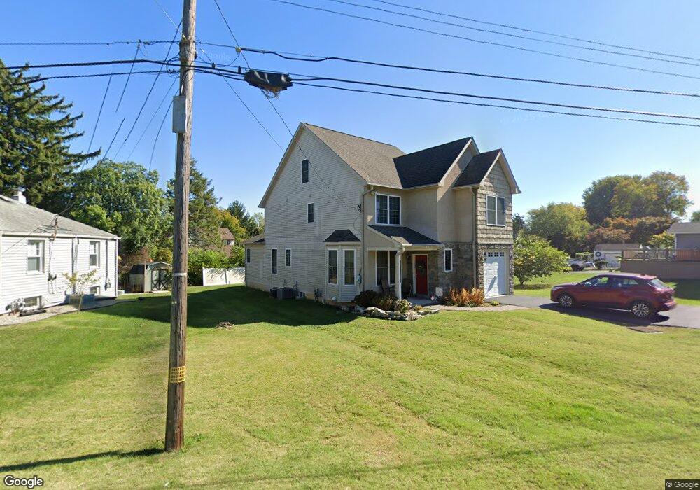
192 David Rd King of Prussia, PA 19406
Estimated Value: $533,000 - $591,509
4
Beds
3
Baths
2,282
Sq Ft
$242/Sq Ft
Est. Value
About This Home
This home is located at 192 David Rd, King of Prussia, PA 19406 and is currently estimated at $553,127, approximately $242 per square foot. 192 David Rd is a home located in Montgomery County with nearby schools including Candlebrook Elementary School, Upper Merion Middle School, and Upper Merion High School.
Ownership History
Date
Name
Owned For
Owner Type
Purchase Details
Closed on
Feb 21, 2020
Sold by
Hubbard George and Hubbard Irma
Bought by
Hubbard Trust
Current Estimated Value
Purchase Details
Closed on
Jan 25, 2008
Sold by
Cadugan Carol
Bought by
Hubbard Irma and Hubbard George
Home Financials for this Owner
Home Financials are based on the most recent Mortgage that was taken out on this home.
Original Mortgage
$375,000
Interest Rate
5.75%
Purchase Details
Closed on
Oct 26, 2007
Sold by
Horan Timothy F
Bought by
Cadugan Carol
Create a Home Valuation Report for This Property
The Home Valuation Report is an in-depth analysis detailing your home's value as well as a comparison with similar homes in the area
Home Values in the Area
Average Home Value in this Area
Purchase History
| Date | Buyer | Sale Price | Title Company |
|---|---|---|---|
| Hubbard Trust | -- | None Available | |
| Hubbard Irma | $40,000 | None Available | |
| Cadugan Carol | -- | None Available |
Source: Public Records
Mortgage History
| Date | Status | Borrower | Loan Amount |
|---|---|---|---|
| Previous Owner | Hubbard Irma | $375,000 |
Source: Public Records
Tax History Compared to Growth
Tax History
| Year | Tax Paid | Tax Assessment Tax Assessment Total Assessment is a certain percentage of the fair market value that is determined by local assessors to be the total taxable value of land and additions on the property. | Land | Improvement |
|---|---|---|---|---|
| 2025 | $4,975 | $161,430 | -- | -- |
| 2024 | $4,975 | $161,430 | -- | -- |
| 2023 | $4,799 | $161,430 | $0 | $0 |
| 2022 | $4,593 | $161,430 | $0 | $0 |
| 2021 | $4,451 | $161,430 | $0 | $0 |
| 2020 | $4,253 | $161,430 | $0 | $0 |
| 2019 | $4,181 | $161,430 | $0 | $0 |
| 2018 | $4,181 | $161,430 | $0 | $0 |
| 2017 | $4,031 | $161,430 | $0 | $0 |
| 2016 | $3,968 | $161,430 | $0 | $0 |
| 2015 | $3,822 | $161,430 | $0 | $0 |
| 2014 | $3,822 | $161,430 | $0 | $0 |
Source: Public Records
Map
Nearby Homes
- 318 Manor Ln Unit 10
- Penwyn Elite Plan at Stonebrook at Upper Merion - Townes Collection
- Wyndale Elite Plan at Stonebrook at Upper Merion - Townes Collection
- Carisbrooke Elite Plan at Stonebrook at Upper Merion - Townes Collection
- Brentford Elite Plan at Stonebrook at Upper Merion - Townes Collection
- Avonwood Elite Plan at Stonebrook at Upper Merion - Townes Collection
- Brentford Plan at Stonebrook at Upper Merion - Townes Collection
- Carisbrooke Plan at Stonebrook at Upper Merion - Townes Collection
- 315 Aspen Way Unit HS 163- CARISBROOKE
- 112 Ivy Ln
- 313 Aspen Way
- 313 Aspen Way Unit HS 164- BRENTFORD
- 319 Aspen Way
- 832 Bush St
- 205 8th St
- 432 Crooked Ln
- 34 7th St
- 634 Coates Ln
- 615 Green St
- 78 W Rambo St
- 198 Glenwood Rd
- 190 David Rd
- 200 Glenwood Rd
- 167 Charles St
- 163 Charles St
- 171 Charles St
- 159 Charles St
- 202 Glenwood Rd
- 175 Charles St
- 204 Glenwood Rd
- 155 Charles St
- 203 Charles St
- 206 Glenwood Rd
- 207 Glenwood Rd
- 208 Glenwood Rd
- 172 Charles St
- 160 Charles St
- 147 Charles St
- 207 Charles St
- 210 Glenwood Rd