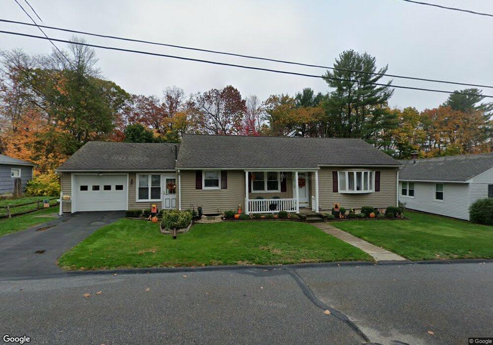
192 Dawes Ave Torrington, CT 06790
Estimated Value: $291,000 - $312,000
3
Beds
1
Bath
1,272
Sq Ft
$238/Sq Ft
Est. Value
About This Home
This home is located at 192 Dawes Ave, Torrington, CT 06790 and is currently estimated at $303,362, approximately $238 per square foot. 192 Dawes Ave is a home located in Litchfield County with nearby schools including Torrington Middle School, Torrington High School, and St. John Paul the Great Academy.
Ownership History
Date
Name
Owned For
Owner Type
Purchase Details
Closed on
Nov 26, 1996
Sold by
Lagamba Diane M
Bought by
Lagamba Susanm
Current Estimated Value
Home Financials for this Owner
Home Financials are based on the most recent Mortgage that was taken out on this home.
Original Mortgage
$80,000
Outstanding Balance
$7,986
Interest Rate
7.5%
Mortgage Type
Unknown
Estimated Equity
$295,377
Purchase Details
Closed on
May 27, 1993
Sold by
Brothwell Earl F
Bought by
Lagamba Diana M
Home Financials for this Owner
Home Financials are based on the most recent Mortgage that was taken out on this home.
Original Mortgage
$88,000
Interest Rate
7.41%
Mortgage Type
Unknown
Create a Home Valuation Report for This Property
The Home Valuation Report is an in-depth analysis detailing your home's value as well as a comparison with similar homes in the area
Home Values in the Area
Average Home Value in this Area
Purchase History
| Date | Buyer | Sale Price | Title Company |
|---|---|---|---|
| Lagamba Susanm | $100,000 | -- | |
| Lagamba Diana M | $110,000 | -- |
Source: Public Records
Mortgage History
| Date | Status | Borrower | Loan Amount |
|---|---|---|---|
| Open | Lagamba Diana M | $80,000 | |
| Previous Owner | Lagamba Diana M | $88,000 |
Source: Public Records
Tax History Compared to Growth
Tax History
| Year | Tax Paid | Tax Assessment Tax Assessment Total Assessment is a certain percentage of the fair market value that is determined by local assessors to be the total taxable value of land and additions on the property. | Land | Improvement |
|---|---|---|---|---|
| 2025 | $7,474 | $194,390 | $30,520 | $163,870 |
| 2024 | $4,719 | $98,380 | $30,550 | $67,830 |
| 2023 | $4,718 | $98,380 | $30,550 | $67,830 |
| 2022 | $4,638 | $98,380 | $30,550 | $67,830 |
| 2021 | $4,542 | $98,380 | $30,550 | $67,830 |
| 2020 | $4,542 | $98,380 | $30,550 | $67,830 |
| 2019 | $4,254 | $92,130 | $33,950 | $58,180 |
| 2018 | $4,254 | $92,130 | $33,950 | $58,180 |
| 2017 | $4,215 | $92,130 | $33,950 | $58,180 |
| 2016 | $4,215 | $92,130 | $33,950 | $58,180 |
| 2015 | $4,215 | $92,130 | $33,950 | $58,180 |
| 2014 | $4,211 | $115,930 | $45,500 | $70,430 |
Source: Public Records
Map
Nearby Homes
- 35 Woodland Rd
- 115 Margerie St
- 96 Edward Ave
- 775 Main St
- 839 Main St Unit 65
- 839 Main St Unit 13
- 839 Main St Unit 91
- 839 Main St Unit 84
- 839 Main St Unit 96
- 230 Winsted Rd
- 00 Winthrop St & E Elm St
- 105 E Elm St
- 183 Brightwood Ave
- 57 Doman Dr
- 38 Surrey Ln Unit 38
- 58 Doman Dr
- 168 Newfield Rd
- 482 Main St
- 0 Queens Rd
- 17 Prospect Place
- 186 Dawes Ave
- 208 Dawes Ave
- 491 Brightwood Ave
- 483 Brightwood Ave
- 170 Dawes Ave
- 220 Dawes Ave
- 204 Northridge Ave
- 499 Brightwood Ave
- 22 Woodland Rd
- 191 Margerie St
- 14 Woodland Rd
- 190 Northridge Ave
- 160 Dawes Ave
- 509 Brightwood Ave
- 185 Margerie St
- 34 Woodland Rd
- 480 Brightwood Ave
- 199 Margerie St
- 519 Brightwood Ave
- 175 Margerie St