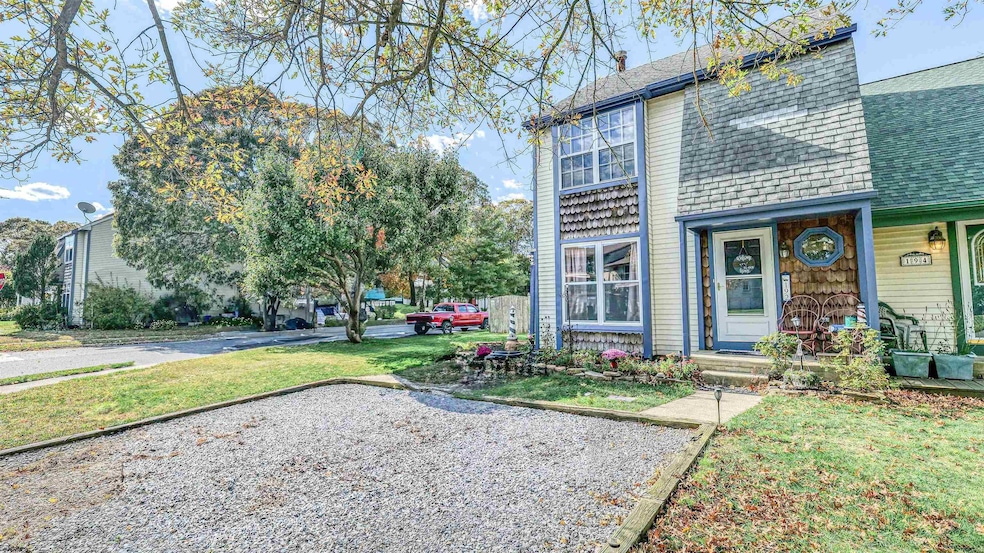
192 Exton Rd Somers Point, NJ 08244
Estimated payment $1,959/month
Highlights
- Cathedral Ceiling
- Porch
- Patio
- Mainland Regional High School Rated A-
- Walk-In Closet
- Shed
About This Home
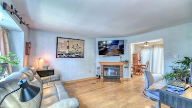
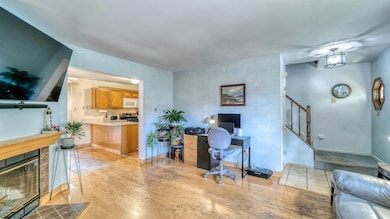
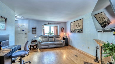
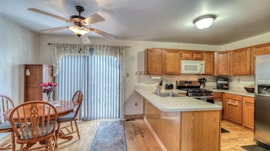
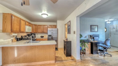
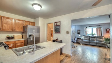
This rare end unit 2 Bed bath and half home is located on a corner lot in the heart of Somers Point. The entry way welcomes you with soaring cathedral ceilings and a large living area with a wood fireplace for cozy winter evenings. The galley style kitchen has all newer appliances with ample space to cook and dine while enjoying the view out the rear sliders to the patio. The large fenced in back yard has an extended patio with a large gazebo for all your grilling and entertaining needs or simply enjoying the sunset and relaxation. There are 2 sheds for storage included with the sale of the home. The HVAC unit was replaced in 2023. The home has no HOA fees. Home is being sold with a 1yr Home Choice Warranty given to buyer at closing. Owner had recent termite inspection without any problems (9/25) Gutters have a lifetime warranty also Minutes from Ocean City beaches and AC casinos, close to near by Ventnor and Margate restaurants.

Home Details
Home Type
- Single Family
Est. Annual Taxes
- $4,577
Year Built
- Built in 1987
Lot Details
- Lot Dimensions are 108x44
- Fenced
Home Design
- Aluminum Siding
- Cedar Siding
Interior Spaces
- 2-Story Property
- Cathedral Ceiling
- Wood Burning Fireplace
- Drapes & Rods
- Blinds
- Crawl Space
Kitchen
- Stove
- Microwave
- Dishwasher
Bedrooms and Bathrooms
- 2 Bedrooms
- Walk-In Closet
Laundry
- Dryer
- Washer
Home Security
- Storm Screens
- Fire and Smoke Detector
Parking
- 2 Parking Spaces
- Stone Driveway
Outdoor Features
- Patio
- Shed
- Porch
Utilities
- Central Air
- Heating System Uses Natural Gas
- Gas Water Heater
Listing and Financial Details
- Tax Lot 23
Map
Home Values in the Area
Average Home Value in this Area
Tax History
| Year | Tax Paid | Tax Assessment Tax Assessment Total Assessment is a certain percentage of the fair market value that is determined by local assessors to be the total taxable value of land and additions on the property. | Land | Improvement |
|---|---|---|---|---|
| 2025 | $4,577 | $128,000 | $44,500 | $83,500 |
| 2024 | $4,577 | $128,000 | $44,500 | $83,500 |
| 2023 | $4,276 | $128,000 | $44,500 | $83,500 |
| 2022 | $4,276 | $128,000 | $44,500 | $83,500 |
| 2021 | $4,212 | $128,000 | $44,500 | $83,500 |
| 2020 | $4,127 | $128,000 | $44,500 | $83,500 |
| 2019 | $4,010 | $128,000 | $44,500 | $83,500 |
| 2018 | $3,926 | $128,000 | $44,500 | $83,500 |
| 2017 | $3,785 | $128,000 | $44,500 | $83,500 |
| 2016 | $3,613 | $128,000 | $44,500 | $83,500 |
| 2015 | $3,576 | $128,000 | $44,500 | $83,500 |
| 2014 | $3,456 | $128,000 | $44,500 | $83,500 |
Property History
| Date | Event | Price | List to Sale | Price per Sq Ft |
|---|---|---|---|---|
| 11/13/2025 11/13/25 | Pending | -- | -- | -- |
| 10/22/2025 10/22/25 | Price Changed | $299,900 | -4.8% | -- |
| 09/05/2025 09/05/25 | Price Changed | $315,000 | -1.6% | -- |
| 08/01/2025 08/01/25 | Price Changed | $320,000 | -1.5% | -- |
| 06/27/2025 06/27/25 | For Sale | $325,000 | -- | -- |
Purchase History
| Date | Type | Sale Price | Title Company |
|---|---|---|---|
| Deed | $119,900 | -- | |
| Bargain Sale Deed | $119,900 | The Title Company Of Jersey | |
| Bargain Sale Deed | $94,000 | The Title Company | |
| Deed | $101,800 | -- |
Mortgage History
| Date | Status | Loan Amount | Loan Type |
|---|---|---|---|
| Open | $82,900 | Purchase Money Mortgage | |
| Closed | $82,900 | No Value Available |
Source: South Jersey Shore Regional MLS
MLS Number: 597723
APN: 21-00529-0000-00023
Disclaimer: Certain information contained herein is derived from information provided by parties other than Homes.com. All information provided is deemed reliable, but is not guaranteed to be accurate and should be independently verified.
![]() IDX information is provided exclusively for personal, non-commercial use, and may not be used for any purpose other than to identify prospective properties consumers may be interested in purchasing.
IDX information is provided exclusively for personal, non-commercial use, and may not be used for any purpose other than to identify prospective properties consumers may be interested in purchasing.
Information is deemed reliable but not guaranteed.
© 2025 South Jersey Shore Regional Multiple Listing Service. All rights reserved.