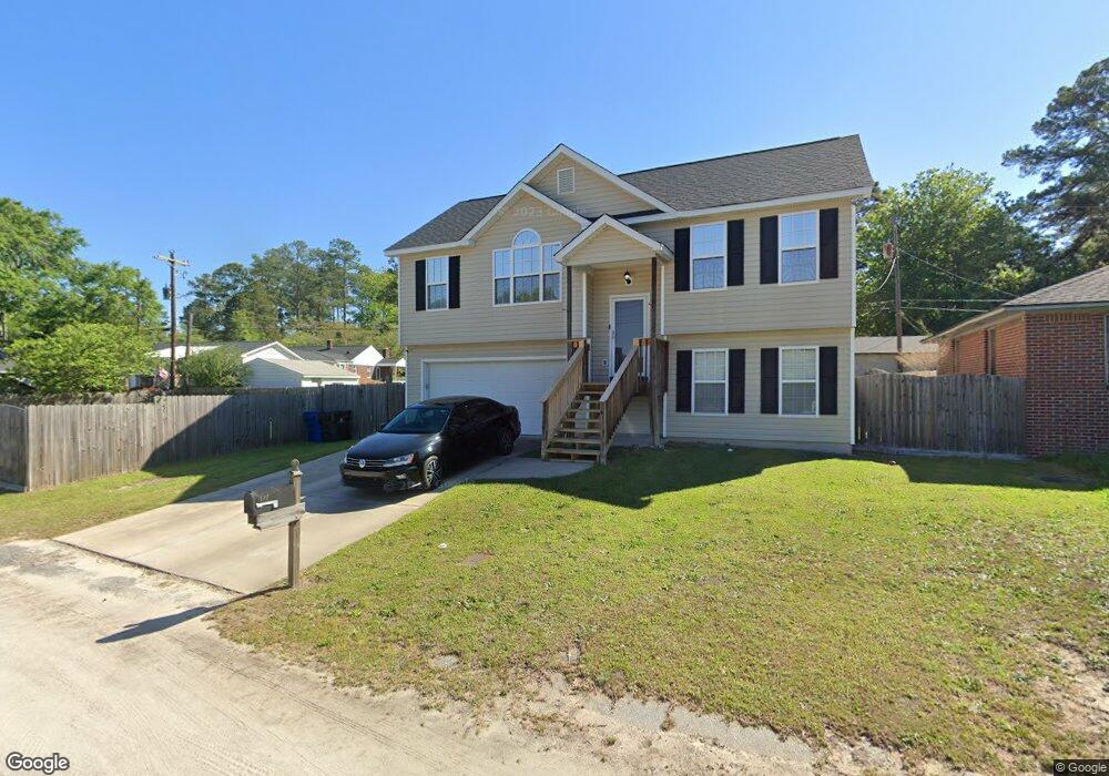
192 Inview Rd West Columbia, SC 29169
Estimated Value: $160,000 - $190,882
3
Beds
3
Baths
920
Sq Ft
$187/Sq Ft
Est. Value
About This Home
This home is located at 192 Inview Rd, West Columbia, SC 29169 and is currently estimated at $172,221, approximately $187 per square foot. 192 Inview Rd is a home located in Lexington County with nearby schools including Riverbank Elementary, Northside Middle, and Brookland-Cayce High School.
Ownership History
Date
Name
Owned For
Owner Type
Purchase Details
Closed on
Jun 9, 2021
Sold by
Clark Franklin L
Bought by
Davis Daquan D
Current Estimated Value
Home Financials for this Owner
Home Financials are based on the most recent Mortgage that was taken out on this home.
Original Mortgage
$130,000
Outstanding Balance
$117,699
Interest Rate
2.9%
Mortgage Type
New Conventional
Estimated Equity
$54,522
Create a Home Valuation Report for This Property
The Home Valuation Report is an in-depth analysis detailing your home's value as well as a comparison with similar homes in the area
Home Values in the Area
Average Home Value in this Area
Purchase History
| Date | Buyer | Sale Price | Title Company |
|---|---|---|---|
| Davis Daquan D | $130,000 | None Available |
Source: Public Records
Mortgage History
| Date | Status | Borrower | Loan Amount |
|---|---|---|---|
| Open | Davis Daquan D | $130,000 |
Source: Public Records
Tax History Compared to Growth
Tax History
| Year | Tax Paid | Tax Assessment Tax Assessment Total Assessment is a certain percentage of the fair market value that is determined by local assessors to be the total taxable value of land and additions on the property. | Land | Improvement |
|---|---|---|---|---|
| 2024 | $994 | $5,200 | $640 | $4,560 |
| 2023 | $994 | $5,200 | $640 | $4,560 |
| 2022 | $2,916 | $7,800 | $960 | $6,840 |
| 2020 | $881 | $4,745 | $640 | $4,105 |
| 2019 | $845 | $4,474 | $600 | $3,874 |
| 2018 | $854 | $4,474 | $600 | $3,874 |
| 2017 | $819 | $4,474 | $600 | $3,874 |
| 2016 | $843 | $4,474 | $600 | $3,874 |
| 2014 | $706 | $4,917 | $600 | $4,317 |
| 2013 | -- | $4,920 | $600 | $4,320 |
Source: Public Records
Map
Nearby Homes
- 2004 Dew Ave
- 106 Earl Ct
- 1615 Holland St
- 165 Cavendish Dr
- 415 Graham St
- 617 Holland Cir
- 1734 C Ave
- 207 Woodhaven Dr
- 215 Sandel Ln
- 1628 C Ave
- 224 17th St
- 212 Alexandria St
- 1802 D Ave
- 1452 C Ave
- 324 N Parson St
- 0 Platt Springs Rd Unit 606355
- 116 Silver Run Place
- 1610 D Ave
- 623 Hook Ave
- 309 Hammond Ave
- 190 Inview Rd
- 189 Pineview Rd
- 187 Pineview Rd
- 193 Pineview Rd
- 188 Inview Rd
- 183 Pineview Rd
- 197 Pineview Rd
- 177 Pineview Rd
- 184 Inview Rd
- 1909 Ann St
- 169 Pineview Rd
- 148 Inview Rd
- 190 Pineview Rd
- 186 Pineview Rd
- 194 Pineview Rd
- 178 Pineview Rd
- 196 Pineview Rd
- 172 Pineview Rd
- 200 Pineview Rd
- 1912 Ann St