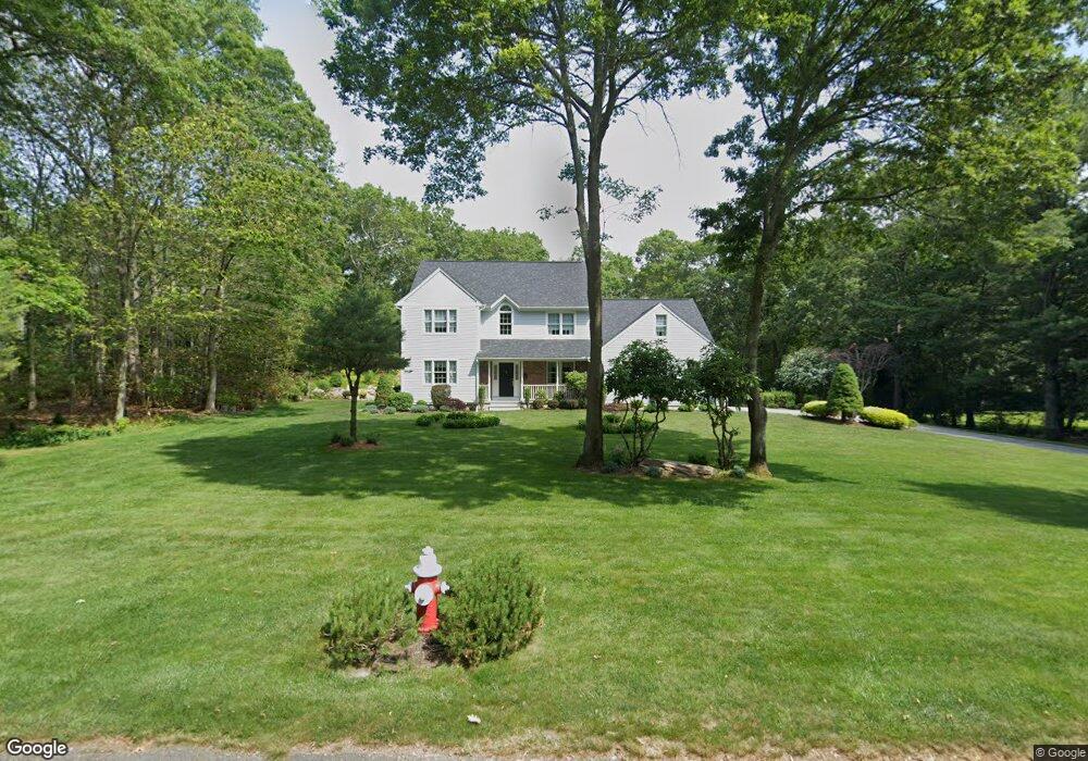
192 Woodridge Dr Saunderstown, RI 02874
Saunderstown NeighborhoodEstimated Value: $886,527 - $1,093,000
4
Beds
3
Baths
2,772
Sq Ft
$370/Sq Ft
Est. Value
About This Home
This home is located at 192 Woodridge Dr, Saunderstown, RI 02874 and is currently estimated at $1,024,382, approximately $369 per square foot. 192 Woodridge Dr is a home located in Washington County with nearby schools including Stony Lane Elementary School, Wickford Middle School, and North Kingstown Sr. High School.
Ownership History
Date
Name
Owned For
Owner Type
Purchase Details
Closed on
Jun 21, 1996
Sold by
Tuckahoe Land Co
Bought by
Andrea Michael E and Andrea Barbara
Current Estimated Value
Home Financials for this Owner
Home Financials are based on the most recent Mortgage that was taken out on this home.
Original Mortgage
$52,000
Interest Rate
8.21%
Create a Home Valuation Report for This Property
The Home Valuation Report is an in-depth analysis detailing your home's value as well as a comparison with similar homes in the area
Home Values in the Area
Average Home Value in this Area
Purchase History
| Date | Buyer | Sale Price | Title Company |
|---|---|---|---|
| Andrea Michael E | $80,000 | -- |
Source: Public Records
Mortgage History
| Date | Status | Borrower | Loan Amount |
|---|---|---|---|
| Open | Andrea Michael E | $100,000 | |
| Open | Andrea Michael E | $194,000 | |
| Closed | Andrea Michael E | $25,000 | |
| Closed | Andrea Michael E | $52,000 |
Source: Public Records
Tax History Compared to Growth
Tax History
| Year | Tax Paid | Tax Assessment Tax Assessment Total Assessment is a certain percentage of the fair market value that is determined by local assessors to be the total taxable value of land and additions on the property. | Land | Improvement |
|---|---|---|---|---|
| 2025 | $9,378 | $849,500 | $318,000 | $531,500 |
| 2024 | $9,737 | $679,000 | $276,400 | $402,600 |
| 2023 | $9,737 | $679,000 | $276,400 | $402,600 |
| 2022 | $9,547 | $679,000 | $276,400 | $402,600 |
| 2021 | $9,137 | $522,100 | $179,800 | $342,300 |
| 2020 | $8,923 | $522,100 | $179,800 | $342,300 |
| 2019 | $8,923 | $522,100 | $179,800 | $342,300 |
| 2018 | $8,497 | $447,900 | $148,300 | $299,600 |
| 2017 | $8,326 | $447,900 | $148,300 | $299,600 |
| 2016 | $8,089 | $447,900 | $148,300 | $299,600 |
| 2015 | $8,110 | $420,200 | $148,300 | $271,900 |
| 2014 | $7,946 | $420,200 | $148,300 | $271,900 |
Source: Public Records
Map
Nearby Homes
- 247 Glen Hill Dr
- 210 Explorer Dr
- 202 Explorer Dr
- 158 Explorer Dr
- 168 Explorer Dr
- 150 Delta Dr
- 470 Sylvan Ct
- 449 Sylvan Ct
- 48 Fieldstone Ln
- 55 Whisper Ln
- 604 Stony Fort Rd
- 0 W Allenton Rd
- 65 Village Hill Ln
- 400 Yawgoo Valley Rd
- 2180 Tower Hill Rd
- 155 Beechwood Hill Trail
- 66 Essex Manor Ln
- 2424 Tower Hill Rd
- 17 Jamaica Way
- 1081 Mooresfield Rd
- 174 Woodridge Dr
- 212 Woodridge Dr
- 193 Woodridge Dr
- 215 Douglas Dr
- 160 Woodridge Dr
- 171 Douglas Dr
- 67 Dale Hill Dr
- 236 Woodridge Dr
- 229 Woodridge Dr
- 210 Douglas Dr
- 161 Douglas Dr
- 192 Douglas Dr
- 228 Douglas Dr
- 136 Woodridge Dr
- 258 Woodridge Dr
- 247 Woodridge Dr
- 174 Douglas Dr
- 66 Dale Hill Dr
- 309 Woodridge Dr
- 0 Woodridge Dr