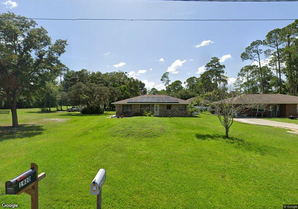
1920 2nd Ave Deland, FL 32724
Estimated Value: $253,000 - $262,752
2
Beds
1
Bath
1,472
Sq Ft
$176/Sq Ft
Est. Value
About This Home
This home is located at 1920 2nd Ave, Deland, FL 32724 and is currently estimated at $258,688, approximately $175 per square foot. 1920 2nd Ave is a home located in Volusia County with nearby schools including Deland High School, George W. Marks Elementary School, and Deland Middle School.
Ownership History
Date
Name
Owned For
Owner Type
Purchase Details
Closed on
Nov 9, 2007
Sold by
Platt John C
Bought by
Platt John C and English Elisabeth
Current Estimated Value
Purchase Details
Closed on
Sep 7, 2001
Sold by
Martin Rudolph V
Bought by
English Elisabeth
Purchase Details
Closed on
Jan 20, 1999
Sold by
Platt John W
Bought by
Platt John C
Purchase Details
Closed on
Mar 15, 1989
Bought by
English Elisabeth
Purchase Details
Closed on
Jan 15, 1976
Bought by
English Elisabeth
Create a Home Valuation Report for This Property
The Home Valuation Report is an in-depth analysis detailing your home's value as well as a comparison with similar homes in the area
Home Values in the Area
Average Home Value in this Area
Purchase History
| Date | Buyer | Sale Price | Title Company |
|---|---|---|---|
| Platt John C | -- | Attorney | |
| English Elisabeth | $3,500 | -- | |
| Platt John C | -- | -- | |
| English Elisabeth | $100 | -- | |
| English Elisabeth | $1,500 | -- |
Source: Public Records
Tax History Compared to Growth
Tax History
| Year | Tax Paid | Tax Assessment Tax Assessment Total Assessment is a certain percentage of the fair market value that is determined by local assessors to be the total taxable value of land and additions on the property. | Land | Improvement |
|---|---|---|---|---|
| 2025 | $1,441 | $109,490 | -- | -- |
| 2024 | $1,441 | $106,405 | -- | -- |
| 2023 | $1,441 | $103,306 | $0 | $0 |
| 2022 | $1,388 | $100,297 | $0 | $0 |
| 2021 | $1,413 | $97,376 | $0 | $0 |
| 2020 | $1,385 | $96,032 | $0 | $0 |
| 2019 | $1,406 | $93,873 | $0 | $0 |
| 2018 | $1,382 | $92,123 | $0 | $0 |
| 2017 | $1,353 | $90,228 | $0 | $0 |
| 2016 | $1,282 | $88,372 | $0 | $0 |
| 2015 | $2,228 | $86,250 | $0 | $0 |
| 2014 | $947 | $65,856 | $0 | $0 |
Source: Public Records
Map
Nearby Homes
- 1875 2nd Ave
- 1965 2nd Ave
- 1972 3rd Ave
- 2355 Cypress Rd
- 1976 5th Ave
- 1465 5th Ave
- 0 5th Ave Unit MFRV4940662
- 2030 1st Ave
- 0 2nd Ave Unit MFRA4571881
- 2051 3rd Ave
- Drexel Plan at Andover Ridge
- Magnolia Plan at Andover Ridge
- Lancaster Plan at Andover Ridge
- Miramar Plan at Andover Ridge
- Vista Plan at Andover Ridge
- 1948 6th Ave
- 2000 6th Ave
- 1785 6th Ave
- 904 Azalea Walk Cir
- 0 6th Ave Unit MFRO6282354