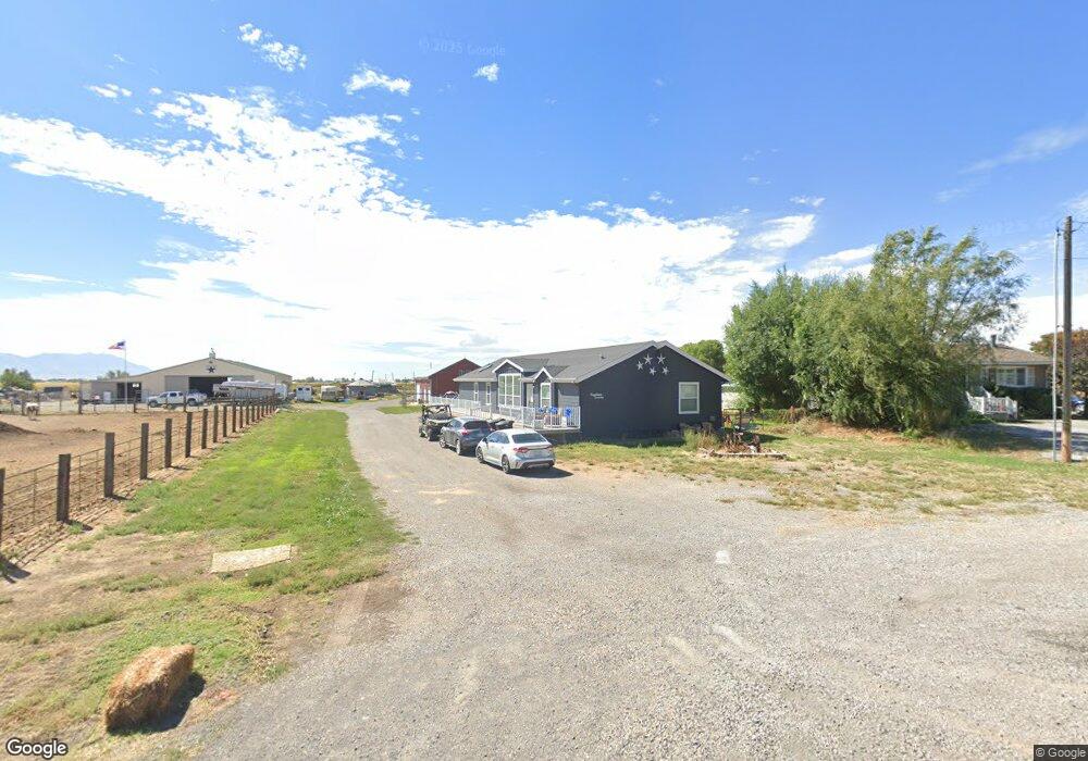
1920 E Main St Tremonton, UT 84337
Estimated Value: $384,065 - $540,000
3
Beds
2
Baths
1,890
Sq Ft
$235/Sq Ft
Est. Value
About This Home
This home is located at 1920 E Main St, Tremonton, UT 84337 and is currently estimated at $444,766, approximately $235 per square foot. 1920 E Main St is a home located in Box Elder County with nearby schools including McKinley School, Bear River Middle School, and Alice C. Harris Intermediate School.
Ownership History
Date
Name
Owned For
Owner Type
Purchase Details
Closed on
Apr 16, 2019
Sold by
Summers Cindy
Bought by
Stephens Tyrell S
Current Estimated Value
Home Financials for this Owner
Home Financials are based on the most recent Mortgage that was taken out on this home.
Original Mortgage
$208,000
Outstanding Balance
$183,237
Interest Rate
4.4%
Mortgage Type
New Conventional
Estimated Equity
$261,529
Purchase Details
Closed on
Mar 28, 2016
Sold by
Tanner Rodger D and Tanner Cindy S
Bought by
Summers Cindy
Purchase Details
Closed on
Jan 18, 2008
Sold by
Tanner Rodger
Bought by
Tanner Rodger D and Tanner Cindy S
Purchase Details
Closed on
Oct 11, 2007
Sold by
Tanner Rodger D and Tanner Roger
Bought by
Tanner Rodger
Home Financials for this Owner
Home Financials are based on the most recent Mortgage that was taken out on this home.
Original Mortgage
$137,500
Interest Rate
6.75%
Mortgage Type
Construction
Create a Home Valuation Report for This Property
The Home Valuation Report is an in-depth analysis detailing your home's value as well as a comparison with similar homes in the area
Home Values in the Area
Average Home Value in this Area
Purchase History
| Date | Buyer | Sale Price | Title Company |
|---|---|---|---|
| Stephens Tyrell S | -- | Northern Title Company | |
| Summers Cindy | -- | Northern Title Company | |
| Tanner Rodger D | -- | -- | |
| Tanner Rodger | -- | Box Elder Land Title Ins Age |
Source: Public Records
Mortgage History
| Date | Status | Borrower | Loan Amount |
|---|---|---|---|
| Open | Stephens Tyrell S | $208,000 | |
| Previous Owner | Tanner Rodger | $137,500 |
Source: Public Records
Tax History
| Year | Tax Paid | Tax Assessment Tax Assessment Total Assessment is a certain percentage of the fair market value that is determined by local assessors to be the total taxable value of land and additions on the property. | Land | Improvement |
|---|---|---|---|---|
| 2025 | $2,269 | $353,128 | $105,000 | $248,128 |
| 2024 | $2,057 | $356,200 | $105,000 | $251,200 |
| 2023 | $2,129 | $361,932 | $100,000 | $261,932 |
| 2022 | $1,763 | $170,954 | $16,500 | $154,454 |
| 2021 | $1,520 | $222,601 | $30,000 | $192,601 |
| 2020 | $1,445 | $222,601 | $30,000 | $192,601 |
| 2019 | $1,342 | $110,244 | $16,500 | $93,744 |
| 2018 | $1,439 | $107,981 | $16,500 | $91,481 |
| 2017 | $1,486 | $196,329 | $16,500 | $166,329 |
| 2016 | $1,461 | $103,624 | $16,500 | $87,124 |
| 2015 | $1,324 | $95,704 | $16,500 | $79,204 |
| 2014 | $1,324 | $91,933 | $16,500 | $75,433 |
| 2013 | -- | $91,944 | $13,338 | $78,606 |
Source: Public Records
Map
Nearby Homes
- 1720 E Main St Unit 502
- 1720 E Main St Unit 501
- 1720 E Main St Unit 403
- 1720 E Main St Unit 503
- 8321 W 10800 N Unit 35
- 408 N 775 E
- 1393 E 240 N Unit 53
- 635 E 240 N Unit 9
- 4979 W 12000 N
- 21 Amber Ave
- 1320 E 1310 S
- 10295 N Vista Ln
- 1268 E 1310 S
- 10283 N Vista Ln
- 1118 E 1310 S
- 384 N 200 E
- 285 S 100 E
- 625 N 300 E
- 108 S 100 E
- 477 E 1325 S
- 1930 E Main St
- 1844 E Main St
- 1780 E Main St
- 1845 E Main St
- 1960 E Main St Unit LOG
- 1785 E Main St
- 1945 E Main St
- 1945 E Main St
- 1955 E Main St
- 1740 E Main St Unit 504
- 1740 E Main St Unit 502
- 1740 E Main St Unit 501
- 2000 E Main St
- 1969 E Main St
- 1709 E Main St
- 1993 E Main St
- 1720 E Main St Unit 102
- 1720 E Main St Unit 5
- 1720 E Main St Unit 106
- 1720 E Main St Unit 105
Your Personal Tour Guide
Ask me questions while you tour the home.