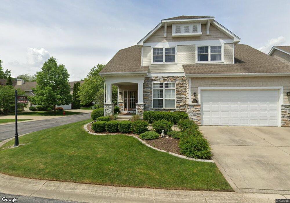
1920 Garland Cir Valparaiso, IN 46383
Estimated Value: $431,228 - $519,000
3
Beds
3
Baths
2,762
Sq Ft
$169/Sq Ft
Est. Value
About This Home
This home is located at 1920 Garland Cir, Valparaiso, IN 46383 and is currently estimated at $466,807, approximately $169 per square foot. 1920 Garland Cir is a home located in Porter County with nearby schools including Flint Lake Elementary School, Thomas Jefferson Middle School, and Valparaiso High School.
Ownership History
Date
Name
Owned For
Owner Type
Purchase Details
Closed on
Jun 7, 2016
Sold by
Buford Stephen C
Bought by
Green Drew A and Green Bruce H
Current Estimated Value
Purchase Details
Closed on
Oct 23, 2009
Sold by
Watkins Wendy
Bought by
Buford Stephen C
Home Financials for this Owner
Home Financials are based on the most recent Mortgage that was taken out on this home.
Original Mortgage
$235,554
Interest Rate
5.1%
Mortgage Type
FHA
Purchase Details
Closed on
Jan 3, 2008
Sold by
Culner Wendy G and Watkins Wendy
Bought by
Watkins Wendy
Purchase Details
Closed on
Oct 1, 2007
Sold by
Singer Thomas E and Singer Helen B
Bought by
Culver Wendy G
Home Financials for this Owner
Home Financials are based on the most recent Mortgage that was taken out on this home.
Original Mortgage
$216,000
Interest Rate
6.55%
Mortgage Type
Purchase Money Mortgage
Create a Home Valuation Report for This Property
The Home Valuation Report is an in-depth analysis detailing your home's value as well as a comparison with similar homes in the area
Home Values in the Area
Average Home Value in this Area
Purchase History
| Date | Buyer | Sale Price | Title Company |
|---|---|---|---|
| Green Drew A | -- | None Available | |
| Buford Stephen C | -- | Chicago Title Insurance Co | |
| Watkins Wendy | -- | None Available | |
| Culver Wendy G | -- | Multiple |
Source: Public Records
Mortgage History
| Date | Status | Borrower | Loan Amount |
|---|---|---|---|
| Previous Owner | Buford Stephen C | $235,554 | |
| Previous Owner | Culver Wendy G | $216,000 |
Source: Public Records
Tax History Compared to Growth
Tax History
| Year | Tax Paid | Tax Assessment Tax Assessment Total Assessment is a certain percentage of the fair market value that is determined by local assessors to be the total taxable value of land and additions on the property. | Land | Improvement |
|---|---|---|---|---|
| 2024 | $3,641 | $405,600 | $61,400 | $344,200 |
| 2023 | $3,637 | $386,000 | $57,400 | $328,600 |
| 2022 | $3,202 | $352,900 | $57,400 | $295,500 |
| 2021 | $3,272 | $299,500 | $57,400 | $242,100 |
| 2020 | $3,248 | $290,500 | $54,700 | $235,800 |
| 2019 | $3,407 | $295,300 | $54,700 | $240,600 |
| 2018 | $3,368 | $291,100 | $54,700 | $236,400 |
| 2017 | $3,221 | $286,000 | $54,700 | $231,300 |
| 2016 | $2,929 | $281,900 | $53,100 | $228,800 |
| 2014 | $2,639 | $287,200 | $52,300 | $234,900 |
| 2013 | -- | $270,800 | $52,300 | $218,500 |
Source: Public Records
Map
Nearby Homes
- 1808 Crimson Dr
- 2305 Thomas Rd
- 122 E 632 N
- 2205 Charlotte Ln
- 636 N Calumet Ave
- 5001 Sunny Ln
- 4805 Princess Dr
- 602 N Scott Dr
- 4707 Downing Dr
- 74 E 600 N
- 4409 Masters Rd
- 4513 Bear Ln
- 633 N 70 E
- 4403 Flint Lake Gateway
- 5402 Garden Gateway Rd
- 208 E 650 N
- Lot #23 John St
- 4408 Thornbury Dr E
- 1401 Oriole Rd
- 4111 Wildwood Rd
- 1920 Garland Circle Dr
- 1918 Garland Cir
- 1918 Garland Circle Dr
- 1900 Garland Circle Dr
- 1900 Garland Cir
- 1902 Garland Circle Dr
- 1902 Garland Cir Unit 2
- 1810 Briam Dr
- 1921 Garland Cir
- 1808 Briam Dr
- 1921 Garland Circle Dr
- 1919 Garland Circle Dr
- 1812 Briam Dr
- 1812 Briam Dr
- 1919 Garland Cir
- 1806 Briam Dr
- 1917 Garland Cir
- 1913 Garland Cir
- 1911 Garland Circle Dr
- 1911 Garland Circle Dr