Estimated Value: $452,000 - $500,000
4
Beds
3
Baths
3,798
Sq Ft
$127/Sq Ft
Est. Value
About This Home
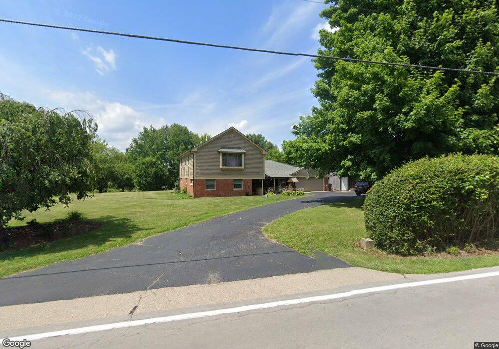
This home is located at 1920 Lower Bellbrook Rd, Xenia, OH 45385 and is currently estimated at $480,993, approximately $126 per square foot. 1920 Lower Bellbrook Rd is a home located in Greene County with nearby schools including Xenia High School and Summit Academy Community School for Alternative Learners - Xenia.
Ownership History
Date
Name
Owned For
Owner Type
Purchase Details
Closed on
Mar 23, 2012
Sold by
Wessel William Paul and Wessel Melanie Ruth
Bought by
Brun Jason E and Brun Dana M
Current Estimated Value
Home Financials for this Owner
Home Financials are based on the most recent Mortgage that was taken out on this home.
Original Mortgage
$194,930
Interest Rate
3.75%
Mortgage Type
FHA
Create a Home Valuation Report for This Property
The Home Valuation Report is an in-depth analysis detailing your home's value as well as a comparison with similar homes in the area
Home Values in the Area
Average Home Value in this Area
Purchase History
| Date | Buyer | Sale Price | Title Company |
|---|---|---|---|
| Brun Jason E | $200,000 | None Available |
Source: Public Records
Mortgage History
| Date | Status | Borrower | Loan Amount |
|---|---|---|---|
| Closed | Brun Jason E | $194,930 |
Source: Public Records
Tax History Compared to Growth
Tax History
| Year | Tax Paid | Tax Assessment Tax Assessment Total Assessment is a certain percentage of the fair market value that is determined by local assessors to be the total taxable value of land and additions on the property. | Land | Improvement |
|---|---|---|---|---|
| 2024 | $5,936 | $116,550 | $18,560 | $97,990 |
| 2023 | $5,936 | $116,550 | $18,560 | $97,990 |
| 2022 | $5,346 | $90,630 | $17,410 | $73,220 |
| 2021 | $5,410 | $90,630 | $17,410 | $73,220 |
| 2020 | $4,966 | $90,630 | $17,410 | $73,220 |
| 2019 | $4,504 | $77,050 | $15,010 | $62,040 |
| 2018 | $4,444 | $77,050 | $15,010 | $62,040 |
| 2017 | $4,212 | $77,050 | $15,010 | $62,040 |
| 2016 | $4,212 | $74,540 | $14,310 | $60,230 |
| 2015 | $4,223 | $74,540 | $14,310 | $60,230 |
| 2014 | $4,055 | $74,540 | $14,310 | $60,230 |
Source: Public Records
Map
Nearby Homes
- 1591 Valley Heights Rd
- 2185 Tanbark Trail
- 1753 Cedar Ridge Dr
- 102 Water St
- 2230 Little Miami Dr
- 196 Mound St
- 1061 Mcpherson Rd
- 1711 Mcclellan Rd
- 1474 Hawkshead St
- Henley Plan at Edenbridge
- Holcombe Plan at Edenbridge
- Newcastle Plan at Edenbridge
- Bellamy Plan at Edenbridge
- Chatham Plan at Edenbridge
- 1068 Hedges Rd
- 1272 Baybury Ave
- 1292 Baybury Ave
- 1293 Baybury Ave
- 2995 Upper Bellbrook Rd
- 2821 Raxit Ct
- 1929 Lower Bellbrook Rd
- 1941 Lower Bellbrook Rd
- 1907 Lower Bellbrook Rd
- 1955 Lower Bellbrook Rd
- 1960 Lower Bellbrook Rd
- 1899 Lower Bellbrook Rd
- 1969 Lower Bellbrook Rd
- 1987 Lower Bellbrook Rd
- 1810 Sunnymeade Rd
- 1794 Simison Rd
- 1817 Simison Rd
- 1803 Simison Rd
- 1781 Simison Rd
- 2015 Lower Bellbrook Rd
- 1829 Simison Rd
- 1781 Sunnymeade Rd
- 1839 Simison Rd
- 1860 Simison Rd
- 1806 Simison Rd
- 1818 Simison Rd