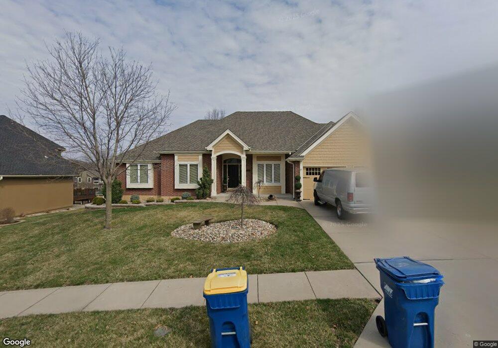
1920 Marvel Ln Liberty, MO 64068
Estimated Value: $372,000 - $465,000
3
Beds
3
Baths
2,092
Sq Ft
$206/Sq Ft
Est. Value
About This Home
This home is located at 1920 Marvel Ln, Liberty, MO 64068 and is currently estimated at $430,691, approximately $205 per square foot. 1920 Marvel Ln is a home located in Clay County with nearby schools including Alexander Doniphan Elementary School, Discovery Middle School, and Liberty High School.
Ownership History
Date
Name
Owned For
Owner Type
Purchase Details
Closed on
Sep 26, 2011
Sold by
Noblet Connie
Bought by
Henderson Russell W and Henderson Catherine Ann
Current Estimated Value
Purchase Details
Closed on
Nov 18, 2009
Sold by
Noblet Jerald
Bought by
Noblet Connie
Home Financials for this Owner
Home Financials are based on the most recent Mortgage that was taken out on this home.
Original Mortgage
$115,000
Interest Rate
4.93%
Mortgage Type
New Conventional
Create a Home Valuation Report for This Property
The Home Valuation Report is an in-depth analysis detailing your home's value as well as a comparison with similar homes in the area
Home Values in the Area
Average Home Value in this Area
Purchase History
| Date | Buyer | Sale Price | Title Company |
|---|---|---|---|
| Henderson Russell W | -- | Kansas City Title Inc | |
| Noblet Connie | -- | None Available |
Source: Public Records
Mortgage History
| Date | Status | Borrower | Loan Amount |
|---|---|---|---|
| Previous Owner | Noblet Connie | $115,000 |
Source: Public Records
Tax History
| Year | Tax Paid | Tax Assessment Tax Assessment Total Assessment is a certain percentage of the fair market value that is determined by local assessors to be the total taxable value of land and additions on the property. | Land | Improvement |
|---|---|---|---|---|
| 2025 | $5,195 | $76,210 | -- | -- |
| 2024 | $5,195 | $67,550 | -- | -- |
| 2023 | $5,283 | $67,550 | $0 | $0 |
| 2022 | $4,415 | $55,730 | $0 | $0 |
| 2021 | $4,380 | $55,727 | $7,600 | $48,127 |
| 2020 | $4,366 | $52,160 | $0 | $0 |
| 2019 | $4,365 | $52,160 | $0 | $0 |
Source: Public Records
Map
Nearby Homes
- 509 Belmont St
- 607 Glendale Rd
- 1601 Dunwich Dr
- 429 Pershing St
- 407 Glendale Rd
- 405 Wherritt Ln
- 1561 Parkside Dr
- 1232 Old Manor Rd
- 1209 Liberty Drive Terrace
- 2116 Winding Woods Dr
- 53 Fulkerson Cir
- 253 S Stewart Rd
- Lot 2 Bent Oaks Dr
- 1768 Homestead Dr
- Lot 2A Oak Crest Dr
- 1114 W Liberty Dr
- 1856 Arbor Trail
- 1836 Green Meadow Dr
- 1829 Green Meadow Dr
- 1515 Trumpet Ct
Your Personal Tour Guide
Ask me questions while you tour the home.