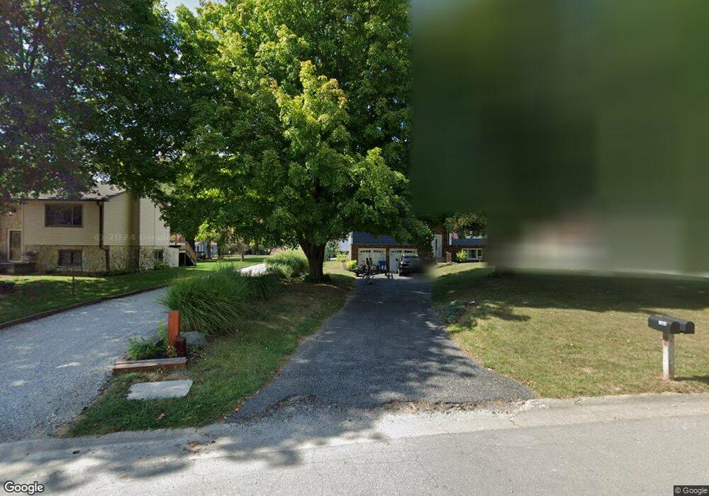
1920 Nantucket Dr Cicero, IN 46034
Estimated Value: $596,319 - $697,000
4
Beds
2
Baths
1,976
Sq Ft
$329/Sq Ft
Est. Value
About This Home
This home is located at 1920 Nantucket Dr, Cicero, IN 46034 and is currently estimated at $651,080, approximately $329 per square foot. 1920 Nantucket Dr is a home located in Hamilton County with nearby schools including Hamilton Heights Primary School, Hamilton Heights Elementary School, and Hamilton Heights Middle School.
Ownership History
Date
Name
Owned For
Owner Type
Purchase Details
Closed on
Aug 17, 2018
Sold by
Webb Joseph G
Bought by
Webb Joseph G and Menze Christie A
Current Estimated Value
Purchase Details
Closed on
Jul 5, 2012
Sold by
Hensley Bonnie
Bought by
Webb Joseph G
Home Financials for this Owner
Home Financials are based on the most recent Mortgage that was taken out on this home.
Original Mortgage
$168,800
Outstanding Balance
$117,399
Interest Rate
3.83%
Mortgage Type
New Conventional
Estimated Equity
$533,681
Purchase Details
Closed on
Apr 1, 2012
Sold by
Hensley Bonnie
Bought by
Webb Joseph G
Purchase Details
Closed on
Apr 26, 2002
Sold by
Olszewski Robert M and Olszewski Susan E
Bought by
Webb Joseph G and Webb Bonnie H
Home Financials for this Owner
Home Financials are based on the most recent Mortgage that was taken out on this home.
Original Mortgage
$179,920
Interest Rate
7.24%
Mortgage Type
Purchase Money Mortgage
Create a Home Valuation Report for This Property
The Home Valuation Report is an in-depth analysis detailing your home's value as well as a comparison with similar homes in the area
Home Values in the Area
Average Home Value in this Area
Purchase History
| Date | Buyer | Sale Price | Title Company |
|---|---|---|---|
| Webb Joseph G | -- | None Available | |
| Webb Joseph G | -- | -- | |
| Webb Joseph G | -- | -- | |
| Webb Joseph G | -- | Pinnacle Land Title Co Inc |
Source: Public Records
Mortgage History
| Date | Status | Borrower | Loan Amount |
|---|---|---|---|
| Open | Webb Joseph G | $168,800 | |
| Previous Owner | Webb Joseph G | $179,920 |
Source: Public Records
Tax History Compared to Growth
Tax History
| Year | Tax Paid | Tax Assessment Tax Assessment Total Assessment is a certain percentage of the fair market value that is determined by local assessors to be the total taxable value of land and additions on the property. | Land | Improvement |
|---|---|---|---|---|
| 2024 | $5,159 | $530,600 | $330,800 | $199,800 |
| 2023 | $5,159 | $495,200 | $330,800 | $164,400 |
| 2022 | $4,522 | $429,900 | $207,900 | $222,000 |
| 2021 | $4,118 | $390,800 | $207,900 | $182,900 |
| 2020 | $3,798 | $357,600 | $207,900 | $149,700 |
| 2019 | $3,356 | $312,800 | $146,500 | $166,300 |
| 2018 | $2,967 | $291,900 | $146,500 | $145,400 |
| 2017 | $2,806 | $275,700 | $146,500 | $129,200 |
| 2016 | $2,841 | $279,200 | $146,500 | $132,700 |
| 2014 | $2,725 | $267,700 | $141,300 | $126,400 |
| 2013 | $2,725 | $261,600 | $154,800 | $106,800 |
Source: Public Records
Map
Nearby Homes
- 1940 Stringtown Pike
- 949 Nantucket Dr
- 2029 Seven Peaks Dr
- 1209 Half Moon Ln
- 2390 Lincoln Dr
- 73 Forest Hollow Dr
- 1306 N Catamaran Cir
- 815 Morse Landing Dr
- 826 N Lanyard Dr
- 100 Confidential Dr
- 1367 Sherman Cir
- 1180 Shoreline Cir
- 221 Common Loon Blvd
- 130 Overston Ct
- 2628 Inlet Dr
- 34 Hovden Dr
- 1628 W Port Ct
- 1055 Spinner Ct
- 131 Batteese Dr
- 70 Armitage St
- 1880 Nantucket Dr
- 1940 Stringtown Ave
- 1860 Nantucket Dr
- 1960 Stringtown Pike
- 1840 Nantucket Dr
- 1820 Nantucket Dr
- 2020 Stringtown Pike
- 1829 Nantucket Dr
- 1780 Nantucket Dr
- 2040 Stringtown Pike
- 1860 Stringtown Pike
- 1789 Nantucket Dr
- 1760 Nantucket Dr
- 22585 Vos Hiatt Ave
- 2060 Stringtown Pike
- 1840 Stringtown Pike
- 22585 Voss Hiatt Ave
- 1740 Nantucket Dr
- 1769 Nantucket Dr
- 2080 Stringtown Pike