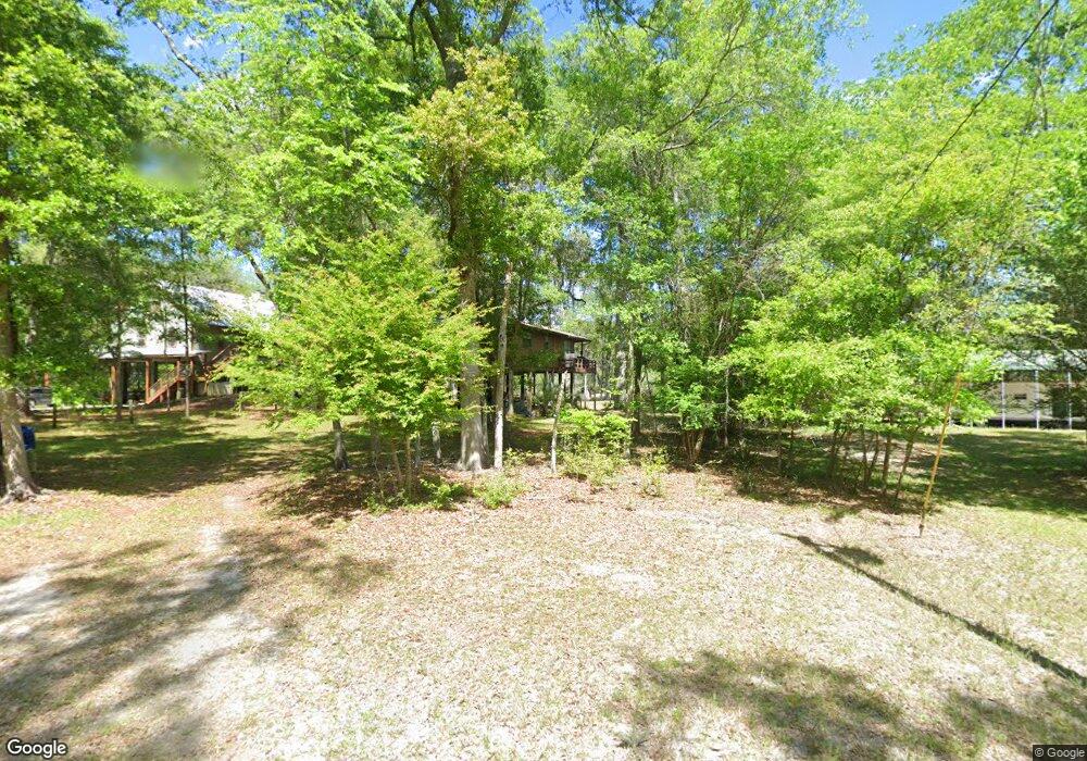
1920 NE 128th Place Branford, FL 32008
Estimated Value: $233,000 - $395,000
2
Beds
1
Bath
1,064
Sq Ft
$277/Sq Ft
Est. Value
About This Home
This home is located at 1920 NE 128th Place, Branford, FL 32008 and is currently estimated at $295,066, approximately $277 per square foot. 1920 NE 128th Place is a home located in Gilchrist County.
Ownership History
Date
Name
Owned For
Owner Type
Purchase Details
Closed on
Apr 8, 2025
Sold by
Crosby Teresa W and Farino Teresa D
Bought by
Adams Kimberly
Current Estimated Value
Purchase Details
Closed on
Sep 18, 2019
Sold by
Crosby Teresa
Bought by
Crosby Teresa and Teresa W Crosby Living Trust
Purchase Details
Closed on
Apr 3, 2008
Sold by
Crosby Teresa Diane and Wayne Mcdaniel R
Bought by
Crosby Teresa
Home Financials for this Owner
Home Financials are based on the most recent Mortgage that was taken out on this home.
Original Mortgage
$212,100
Interest Rate
5.84%
Mortgage Type
Purchase Money Mortgage
Purchase Details
Closed on
Jul 1, 2004
Sold by
Drake Melissa R
Bought by
Crosby Teresa Diane
Home Financials for this Owner
Home Financials are based on the most recent Mortgage that was taken out on this home.
Original Mortgage
$33,000
Interest Rate
4%
Mortgage Type
Seller Take Back
Create a Home Valuation Report for This Property
The Home Valuation Report is an in-depth analysis detailing your home's value as well as a comparison with similar homes in the area
Home Values in the Area
Average Home Value in this Area
Purchase History
| Date | Buyer | Sale Price | Title Company |
|---|---|---|---|
| Adams Kimberly | $100 | None Listed On Document | |
| Crosby Teresa | -- | Attorney | |
| Crosby Teresa | $140,000 | Industry Partners Title Llc | |
| Crosby Teresa Diane | $53,000 | -- |
Source: Public Records
Mortgage History
| Date | Status | Borrower | Loan Amount |
|---|---|---|---|
| Previous Owner | Crosby Teresa | $212,100 | |
| Previous Owner | Crosby Teresa Diane | $33,000 |
Source: Public Records
Tax History Compared to Growth
Tax History
| Year | Tax Paid | Tax Assessment Tax Assessment Total Assessment is a certain percentage of the fair market value that is determined by local assessors to be the total taxable value of land and additions on the property. | Land | Improvement |
|---|---|---|---|---|
| 2025 | $3,143 | $208,019 | $100,700 | $107,319 |
| 2024 | $2,625 | $187,471 | $90,100 | $97,371 |
| 2023 | $2,625 | $147,079 | $0 | $0 |
| 2022 | $2,413 | $154,868 | $68,900 | $85,968 |
| 2021 | $2,229 | $131,790 | $58,300 | $73,490 |
| 2020 | $2,022 | $110,503 | $50,325 | $60,178 |
| 2019 | $1,305 | $108,116 | $50,325 | $57,791 |
| 2018 | $1,321 | $108,017 | $50,325 | $57,692 |
| 2017 | $1,323 | $107,105 | $0 | $0 |
| 2016 | $1,348 | $106,928 | $0 | $0 |
| 2015 | $1,417 | $108,872 | $0 | $0 |
| 2013 | -- | $106,513 | $0 | $0 |
Source: Public Records
Map
Nearby Homes
- 1759 NE 127th St
- 12890 NE 120 Loop
- 0 SW Bumble St Unit 128719
- 158 SW Bumble St
- lot 36 SW Bumble St
- 0 NE 127th St
- 498 SW Manatee Terrace
- 1521 SW Central Terrace
- TBD SW Boston Terrace
- TBD SW Reno Way
- 843 SW Illinois St
- 0 NE 120th Loop
- 00 SW Newark Dr Unit 3
- 0 SW Newark Dr Unit MFRGC535738
- 0 SW Newark Dr Unit MFRR4908315
- 0 SW Newark Dr Unit MFRR4908314
- 960 SW Iowa Dr
- 1745 SW Newark Dr
- 1965 SW Newark Dr
- TBD SW Central Terrace
- 1930 NE 128th Place
- 1960 NE 128th Place
- 1910 NE 128th Place
- 1880 NE 128th Place
- 1879 NE 128th Place
- 1930 NE 127th Ln
- 1890 NE 127th Ln
- 1850 NE 128th Place
- 2030 NE 128th Place
- 898 SW Santa fe Dr
- 1840 NE 127th Ln
- 826 SW Santa fe Dr
- 1052 SW Santa fe Dr
- 2060 NE 128th Place
- 1949 NE 127th Ln
- 1024 SW Santa fe Dr
- 1074 SW Santa fe Dr
- 1979 NE 127th Ln
- 1869 NE 127th Ln
- 792 SW Santa fe Dr