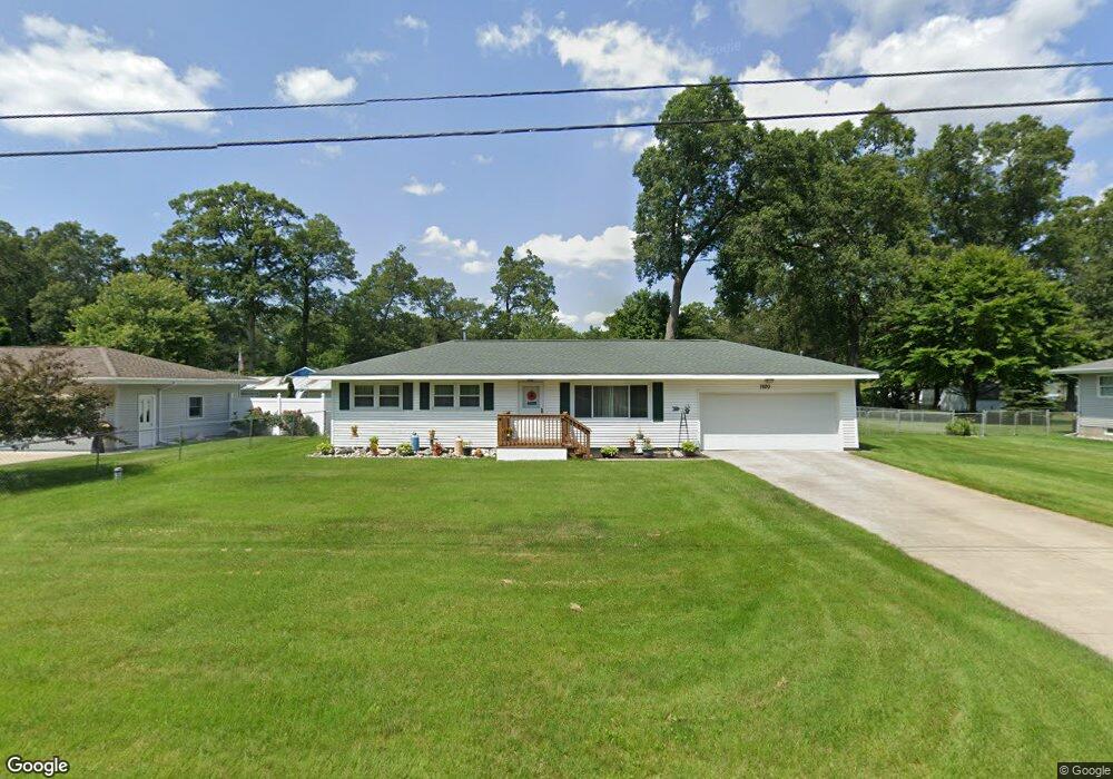
1920 Nielwood Dr Muskegon, MI 49445
Estimated Value: $204,975 - $271,000
--
Bed
1
Bath
1,008
Sq Ft
$240/Sq Ft
Est. Value
About This Home
This home is located at 1920 Nielwood Dr, Muskegon, MI 49445 and is currently estimated at $241,744, approximately $239 per square foot. 1920 Nielwood Dr is a home located in Muskegon County with nearby schools including Reeths-Puffer High School.
Ownership History
Date
Name
Owned For
Owner Type
Purchase Details
Closed on
Jun 10, 2014
Sold by
Stroud David Alan and Stroud Pamela Kay
Bought by
Stroud Pamela Kay
Current Estimated Value
Purchase Details
Closed on
Feb 27, 2004
Sold by
Swett Pamela K
Bought by
Stroud David A and Stroud Pamela K
Purchase Details
Closed on
Jun 11, 2003
Sold by
The Estate Of Dorothy J Burgess
Bought by
Swett Pamela K
Home Financials for this Owner
Home Financials are based on the most recent Mortgage that was taken out on this home.
Original Mortgage
$63,920
Interest Rate
5.71%
Mortgage Type
Purchase Money Mortgage
Create a Home Valuation Report for This Property
The Home Valuation Report is an in-depth analysis detailing your home's value as well as a comparison with similar homes in the area
Home Values in the Area
Average Home Value in this Area
Purchase History
| Date | Buyer | Sale Price | Title Company |
|---|---|---|---|
| Stroud Pamela Kay | -- | None Available | |
| Stroud David A | -- | -- | |
| Swett Pamela K | $80,000 | Muskegon Land Title Agency L |
Source: Public Records
Mortgage History
| Date | Status | Borrower | Loan Amount |
|---|---|---|---|
| Previous Owner | Swett Pamela K | $63,920 | |
| Closed | Swett Pamela K | $15,980 |
Source: Public Records
Tax History Compared to Growth
Tax History
| Year | Tax Paid | Tax Assessment Tax Assessment Total Assessment is a certain percentage of the fair market value that is determined by local assessors to be the total taxable value of land and additions on the property. | Land | Improvement |
|---|---|---|---|---|
| 2025 | $1,400 | $91,300 | $0 | $0 |
| 2024 | $485 | $74,100 | $0 | $0 |
| 2023 | $449 | $63,100 | $0 | $0 |
| 2022 | $1,209 | $51,000 | $0 | $0 |
| 2021 | $1,183 | $46,700 | $0 | $0 |
| 2020 | $1,188 | $44,400 | $0 | $0 |
| 2019 | $1,144 | $40,900 | $0 | $0 |
| 2018 | $1,152 | $39,800 | $0 | $0 |
| 2017 | $1,151 | $38,700 | $0 | $0 |
| 2016 | $383 | $35,000 | $0 | $0 |
| 2015 | -- | $32,800 | $0 | $0 |
| 2014 | -- | $33,200 | $0 | $0 |
| 2013 | -- | $32,800 | $0 | $0 |
Source: Public Records
Map
Nearby Homes
- 1960 Nielwood Dr
- 1934 E River Rd
- 0 Holton Vl Rd Unit 20027438
- V/L Holton Rd
- 2624 Holton Rd
- 2026 N Port Blvd
- 1925 Shady Oak Dr
- 2021 Queens Ct
- 2337 Northwind Dr
- 0 E Mcmillan Rd
- 2635 E River Rd
- 2960 Holton Rd
- 2551 Hiawatha Trail
- 2060 N Roberts Rd
- 3096 Pillon Rd
- 3268 Pillon Rd
- 1291 Logan Rd
- 0 N Getty St
- 2340 Beech Ln
- 3450 Spruce St
- 1934 Nielwood Dr
- 1921 Nielwood Dr
- 1935 Nielwood Dr
- 1905 Nielwood Dr
- 1894 Nielwood Dr
- 1904 Nielwood Dr
- 1893 Nielwood Dr
- 1949 Nielwood Dr
- 1944 Nielwood Dr
- 1880 Nielwood Dr
- 1881 Nielwood Dr
- 1935 Ora St
- 1961 Nielwood Dr
- 1980 Nielwood Dr
- 1860 Nielwood Dr
- 1949 Ora St
- 1981 Nielwood Dr
- 1859 Nielwood Dr
- 1893 Ora St
- 1961 Ora St