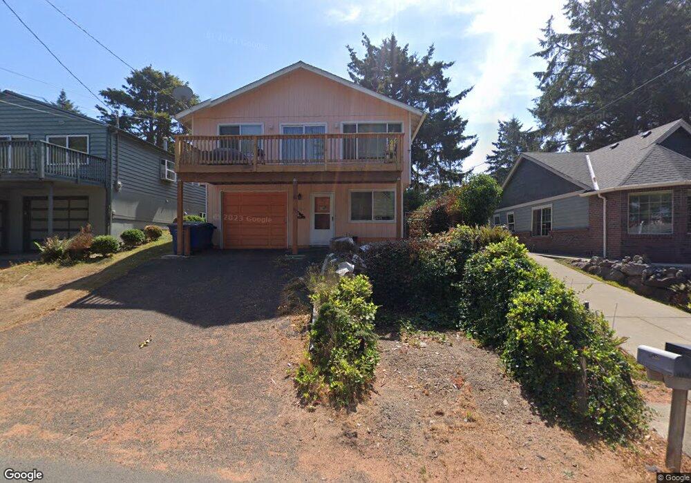
1920 NW 39th St Lincoln City, OR 97367
Estimated Value: $511,118 - $575,000
3
Beds
2
Baths
1,664
Sq Ft
$334/Sq Ft
Est. Value
About This Home
This home is located at 1920 NW 39th St, Lincoln City, OR 97367 and is currently estimated at $555,280, approximately $333 per square foot. 1920 NW 39th St is a home located in Lincoln County with nearby schools including Oceanlake Elementary School, Taft Elementary School, and Taft High School.
Ownership History
Date
Name
Owned For
Owner Type
Purchase Details
Closed on
May 7, 2009
Sold by
Sparks Jonathan S and Sparks Kari M
Bought by
Williams Ernest E and Williams Tami J
Current Estimated Value
Home Financials for this Owner
Home Financials are based on the most recent Mortgage that was taken out on this home.
Original Mortgage
$233,923
Outstanding Balance
$147,400
Interest Rate
4.8%
Mortgage Type
VA
Estimated Equity
$407,880
Purchase Details
Closed on
Jul 10, 2008
Sold by
Sparks Jonathan S and Sparks Kari M
Bought by
Sparks Jonathan S and Sparks Kari M
Home Financials for this Owner
Home Financials are based on the most recent Mortgage that was taken out on this home.
Original Mortgage
$195,000
Interest Rate
6.07%
Mortgage Type
New Conventional
Create a Home Valuation Report for This Property
The Home Valuation Report is an in-depth analysis detailing your home's value as well as a comparison with similar homes in the area
Home Values in the Area
Average Home Value in this Area
Purchase History
| Date | Buyer | Sale Price | Title Company |
|---|---|---|---|
| Williams Ernest E | $229,000 | Premier Title Of Oregon | |
| Sparks Jonathan S | -- | Commonwealth Land Title Co |
Source: Public Records
Mortgage History
| Date | Status | Borrower | Loan Amount |
|---|---|---|---|
| Open | Williams Ernest E | $233,923 | |
| Previous Owner | Sparks Jonathan S | $195,000 |
Source: Public Records
Tax History Compared to Growth
Tax History
| Year | Tax Paid | Tax Assessment Tax Assessment Total Assessment is a certain percentage of the fair market value that is determined by local assessors to be the total taxable value of land and additions on the property. | Land | Improvement |
|---|---|---|---|---|
| 2024 | $4,203 | $246,540 | -- | -- |
| 2023 | $4,087 | $239,360 | $0 | $0 |
| 2022 | $3,973 | $232,390 | $0 | $0 |
| 2021 | $3,785 | $225,630 | $0 | $0 |
| 2020 | $3,698 | $219,060 | $0 | $0 |
| 2019 | $3,572 | $212,680 | $0 | $0 |
| 2018 | $3,492 | $206,490 | $0 | $0 |
| 2017 | $3,342 | $200,480 | $0 | $0 |
| 2016 | $3,134 | $194,650 | $0 | $0 |
| 2015 | $3,056 | $188,990 | $0 | $0 |
| 2014 | $2,949 | $183,490 | $0 | $0 |
| 2013 | -- | $178,150 | $0 | $0 |
Source: Public Records
Map
Nearby Homes
- 1900 Blk Nw 38th Tl5000
- 1900 Blk Nw 38th Street Tl5000
- 4000 NW Blk 40th St
- 3848 NW Port Ave
- 4000 Blk NW 40th St
- 1938 NW 40th St
- 1587 NW 39th St
- 1830 NW 35th Place
- 3929 NW Jetty Ave Unit 3
- 1756 NW 35th Place
- 3845 NW Jetty Ave
- 3507 NW Port Ave
- 3595 NE Reef Dr
- 1715 NW 35th Place
- 1616 NW 36th St
- 3570 NE Reef Dr
- 3522 NE Quay Ave
- 3432 NW Port Ct
- TL 1001 NW Jetty Ave
- 3700 NE Surf Ave
- 1900 NW 39th St
- 1930 NW 39th St
- 1900 BLK 39th St NW
- 1900 39th (Blk) NW
- 1890 NW 39th St
- 3857 NW Port Ave
- 3893 NW Port Ave
- 1955 NW 39th St
- 1830 NW 39th St
- 1925 NW 38th St
- 1818 NW 39th St
- 3800 Port (Tl) SE
- 1950 NW 39th St
- 1841 NW 39th St
- 0 39th St NW
- 1835 NW 38th St
- 1825 NW 39th St
- 1827 NW 39th St
- 1829 NW 38th St
- 4000 Blk NW 40th Street Tl 1200