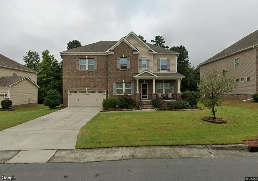
1920 Pattersons Mill Rd Durham, NC 27703
Eastern Durham NeighborhoodEstimated Value: $670,000 - $727,000
5
Beds
4
Baths
3,288
Sq Ft
$214/Sq Ft
Est. Value
About This Home
This home is located at 1920 Pattersons Mill Rd, Durham, NC 27703 and is currently estimated at $702,856, approximately $213 per square foot. 1920 Pattersons Mill Rd is a home located in Durham County with nearby schools including Spring Valley Elementary School, John W Neal Middle School, and Southern School of Energy & Sustainability.
Ownership History
Date
Name
Owned For
Owner Type
Purchase Details
Closed on
Jul 28, 2017
Sold by
Calatlantic Group Inc
Bought by
Babwah Harry D and Babwah Arlene G
Current Estimated Value
Home Financials for this Owner
Home Financials are based on the most recent Mortgage that was taken out on this home.
Original Mortgage
$313,452
Outstanding Balance
$69,917
Interest Rate
3.91%
Mortgage Type
New Conventional
Estimated Equity
$632,939
Purchase Details
Closed on
Jun 30, 2016
Sold by
Mrec Brightleaf Llc
Bought by
Calatlantic Grp Inc
Create a Home Valuation Report for This Property
The Home Valuation Report is an in-depth analysis detailing your home's value as well as a comparison with similar homes in the area
Home Values in the Area
Average Home Value in this Area
Purchase History
| Date | Buyer | Sale Price | Title Company |
|---|---|---|---|
| Babwah Harry D | -- | None Available | |
| Calatlantic Grp Inc | $2,075,000 | -- |
Source: Public Records
Mortgage History
| Date | Status | Borrower | Loan Amount |
|---|---|---|---|
| Open | Babwah Harry D | $313,452 |
Source: Public Records
Tax History
| Year | Tax Paid | Tax Assessment Tax Assessment Total Assessment is a certain percentage of the fair market value that is determined by local assessors to be the total taxable value of land and additions on the property. | Land | Improvement |
|---|---|---|---|---|
| 2025 | $7,526 | $759,196 | $111,125 | $648,071 |
| 2024 | $5,788 | $414,960 | $63,013 | $351,947 |
| 2023 | $5,436 | $414,960 | $63,013 | $351,947 |
| 2022 | $5,311 | $414,960 | $63,013 | $351,947 |
| 2021 | $5,286 | $414,960 | $63,013 | $351,947 |
| 2020 | $5,162 | $414,960 | $63,013 | $351,947 |
| 2019 | $5,162 | $414,960 | $63,013 | $351,947 |
| 2018 | $4,767 | $351,445 | $63,650 | $287,795 |
| 2017 | $857 | $63,650 | $63,650 | $0 |
| 2016 | $828 | $63,650 | $63,650 | $0 |
| 2015 | $1,113 | $80,411 | $80,411 | $0 |
| 2014 | $1,113 | $80,411 | $80,411 | $0 |
Source: Public Records
Map
Nearby Homes
- 1020 Constellation Cir
- 3105 Ranger Dr
- 1821 S Mineral Springs Rd
- 3112 Ranger Dr
- 1948 Hinesley Dr
- 1950 Hinesley Dr
- 1944 Hinesley Dr
- 1942 Hinesley Dr
- 1936 Hinesley Dr
- 1940 Hinesley Dr
- 1938 Hinesley Dr
- 1932 Hinesley Dr
- 1934 Hinesley Dr
- 1946 Hinesley Dr
- 1931 Hinesley Dr
- 1937 Hinesley Dr
- 1935 Hinesley Dr
- 1939 Hinesley Dr
- 727A Peyton Ave
- 1923 Hinesley Dr
- 1918 Pattersons Mill Rd
- 1924 Pattersons Mill Rd
- 1924 Patterson's Mill Rd
- 1 Bonsack Ct
- 1916 Pattersons Mill Rd
- 1923 Pattersons Mill Rd
- 1 Horton Grove Ct
- 1926 Pattersons Mill Rd
- 1913 Pattersons Mill Rd
- 3 Bonsack Ct
- 1914 Pattersons Mill Rd
- 3 Horton Grove
- 3 Horton Grove Ct
- 1928 Pattersons Mill Rd
- 4 Bonsack Ct
- 5 Bonsack Ct
- 1912 Pattersons Mill Rd
- 1911 Pattersons Mill Rd
- 2 Horton Grove Ct
- 6 Bonsack
Your Personal Tour Guide
Ask me questions while you tour the home.