Estimated Value: $400,093 - $485,000
3
Beds
2
Baths
1,816
Sq Ft
$238/Sq Ft
Est. Value
About This Home
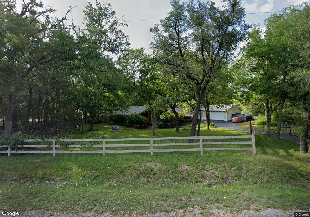
This home is located at 1920 Reynolds Dr, Azle, TX 76020 and is currently estimated at $431,523, approximately $237 per square foot. 1920 Reynolds Dr is a home located in Parker County with nearby schools including Azle Elementary School, Azle Junior High School, and Azle High School.
Ownership History
Date
Name
Owned For
Owner Type
Purchase Details
Closed on
Nov 5, 2019
Sold by
Scott Loyad Fred and Scott Eugenia M
Bought by
Anderson Andrew and Anderson Angela
Current Estimated Value
Home Financials for this Owner
Home Financials are based on the most recent Mortgage that was taken out on this home.
Original Mortgage
$244,815
Outstanding Balance
$215,374
Interest Rate
3.6%
Mortgage Type
New Conventional
Estimated Equity
$216,149
Purchase Details
Closed on
Jan 11, 2019
Sold by
Scott Eugenia Messer and Power Statutory Durable
Bought by
Scott Eugenia Messer
Purchase Details
Closed on
Aug 18, 2005
Sold by
Mcnair Mark Asa
Bought by
Scott Loyad Fred and Scott Eugenia M
Home Financials for this Owner
Home Financials are based on the most recent Mortgage that was taken out on this home.
Original Mortgage
$29,300
Interest Rate
5.61%
Mortgage Type
Stand Alone Second
Purchase Details
Closed on
Mar 21, 2002
Sold by
Mcnair Mark A
Bought by
Scott Loyad F and Scott Eugenia
Create a Home Valuation Report for This Property
The Home Valuation Report is an in-depth analysis detailing your home's value as well as a comparison with similar homes in the area
Home Values in the Area
Average Home Value in this Area
Purchase History
| Date | Buyer | Sale Price | Title Company |
|---|---|---|---|
| Anderson Andrew | -- | Ort | |
| Scott Eugenia Messer | -- | None Available | |
| Scott Loyad Fred | -- | None Available | |
| Scott Loyad F | -- | -- |
Source: Public Records
Mortgage History
| Date | Status | Borrower | Loan Amount |
|---|---|---|---|
| Open | Anderson Andrew | $244,815 | |
| Previous Owner | Scott Loyad Fred | $29,300 | |
| Previous Owner | Scott Loyad Fred | $117,200 |
Source: Public Records
Tax History Compared to Growth
Tax History
| Year | Tax Paid | Tax Assessment Tax Assessment Total Assessment is a certain percentage of the fair market value that is determined by local assessors to be the total taxable value of land and additions on the property. | Land | Improvement |
|---|---|---|---|---|
| 2025 | $1,857 | $343,700 | -- | -- |
| 2024 | $1,857 | $312,455 | -- | -- |
| 2023 | $1,857 | $284,050 | $0 | $0 |
| 2022 | $4,750 | $256,710 | $68,480 | $188,230 |
| 2021 | $4,977 | $256,710 | $68,480 | $188,230 |
| 2020 | $4,606 | $238,840 | $46,660 | $192,180 |
| 2019 | $4,518 | $238,840 | $46,660 | $192,180 |
| 2018 | $4,120 | $204,270 | $33,450 | $170,820 |
| 2017 | $3,569 | $204,270 | $33,450 | $170,820 |
| 2016 | $3,245 | $166,080 | $33,450 | $132,630 |
| 2015 | $902 | $166,080 | $33,450 | $132,630 |
| 2014 | $2,261 | $168,110 | $33,450 | $134,660 |
Source: Public Records
Map
Nearby Homes
- 595 Flat Rock Rd
- 1550 S Stewart St
- 405 Glade Crest Rd
- 255 Baughman Hill Rd
- 6021 Piper Anne St
- TBD 2 Flat Rock Rd
- Lot 143 Blk 4 Veal Station Rd
- TBD Flat Rock Rd
- 4024 Olivia Lucille St
- 1600 Flat Rock Rd
- 616 Cameron Way
- 351 Don Propp Rd
- 140 Huling Dr
- 181 Churchill Cir
- 1020 Don Eve Ct
- 209 Churchill Ct
- 1055 Meadow Wood Terrace
- 237 Gardenia Dr
- 1017 Don Eve Ct
- 1013 Don Eve Ct
- 1912 Reynolds Dr
- 1925 Reynolds Dr
- 1937 Reynolds Dr
- 1940 Reynolds Dr
- 1904 Reynolds Dr
- 1932 Reynolds Dr
- 1948 Reynolds Dr
- 1917 1917 Dr
- 1905 Reynolds Dr
- 1957 Reynolds Dr
- 1721 S Stewart St
- 1733 S Stewart St
- 1960 Reynolds Dr
- 250 Palmer Ranch Rd
- 1972 Reynolds Dr
- 205 Palmer Ranch Rd
- 1988 Reynolds Dr
- 781 Flat Rock Rd
- 1965 Reynolds Dr
- 1 Mundi Ln