Estimated Value: $322,000 - $356,000
3
Beds
2
Baths
1,539
Sq Ft
$220/Sq Ft
Est. Value
About This Home
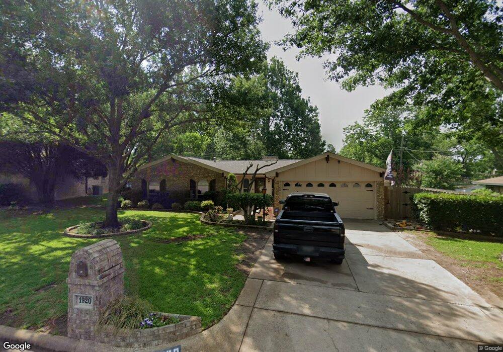
This home is located at 1920 Sage Trail, Hurst, TX 76054 and is currently estimated at $338,735, approximately $220 per square foot. 1920 Sage Trail is a home located in Tarrant County with nearby schools including Shady Oaks Elementary School, Bedford Junior High School, and L.D. Bell High School.
Ownership History
Date
Name
Owned For
Owner Type
Purchase Details
Closed on
Jun 28, 2019
Sold by
Lindsay Derwood Duane
Bought by
Binton Robert E and Vernoski Kristen Marie
Current Estimated Value
Home Financials for this Owner
Home Financials are based on the most recent Mortgage that was taken out on this home.
Original Mortgage
$181,649
Outstanding Balance
$160,519
Interest Rate
4.25%
Mortgage Type
FHA
Estimated Equity
$178,216
Purchase Details
Closed on
Feb 24, 2014
Sold by
Casler Steven Kelly
Bought by
Lindsay Derwood Duane
Create a Home Valuation Report for This Property
The Home Valuation Report is an in-depth analysis detailing your home's value as well as a comparison with similar homes in the area
Home Values in the Area
Average Home Value in this Area
Purchase History
| Date | Buyer | Sale Price | Title Company |
|---|---|---|---|
| Binton Robert E | -- | Itc | |
| Lindsay Derwood Duane | -- | None Available |
Source: Public Records
Mortgage History
| Date | Status | Borrower | Loan Amount |
|---|---|---|---|
| Open | Binton Robert E | $181,649 |
Source: Public Records
Tax History Compared to Growth
Tax History
| Year | Tax Paid | Tax Assessment Tax Assessment Total Assessment is a certain percentage of the fair market value that is determined by local assessors to be the total taxable value of land and additions on the property. | Land | Improvement |
|---|---|---|---|---|
| 2025 | $3,966 | $293,550 | $65,000 | $228,550 |
| 2024 | $3,966 | $293,550 | $65,000 | $228,550 |
| 2023 | $4,911 | $299,421 | $45,000 | $254,421 |
| 2022 | $5,131 | $241,570 | $45,000 | $196,570 |
| 2021 | $4,886 | $202,585 | $45,000 | $157,585 |
| 2020 | $4,889 | $203,191 | $45,000 | $158,191 |
| 2019 | $4,547 | $204,629 | $45,000 | $159,629 |
| 2018 | $1,577 | $168,904 | $45,000 | $123,904 |
| 2017 | $3,886 | $177,824 | $35,000 | $142,824 |
| 2016 | $3,532 | $153,236 | $35,000 | $118,236 |
| 2015 | $1,621 | $126,900 | $15,000 | $111,900 |
| 2014 | $1,621 | $126,900 | $15,000 | $111,900 |
Source: Public Records
Map
Nearby Homes
- 520 Baker Dr
- 421 Cavender Ct
- 440 W Louella Dr
- 1625 Oak Creek Dr
- 608 W Pleasantview Dr
- 2212 Hurstview Dr
- 521 Brookview Dr
- 425 W Pleasantview Dr
- 2244 Hurstview Dr
- 823 W Harwood Rd
- 404 Heather Ln
- 229 Brookview Dr
- 100 Hillview Ct
- 121 Kay Ct
- 124 Jeannie Ct
- 6124 Mayfair Mews
- 6105 Parker Blvd
- 2668 Bent Tree Dr
- 1732 Jeannie Ln
- 6008 Kessler Dr
- 1916 Sage Trail
- 1924 Sage Trail
- 1921 Mesquite Trail
- 1917 Mesquite Trail
- 1925 Mesquite Trail
- 1912 Sage Trail
- 1928 Sage Trail
- 1913 Mesquite Trail
- 1929 Mesquite Trail
- 1917 Sage Trail
- 1908 Sage Trail
- 1933 Mesquite Trail
- 1925 Sage Trail
- 1909 Mesquite Trail
- 1913 Sage Trail
- 1932 Sage Trail
- 613 Tumbleweed Dr
- 1920 Mesquite Trail
- 1937 Mesquite Trail
- 1916 Mesquite Trail