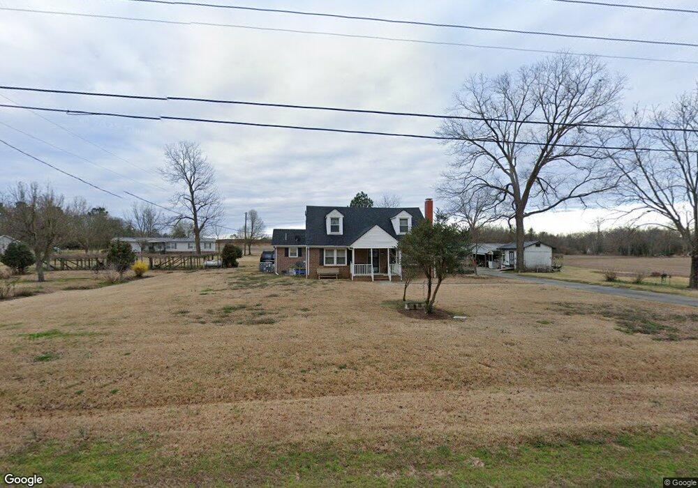
1920 Taylors Bridge Hwy Clinton, NC 28328
Estimated Value: $161,000 - $220,941
3
Beds
3
Baths
1,821
Sq Ft
$104/Sq Ft
Est. Value
About This Home
This home is located at 1920 Taylors Bridge Hwy, Clinton, NC 28328 and is currently estimated at $188,735, approximately $103 per square foot. 1920 Taylors Bridge Hwy is a home located in Sampson County with nearby schools including Union Elementary School, Union Intermediate School, and Union Middle School.
Ownership History
Date
Name
Owned For
Owner Type
Purchase Details
Closed on
Jan 15, 1993
Bought by
Mckoy Thermon
Current Estimated Value
Create a Home Valuation Report for This Property
The Home Valuation Report is an in-depth analysis detailing your home's value as well as a comparison with similar homes in the area
Home Values in the Area
Average Home Value in this Area
Purchase History
| Date | Buyer | Sale Price | Title Company |
|---|---|---|---|
| Mckoy Thermon | -- | -- |
Source: Public Records
Tax History Compared to Growth
Tax History
| Year | Tax Paid | Tax Assessment Tax Assessment Total Assessment is a certain percentage of the fair market value that is determined by local assessors to be the total taxable value of land and additions on the property. | Land | Improvement |
|---|---|---|---|---|
| 2025 | $1,061 | $136,044 | $18,975 | $117,069 |
| 2024 | $966 | $136,044 | $18,975 | $117,069 |
| 2023 | $938 | $101,373 | $16,500 | $84,873 |
| 2022 | $938 | $101,373 | $16,500 | $84,873 |
| 2021 | $938 | $101,373 | $16,500 | $84,873 |
| 2020 | $938 | $101,373 | $16,500 | $84,873 |
| 2019 | $938 | $101,373 | $0 | $0 |
| 2018 | $834 | $93,224 | $0 | $0 |
| 2017 | $834 | $93,224 | $0 | $0 |
| 2016 | $839 | $93,224 | $0 | $0 |
| 2015 | $839 | $93,224 | $0 | $0 |
| 2014 | $839 | $93,224 | $0 | $0 |
Source: Public Records
Map
Nearby Homes
- 865 Cecil Odie Rd
- 0 Reedsford Rd
- 2153 Rowan Rd
- 2228 Indian Town Rd
- Off of Reedsford Rd Unit LotWP001
- 500 Rowan Rd
- 471 John Mark Rd
- 393 Moltonville Rd
- 1206 Southwest Blvd
- 0 Moltonville Rd
- 1116 Phillips St
- 112 Martin Luther King Junior Blvd
- 110 Martin Luther King Junior Blvd
- 111 Colonial Dr
- 603 Pine St
- 0 Boykin Bridge Rd
- 1 Boykin Bridge Rd
- N11 0 1 Sr 1004
- 335 Sprunt Dr
- 107 Miami St
- 1936 Taylors Bridge Hwy
- 1889 Taylors Bridge Hwy
- 1980 Taylors Bridge Hwy
- 1791 Taylors Bridge Hwy
- 2065 Taylors Bridge Hwy
- 1750 Taylors Bridge Hwy
- 1678 Taylors Bridge Hwy
- 2109 Taylors Bridge Hwy
- 2137 Taylors Bridge Hwy
- 2191 Taylors Bridge Hwy
- 1630 Taylors Bridge Hwy
- 1496 Taylors Bridge Hwy
- 1584 Taylors Bridge Hwy
- 1368 Taylors Bridge Hwy
- 1300 Taylors Bridge Hwy
- 29 Sandy Ln
- 1265 Taylors Bridge Hwy
- 180 Sandy Ln
- 1244 Taylors Bridge Hwy
- 240 Sandy Ln