1920 W Wilson Rd Pahrump, NV 89048
Estimated payment $1,504/month
Highlights
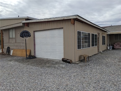
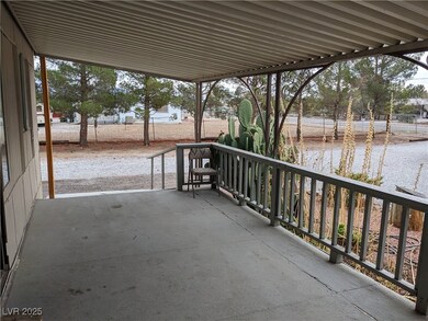
- Guest House
- Circular Driveway
- Wainscoting
- No HOA
- 1 Car Detached Garage
- Laundry Room
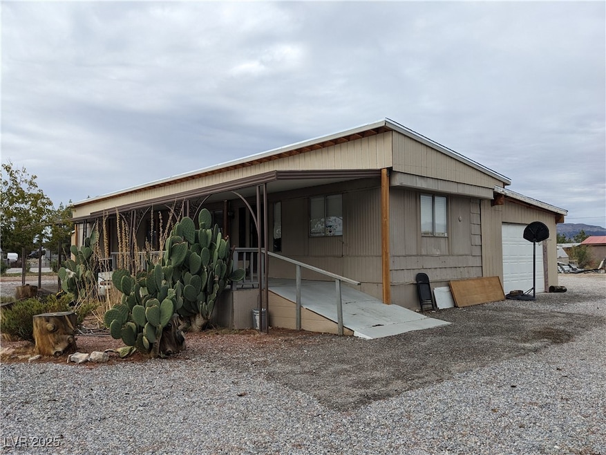
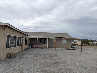
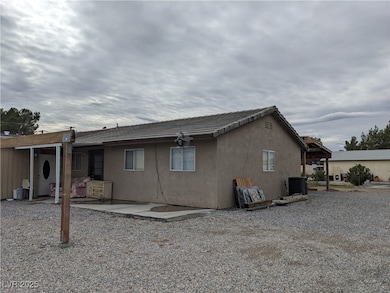
About This Home
Great income opportunity- 3 homes on one lot. Or use for nex-gen with maximum privacy. The Manufactured Home is a fixer upper, 2 bedroom and 2 bathrooms. The second property has a 1 car garage, 1 bedroom and 1 full bathroom. The 3rd property has 2 bedrooms and 1 bathroom.,
NO HOA'S AND NOT IN A FLOOD ZONE. FULLY FENCED. PRIVATE WELL AND SEPTIC SYSTEM.
Listing Agent
Trish Rippie Realty Inc Brokerage Phone: 775-727-4343 License #S.0072399 Listed on: 11/28/2025
Property Details
Home Type
- Manufactured Home
Est. Annual Taxes
- $999
Year Built
- Built in 1975
Lot Details
- 1 Acre Lot
- South Facing Home
- Wrought Iron Fence
- Property is Fully Fenced
- Barbed Wire
- Chain Link Fence
- Drip System Landscaping
Parking
- 1 Car Detached Garage
- Circular Driveway
- Open Parking
Home Design
- Shingle Roof
- Tile Roof
- Composition Roof
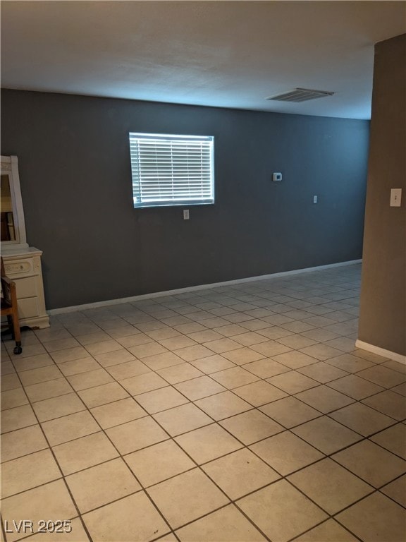
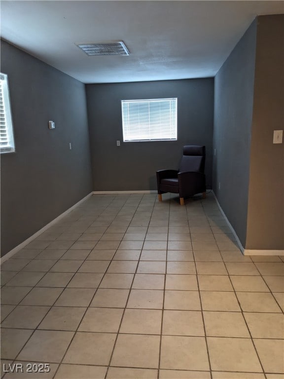
Interior Spaces
- 2,568 Sq Ft Home
- 1-Story Property
- Wainscoting
- Gas Cooktop
Flooring
- Carpet
- Linoleum
- Laminate
- Tile
- Vinyl
Bedrooms and Bathrooms
- 5 Bedrooms
Laundry
- Laundry Room
- Electric Dryer Hookup
Schools
- Manse Elementary School
- Rosemary Clarke Middle School
- Pahrump Valley High School
Utilities
- Central Heating and Cooling System
- Multiple Heating Units
- Private Water Source
- Well
- Septic Tank
Additional Features
- Sprinkler System
- Guest House
- Mobile Home is 14 x 66 Feet
Community Details
- No Home Owners Association
- Built by Fleetwood
- Cal Vegas Ranchos Uf Subdivision
Map
Home Values in the Area
Average Home Value in this Area
Tax History
| Year | Tax Paid | Tax Assessment Tax Assessment Total Assessment is a certain percentage of the fair market value that is determined by local assessors to be the total taxable value of land and additions on the property. | Land | Improvement |
|---|---|---|---|---|
| 2025 | $923 | $37,565 | $4,135 | $33,430 |
| 2024 | $923 | $37,983 | $4,135 | $33,848 |
| 2023 | $923 | $37,235 | $4,135 | $33,100 |
| 2022 | $796 | $32,115 | $4,135 | $27,980 |
| 2021 | $639 | $26,858 | $3,308 | $23,550 |
| 2020 | $567 | $25,650 | $3,308 | $22,342 |
| 2019 | $533 | $20,709 | $3,308 | $17,401 |
| 2018 | $511 | $19,471 | $2,646 | $16,825 |
| 2017 | $488 | $16,043 | $2,646 | $13,397 |
| 2016 | $476 | $12,698 | $2,646 | $10,052 |
| 2015 | $476 | $12,211 | $2,646 | $9,565 |
| 2014 | $462 | $13,031 | $2,646 | $10,385 |
Property History
| Date | Event | Price | List to Sale | Price per Sq Ft |
|---|---|---|---|---|
| 11/28/2025 11/28/25 | For Sale | $270,000 | -- | $105 / Sq Ft |
Purchase History
| Date | Type | Sale Price | Title Company |
|---|---|---|---|
| Bargain Sale Deed | $135,000 | Cow County Title Co | |
| Bargain Sale Deed | $100,000 | Cow County Title Co | |
| Interfamily Deed Transfer | -- | Markem Title Company | |
| Interfamily Deed Transfer | -- | Markem Title Company | |
| Bargain Sale Deed | $130,000 | Markem Title Company |
Mortgage History
| Date | Status | Loan Amount | Loan Type |
|---|---|---|---|
| Previous Owner | $130,000 | Purchase Money Mortgage |
Source: Las Vegas REALTORS®
MLS Number: 2737365
APN: 36-282-17
Disclaimer: Certain information contained herein is derived from information provided by parties other than Homes.com. All information provided is deemed reliable, but is not guaranteed to be accurate and should be independently verified.
![]() The data relating to real estate for sale on this web site comes in part from the INTERNET DATA EXCHANGE Program of the Greater Las Vegas Association of REALTORS® MLS. Real estate listings held by brokerage firms other than this site owner are marked with the IDX logo. Information is deemed reliable but not guaranteed. Copyright 2025 of the Greater Las Vegas Association of REALTORS® MLS. All rights reserved.
The data relating to real estate for sale on this web site comes in part from the INTERNET DATA EXCHANGE Program of the Greater Las Vegas Association of REALTORS® MLS. Real estate listings held by brokerage firms other than this site owner are marked with the IDX logo. Information is deemed reliable but not guaranteed. Copyright 2025 of the Greater Las Vegas Association of REALTORS® MLS. All rights reserved.
- 1921 W Wilson Rd
- 1980 W Irons St
- 1830 W Irons St
- 1950 W Horn Rd
- 1740 W Donner St
- 1640 W Donner St
- 1751 Vondell Dr
- 2221 W Windsong Ln
- 551 Cynthia St
- 801 S Ford Loop
- 831 S Ford Loop
- 550 SE Cynthia St
- 520 Cynthia St
- 2141 W Basin Ave
- 2171 W Basin Ave
- 670 Cynthia St
- 700 Cynthia St
- 1770 W Charleston Park Ave
- 2431 Dyer Ct
- 1660 W Charleston Park Ave
- 1550 W Irons St Unit B
- 1480 W Irons St
- 1111 Hardy Ln Unit B - Back
- 1060 S Bunch St
- 1781 Baradonna Rd
- 70 Montecito Dr
- 3641 W Windsong Ln
- 551 Piltz Rd
- 1721 S Blagg Rd
- 1601 Zelzah Ave
- 4201 Jessica St
- 1140 Sixshooter Ave Unit 2
- 448 Comstock St
- 452 Comstock St Unit 3
- 1420 Ogallala St Unit 3
- 1111 Sixshooter Ave Unit 2B
- 1390 Ogallala St Unit 3
- 1370 Ogallala St Unit 2
- 1411 Ogallala St Unit C
- 1401 Ogallala St Unit 2
