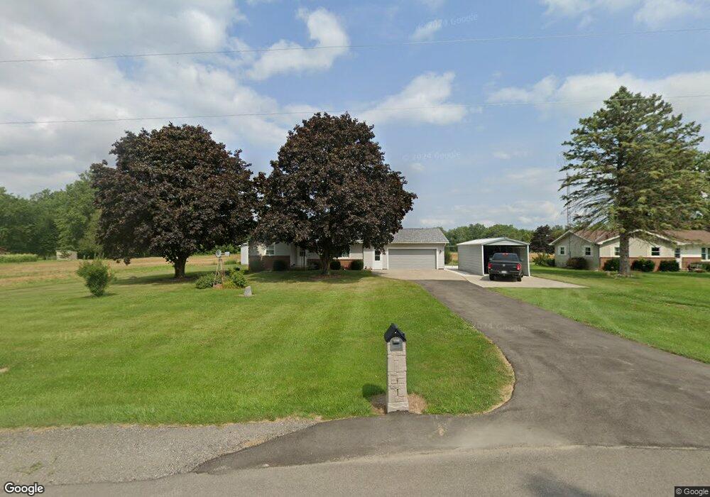
19202 State Route 15 Pioneer, OH 43554
Estimated Value: $163,000 - $209,000
3
Beds
1
Bath
1,268
Sq Ft
$145/Sq Ft
Est. Value
About This Home
This home is located at 19202 State Route 15, Pioneer, OH 43554 and is currently estimated at $183,443, approximately $144 per square foot. 19202 State Route 15 is a home located in Williams County with nearby schools including North Central Elementary School and North Central Junior/Senior High School.
Ownership History
Date
Name
Owned For
Owner Type
Purchase Details
Closed on
Jul 22, 2020
Sold by
Carr Paul J and Carr Shirley J
Bought by
Carr Paul J and Carr Shirley J
Current Estimated Value
Home Financials for this Owner
Home Financials are based on the most recent Mortgage that was taken out on this home.
Original Mortgage
$130,500
Outstanding Balance
$103,433
Interest Rate
2.8%
Mortgage Type
VA
Estimated Equity
$80,010
Purchase Details
Closed on
Oct 24, 1996
Sold by
Gillespie Edward
Bought by
Carr Paul J and Carr Wilson Shirley J
Purchase Details
Closed on
May 19, 1995
Sold by
Goebel Laree M
Bought by
Gillespie Edward
Create a Home Valuation Report for This Property
The Home Valuation Report is an in-depth analysis detailing your home's value as well as a comparison with similar homes in the area
Home Values in the Area
Average Home Value in this Area
Purchase History
| Date | Buyer | Sale Price | Title Company |
|---|---|---|---|
| Carr Paul J | -- | Advantage Title Llc | |
| Carr Paul J | $79,000 | -- | |
| Gillespie Edward | $79,000 | -- |
Source: Public Records
Mortgage History
| Date | Status | Borrower | Loan Amount |
|---|---|---|---|
| Open | Carr Paul J | $130,500 |
Source: Public Records
Tax History Compared to Growth
Tax History
| Year | Tax Paid | Tax Assessment Tax Assessment Total Assessment is a certain percentage of the fair market value that is determined by local assessors to be the total taxable value of land and additions on the property. | Land | Improvement |
|---|---|---|---|---|
| 2024 | $1,513 | $47,530 | $6,580 | $40,950 |
| 2023 | $1,513 | $35,850 | $6,690 | $29,160 |
| 2022 | $1,222 | $35,850 | $6,690 | $29,160 |
| 2021 | $1,222 | $35,850 | $6,690 | $29,160 |
| 2020 | $982 | $29,860 | $5,570 | $24,290 |
| 2019 | $975 | $29,860 | $5,570 | $24,290 |
| 2018 | $973 | $29,860 | $5,570 | $24,290 |
| 2017 | $946 | $29,860 | $5,430 | $24,430 |
| 2016 | $899 | $29,860 | $5,430 | $24,430 |
| 2015 | $949 | $29,860 | $5,430 | $24,430 |
| 2014 | $949 | $29,860 | $5,430 | $24,430 |
| 2013 | $958 | $29,860 | $5,430 | $24,430 |
Source: Public Records
Map
Nearby Homes
- 204 Lincoln St
- 4610 Wynnewood Dr
- 14667 Roberts Ct
- 4324 Oak Glen Dr
- 14621 Laura Ln
- 301 S 3rd St
- 4002 & 4014 Meadowlawn Dr
- 513 Tanglewood Ln
- 14165 Crampton Rd
- V/L E Territorial Rd
- 16748 Us Highway 20ns
- 13151 Tripp Rd
- 12471 Crampton Rd
- 13551 Hillsdale Rd
- 131 Choctaw Trail
- 11794 Clark Rd
- 155 Navajo Trail
- 13791 E Diane Dr
- 13857 E Diane Dr
- 5311 E Burt Rd
- 19180 State Route 15
- 19180 St Rt 15
- 19274 State Route 15
- 19344 State Route 15
- 19351 State Route 15
- 14659 County Rd S
- 0 Ohio 15 Unit 4663651
- 13848 County Road S
- 18902 State Route 15
- 13776 County Road S
- 13683 County Road S
- 13645 County Road S
- 18783 State Route 15
- 13615 County Road S
- 13738 S Rd
- 18653 State Route 15
- 701 N State St
- 0 Ohio 15 Unit 4653625
- 5251 E Territorial Rd
- 4831 E Territorial Rd