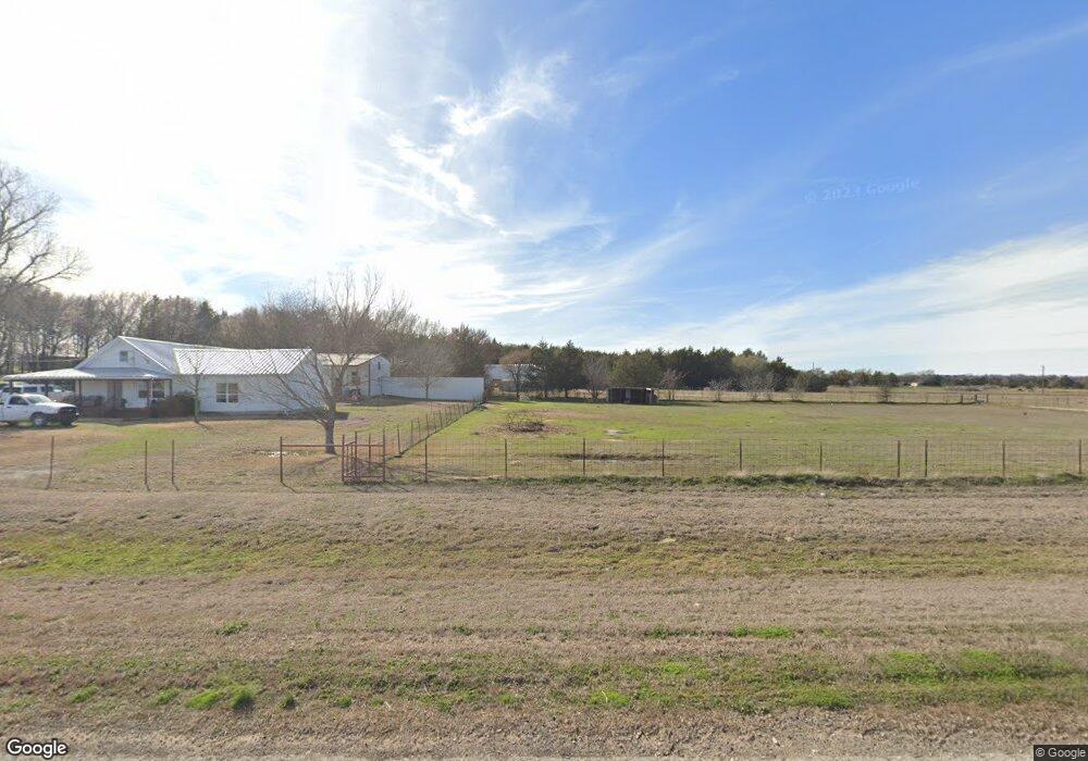
19209 Fm 678 Whitesboro, TX 76273
Estimated Value: $320,508 - $726,000
3
Beds
2
Baths
1,845
Sq Ft
$265/Sq Ft
Est. Value
About This Home
This home is located at 19209 Fm 678, Whitesboro, TX 76273 and is currently estimated at $489,127, approximately $265 per square foot. 19209 Fm 678 is a home located in Cooke County with nearby schools including Callisburg Elementary School, Callisburg Middle School, and Callisburg High School.
Ownership History
Date
Name
Owned For
Owner Type
Purchase Details
Closed on
Nov 13, 2019
Sold by
Hatten Clifford P
Bought by
Hatten Sarah R
Current Estimated Value
Purchase Details
Closed on
Dec 6, 2007
Sold by
Holder Tommy and Holder Patti
Bought by
Hatten Clifford P
Home Financials for this Owner
Home Financials are based on the most recent Mortgage that was taken out on this home.
Original Mortgage
$130,612
Outstanding Balance
$82,298
Interest Rate
6.3%
Mortgage Type
New Conventional
Estimated Equity
$406,829
Purchase Details
Closed on
May 19, 2006
Sold by
Hensley George and Hensley Jennifer
Bought by
Holder Tommy and Holder Patti
Home Financials for this Owner
Home Financials are based on the most recent Mortgage that was taken out on this home.
Original Mortgage
$82,000
Interest Rate
6.4%
Mortgage Type
Purchase Money Mortgage
Create a Home Valuation Report for This Property
The Home Valuation Report is an in-depth analysis detailing your home's value as well as a comparison with similar homes in the area
Home Values in the Area
Average Home Value in this Area
Purchase History
| Date | Buyer | Sale Price | Title Company |
|---|---|---|---|
| Hatten Sarah R | -- | None Available | |
| Hatten Clifford P | -- | -- | |
| Holder Tommy | -- | -- |
Source: Public Records
Mortgage History
| Date | Status | Borrower | Loan Amount |
|---|---|---|---|
| Open | Hatten Clifford P | $130,612 | |
| Previous Owner | Holder Tommy | $82,000 |
Source: Public Records
Tax History Compared to Growth
Tax History
| Year | Tax Paid | Tax Assessment Tax Assessment Total Assessment is a certain percentage of the fair market value that is determined by local assessors to be the total taxable value of land and additions on the property. | Land | Improvement |
|---|---|---|---|---|
| 2025 | $2,091 | $233,114 | $30,863 | $202,251 |
| 2024 | $2,091 | $244,558 | $0 | $0 |
| 2023 | $2,621 | $224,434 | $0 | $0 |
| 2022 | $2,769 | $186,662 | $0 | $0 |
| 2021 | $3,103 | $0 | $0 | $0 |
| 2020 | $3,286 | $0 | $0 | $0 |
| 2019 | $2,985 | $158,243 | $38,000 | $120,243 |
| 2018 | $2,728 | $147,562 | $36,000 | $111,562 |
| 2017 | $2,503 | $126,607 | $26,000 | $100,607 |
| 2015 | $2,198 | $124,383 | $26,000 | $98,383 |
| 2014 | $2,198 | $123,702 | $26,000 | $97,702 |
Source: Public Records
Map
Nearby Homes
- 239 County Road 118
- 247 County Road 156
- TBD Bar Brock Trail
- 1619 County Rd 156
- TBD Annahill
- TBD1 County Rd 116
- TBD8 County Road 141
- 0 Tbd County Road 113
- TBD Cr 113
- 210 County Road 1264
- TBD Old Sherman Rd
- 0 Sandusky Rd Unit 18837132
- 0 Sandusky Rd Unit 18837131
- TBD Frank Wood Rd
- TBD Sandusky Rd
- 0 Sandusky Rd Unit 18837133
- 0 Sandusky Rd Unit 18837128
- TBD Davis Rd
- 130 County Road 1264
- 000 County Road 1258