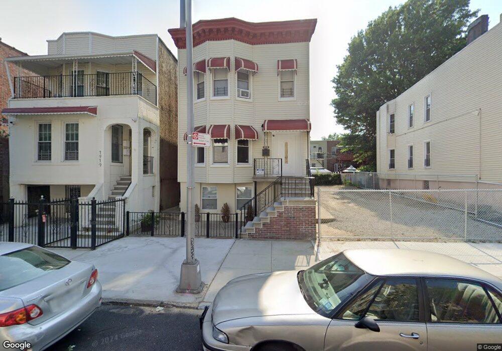
1921 Barnes Ave Unit 2 Bronx, NY 10462
Van Nest NeighborhoodEstimated Value: $867,000 - $936,000
3
Beds
1
Bath
3,214
Sq Ft
$280/Sq Ft
Est. Value
About This Home
This home is located at 1921 Barnes Ave Unit 2, Bronx, NY 10462 and is currently estimated at $900,808, approximately $280 per square foot. 1921 Barnes Ave Unit 2 is a home located in Bronx County with nearby schools including P.S. 105 Senator Abraham Bernstein, Pelham Academy, and Bronx Green Middle School.
Ownership History
Date
Name
Owned For
Owner Type
Purchase Details
Closed on
Dec 28, 2023
Sold by
Adorno Anthony and Adorno Marjorie
Bought by
Chan Cuidan
Current Estimated Value
Home Financials for this Owner
Home Financials are based on the most recent Mortgage that was taken out on this home.
Original Mortgage
$540,000
Outstanding Balance
$531,022
Interest Rate
7.22%
Mortgage Type
Purchase Money Mortgage
Estimated Equity
$369,786
Purchase Details
Closed on
Sep 17, 2001
Sold by
Zwick Gertrude
Bought by
Adorno Anthony and Adorno Marjorie
Home Financials for this Owner
Home Financials are based on the most recent Mortgage that was taken out on this home.
Original Mortgage
$243,200
Interest Rate
6.66%
Mortgage Type
Purchase Money Mortgage
Create a Home Valuation Report for This Property
The Home Valuation Report is an in-depth analysis detailing your home's value as well as a comparison with similar homes in the area
Home Values in the Area
Average Home Value in this Area
Purchase History
| Date | Buyer | Sale Price | Title Company |
|---|---|---|---|
| Chan Cuidan | $840,000 | -- | |
| Adorno Anthony | $256,000 | First American Title Ins Co |
Source: Public Records
Mortgage History
| Date | Status | Borrower | Loan Amount |
|---|---|---|---|
| Open | Chan Cuidan | $540,000 | |
| Previous Owner | Adorno Anthony | $243,200 |
Source: Public Records
Tax History Compared to Growth
Tax History
| Year | Tax Paid | Tax Assessment Tax Assessment Total Assessment is a certain percentage of the fair market value that is determined by local assessors to be the total taxable value of land and additions on the property. | Land | Improvement |
|---|---|---|---|---|
| 2025 | $6,316 | $34,814 | $6,525 | $28,289 |
| 2024 | $6,316 | $32,844 | $5,580 | $27,264 |
| 2023 | $6,386 | $32,844 | $5,979 | $26,865 |
| 2022 | $6,220 | $47,220 | $9,480 | $37,740 |
| 2021 | $6,169 | $46,680 | $9,480 | $37,200 |
| 2020 | $5,845 | $43,020 | $9,480 | $33,540 |
| 2019 | $5,433 | $35,040 | $9,480 | $25,560 |
| 2018 | $5,282 | $27,370 | $8,496 | $18,874 |
| 2017 | $5,238 | $27,163 | $9,210 | $17,953 |
| 2016 | $4,813 | $25,627 | $8,633 | $16,994 |
| 2015 | $2,871 | $24,177 | $10,059 | $14,118 |
| 2014 | $2,871 | $22,809 | $8,061 | $14,748 |
Source: Public Records
Map
Nearby Homes
- 1907 Barnes Ave
- 1916 Barnes Ave
- 1914 Holland Ave
- 1858 Wallace Ave
- 1961 Wallace Ave
- 1869 Muliner Ave
- 1904 Bronxdale Ave
- 1865 Hunt Ave
- 1925 Bogart Ave
- 928 Rhinelander Ave
- 762 Brady Ave Unit 221
- 762 Brady Ave Unit 621
- 760 Brady Ave Unit 117
- 758 Brady Ave Unit 411
- 758 Brady Ave Unit 214
- 760 Brady Ave Unit 417
- 661 Sagamore St
- 754 Brady Ave Unit 303
- 756 Brady Ave Unit 507
- 848 Morris Park Ave
- 1919 Barnes Ave
- 1917 Barnes Ave
- 1921 Barnes Ave Unit 1
- 1921 Barnes Ave
- 1915 Barnes Ave
- 1923 Barnes Ave
- 1913 Barnes Ave
- 1925 Barnes Ave
- 1911 Barnes Ave
- 1918 Wallace Ave Unit 2
- 1918 Wallace Ave Unit 1
- 1918 Wallace Ave
- 1920 Wallace Ave
- 1916 Wallace Ave
- 1909 Barnes Ave
- 1927 Barnes Ave
- 1922 Wallace Ave
- 1914 Wallace Ave
- 1926 Wallace Ave
- 1912 Wallace Ave