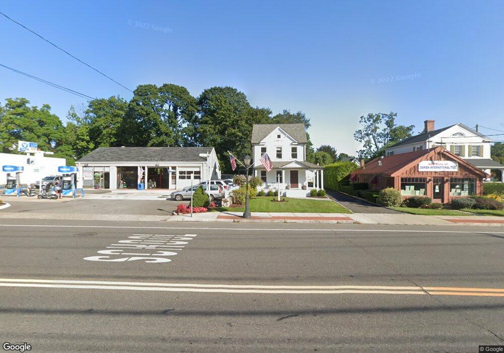
1921 Boston Post Rd Darien, CT 06820
Estimated Value: $1,051,445
3
Beds
2
Baths
1,456
Sq Ft
$722/Sq Ft
Est. Value
About This Home
This home is located at 1921 Boston Post Rd, Darien, CT 06820 and is currently estimated at $1,051,445, approximately $722 per square foot. 1921 Boston Post Rd is a home located in Fairfield County with nearby schools including Hindley Elementary School, Middlesex Middle School, and Darien High School.
Ownership History
Date
Name
Owned For
Owner Type
Purchase Details
Closed on
Feb 1, 2019
Sold by
1921 Post Road Llc
Bought by
1921 Boston Post Road Llc
Current Estimated Value
Home Financials for this Owner
Home Financials are based on the most recent Mortgage that was taken out on this home.
Original Mortgage
$460,000
Outstanding Balance
$405,239
Interest Rate
4.6%
Mortgage Type
Purchase Money Mortgage
Estimated Equity
$646,206
Purchase Details
Closed on
Jul 1, 2004
Sold by
Fazzino F Vance and Capodonna Alex B
Bought by
1821 Post Rd Llc
Home Financials for this Owner
Home Financials are based on the most recent Mortgage that was taken out on this home.
Original Mortgage
$360,000
Interest Rate
6%
Mortgage Type
Commercial
Create a Home Valuation Report for This Property
The Home Valuation Report is an in-depth analysis detailing your home's value as well as a comparison with similar homes in the area
Home Values in the Area
Average Home Value in this Area
Purchase History
| Date | Buyer | Sale Price | Title Company |
|---|---|---|---|
| 1921 Boston Post Road Llc | $587,000 | -- | |
| 1921 Boston Post Road Llc | $587,000 | -- | |
| 1821 Post Rd Llc | $440,000 | -- | |
| 1821 Post Rd Llc | $440,000 | -- |
Source: Public Records
Mortgage History
| Date | Status | Borrower | Loan Amount |
|---|---|---|---|
| Open | 1821 Post Rd Llc | $460,000 | |
| Closed | 1821 Post Rd Llc | $460,000 | |
| Previous Owner | 1821 Post Rd Llc | $250,000 | |
| Previous Owner | 1821 Post Rd Llc | $360,000 |
Source: Public Records
Tax History
| Year | Tax Paid | Tax Assessment Tax Assessment Total Assessment is a certain percentage of the fair market value that is determined by local assessors to be the total taxable value of land and additions on the property. | Land | Improvement |
|---|---|---|---|---|
| 2025 | $0 | $551,740 | $284,410 | $267,330 |
| 2024 | $8,714 | $368,830 | $284,410 | $84,420 |
| 2023 | $8,714 | $494,830 | $351,890 | $142,940 |
| 2022 | $8,526 | $494,830 | $351,890 | $142,940 |
| 2021 | $8,333 | $494,830 | $351,890 | $142,940 |
| 2020 | $8,095 | $494,830 | $351,890 | $142,940 |
| 2019 | $8,150 | $494,830 | $351,890 | $142,940 |
| 2018 | $7,770 | $483,210 | $351,890 | $131,320 |
| 2017 | $7,466 | $462,000 | $351,890 | $110,110 |
| 2016 | $7,286 | $462,000 | $351,890 | $110,110 |
| 2015 | $7,082 | $461,370 | $351,260 | $110,110 |
| 2014 | $6,925 | $461,370 | $351,260 | $110,110 |
Source: Public Records
Map
Nearby Homes
- 18 Pasture Ln
- 32 Relihan Rd
- 23 Beach Dr
- 77 Maple St
- 166 Hollow Tree Ridge Rd
- 13 Patton Dr
- 5 Shields Ln
- 29 Waterbury Ave
- 105 Houston Terrace
- 223 Middlesex Rd
- 20 Locust Hill Rd
- 10 Stony Brook Rd
- 33 Dora St
- 171 Sylvan Knoll Rd
- 163 Sylvan Knoll Rd
- 209 Seaside Ave Unit 2
- 254 Seaside Ave Unit A
- 73 Courtland Ave Unit 163 ( 8)
- 950 Cove Rd Unit B6
- 10 Cross Rd
- 1921 Post Rd
- 1909 Boston Post Rd
- 1926 Post Rd
- 1910 Post Rd
- 1909 Post Rd
- 1936 Boston Post Rd
- 1897 Boston Post Rd Unit 1
- 1897 Post Rd Unit 4
- 1897 Post Rd Unit 3
- 1897 Post Rd Unit 2
- 1897 Post Rd Unit 1
- 6 Rings End Rd
- 7 Garden City Rd
- 39 Dickinson Rd
- 9 Garden City Rd
- 1936 Post Rd
- 8 Rings End Rd
- 1950 Post Rd
- 1950 Boston Post Rd Unit 2A
- 1950 Post Rd Unit 2A
Your Personal Tour Guide
Ask me questions while you tour the home.