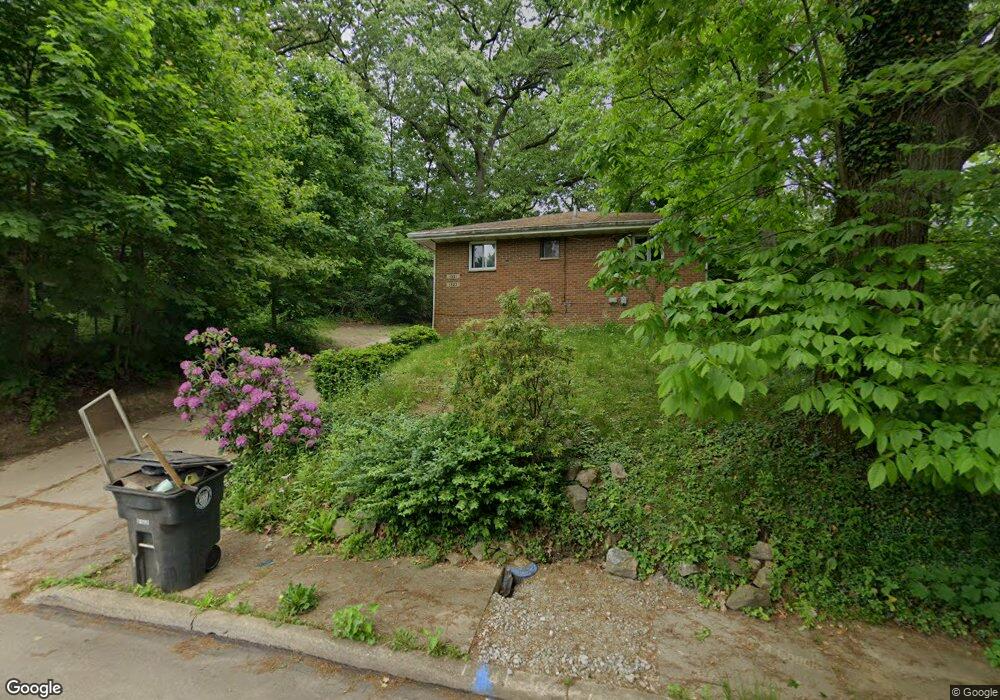
1921 Chestnut Ridge Blvd Unit 1923 Akron, OH 44314
Kenmore NeighborhoodEstimated Value: $98,185 - $133,000
4
Beds
2
Baths
1,323
Sq Ft
$85/Sq Ft
Est. Value
About This Home
This home is located at 1921 Chestnut Ridge Blvd Unit 1923, Akron, OH 44314 and is currently estimated at $112,796, approximately $85 per square foot. 1921 Chestnut Ridge Blvd Unit 1923 is a home located in Summit County with nearby schools including Pfeiffer Elementary School, Kenmore Garfield Community Learning Center, and Emmanuel Christian Academy.
Ownership History
Date
Name
Owned For
Owner Type
Purchase Details
Closed on
Nov 22, 2016
Sold by
Wagler Thomas A
Bought by
T & M Wagler Enterprises
Current Estimated Value
Purchase Details
Closed on
Nov 14, 2016
Sold by
Wagler Thomas R and Wagler Judy L
Bought by
Wagler Thomas A
Purchase Details
Closed on
Jun 11, 2014
Sold by
Stehler Donald A and Stehler Leslie L
Bought by
Wagler Thomas R and Wagler Judy L
Purchase Details
Closed on
Oct 16, 2002
Sold by
Heasley Norma J
Bought by
Stehler Donald A and Stehler Leslie L
Home Financials for this Owner
Home Financials are based on the most recent Mortgage that was taken out on this home.
Original Mortgage
$60,240
Interest Rate
6.29%
Mortgage Type
Purchase Money Mortgage
Create a Home Valuation Report for This Property
The Home Valuation Report is an in-depth analysis detailing your home's value as well as a comparison with similar homes in the area
Home Values in the Area
Average Home Value in this Area
Purchase History
| Date | Buyer | Sale Price | Title Company |
|---|---|---|---|
| T & M Wagler Enterprises | -- | None Available | |
| Wagler Thomas A | -- | None Available | |
| Wagler Thomas R | $60,000 | Chicago Title Insurance Co | |
| Stehler Donald A | $75,300 | Real Living Title Agency Ltd |
Source: Public Records
Mortgage History
| Date | Status | Borrower | Loan Amount |
|---|---|---|---|
| Previous Owner | Stehler Donald A | $60,240 |
Source: Public Records
Tax History Compared to Growth
Tax History
| Year | Tax Paid | Tax Assessment Tax Assessment Total Assessment is a certain percentage of the fair market value that is determined by local assessors to be the total taxable value of land and additions on the property. | Land | Improvement |
|---|---|---|---|---|
| 2025 | $1,722 | $30,086 | $7,210 | $22,876 |
| 2024 | $1,722 | $30,086 | $7,210 | $22,876 |
| 2023 | $1,722 | $30,086 | $7,210 | $22,876 |
| 2022 | $1,401 | $19,793 | $4,743 | $15,050 |
| 2021 | $1,403 | $19,793 | $4,743 | $15,050 |
| 2020 | $1,382 | $19,790 | $4,740 | $15,050 |
| 2019 | $1,327 | $17,220 | $4,490 | $12,730 |
| 2018 | $1,310 | $17,220 | $4,490 | $12,730 |
| 2017 | $1,548 | $17,220 | $4,490 | $12,730 |
| 2016 | $1,549 | $20,200 | $5,200 | $15,000 |
| 2015 | $1,548 | $20,200 | $5,200 | $15,000 |
| 2014 | $1,536 | $20,200 | $5,200 | $15,000 |
| 2013 | $1,657 | $22,350 | $5,200 | $17,150 |
Source: Public Records
Map
Nearby Homes
- 1866 17th St SW
- 955 Iona Ave
- 1899 16th St SW
- 1855 17th St SW
- 918 Silvercrest Ave
- 2078 18th St SW
- 898 Iona Ave
- 2083 17th St SW
- 2016 13th St SW
- 2001 13th St SW
- 1199 Iona Ave
- 2140 18th St SW
- 940 Lakewood Blvd
- 2041 13th St SW
- 2086 13th St SW
- 1637 East Ave Unit 1639
- 2205 Kimball Ct
- 905 National Ave
- 773 Montana Ave
- 2189 15th St SW
- 1921 Chestnut Ridge Blvd
- 1923 Chestnut Ridge Blvd
- 1043 Silvercrest Ave
- 1033 Silvercrest Ave
- 1045 Silvercrest Ave
- 1944 19th St SW
- 1916 Chestnut Ridge Blvd
- 1938 19th St SW
- 1936 Chestnut Ridge Blvd
- 1019 Silvercrest Ave
- 1059 Silvercrest Ave
- 1926 Chestnut Ridge Blvd
- 1922 19th St SW
- 1036 Silvercrest Ave
- 1937 19th St SW
- 1044 Silvercrest Ave
- 1028 Silvercrest Ave
- 1951 19th St SW
- 1024 Silvercrest Ave
- 1918 19th St SW