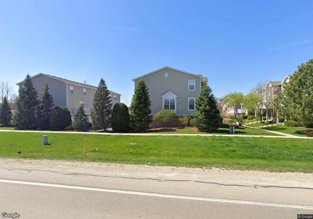
1921 Freedom Ct Unit 1 Zion, IL 60099
West Zion NeighborhoodEstimated Value: $196,000 - $221,000
2
Beds
2
Baths
1,871
Sq Ft
$112/Sq Ft
Est. Value
About This Home
This home is located at 1921 Freedom Ct Unit 1, Zion, IL 60099 and is currently estimated at $208,694, approximately $111 per square foot. 1921 Freedom Ct Unit 1 is a home located in Lake County with nearby schools including Kenneth Murphy School, Beach Park Middle School, and Zion-Benton Township High School.
Ownership History
Date
Name
Owned For
Owner Type
Purchase Details
Closed on
Aug 31, 2021
Sold by
Moore Deandre E
Bought by
Mcclinton Joetta
Current Estimated Value
Home Financials for this Owner
Home Financials are based on the most recent Mortgage that was taken out on this home.
Original Mortgage
$107,920
Outstanding Balance
$98,199
Interest Rate
2.8%
Mortgage Type
New Conventional
Estimated Equity
$110,495
Purchase Details
Closed on
Jun 19, 2012
Sold by
Sb1 Lake County Llc
Bought by
Moore Deandre E
Home Financials for this Owner
Home Financials are based on the most recent Mortgage that was taken out on this home.
Original Mortgage
$81,000
Interest Rate
3.54%
Mortgage Type
Assumption
Purchase Details
Closed on
Dec 30, 2010
Sold by
Dph Shepherds Point Llc
Bought by
Sb1 Lake County Llc
Create a Home Valuation Report for This Property
The Home Valuation Report is an in-depth analysis detailing your home's value as well as a comparison with similar homes in the area
Home Values in the Area
Average Home Value in this Area
Purchase History
| Date | Buyer | Sale Price | Title Company |
|---|---|---|---|
| Mcclinton Joetta | $135,000 | Chicago Title | |
| Moore Deandre E | $83,000 | First American Title | |
| Sb1 Lake County Llc | -- | First American Title Ins Co |
Source: Public Records
Mortgage History
| Date | Status | Borrower | Loan Amount |
|---|---|---|---|
| Open | Mcclinton Joetta | $107,920 | |
| Previous Owner | Moore Deandre E | $81,000 |
Source: Public Records
Tax History Compared to Growth
Tax History
| Year | Tax Paid | Tax Assessment Tax Assessment Total Assessment is a certain percentage of the fair market value that is determined by local assessors to be the total taxable value of land and additions on the property. | Land | Improvement |
|---|---|---|---|---|
| 2024 | $4,783 | $50,966 | $3,069 | $47,897 |
| 2023 | $4,928 | $45,440 | $2,736 | $42,704 |
| 2022 | $4,928 | $43,769 | $2,248 | $41,521 |
| 2021 | $4,909 | $41,603 | $2,109 | $39,494 |
| 2020 | $4,711 | $39,130 | $1,984 | $37,146 |
| 2019 | $4,559 | $36,451 | $1,848 | $34,603 |
| 2018 | $4,373 | $34,767 | $1,842 | $32,925 |
| 2017 | $4,272 | $32,252 | $1,709 | $30,543 |
| 2016 | $3,917 | $30,138 | $1,551 | $28,587 |
| 2015 | $3,853 | $27,346 | $1,407 | $25,939 |
| 2014 | $3,545 | $25,977 | $1,300 | $24,677 |
| 2012 | $5,654 | $35,385 | $1,384 | $34,001 |
Source: Public Records
Map
Nearby Homes
- 4109 Sarah Dr
- 42334 N Heritage Lot 7 Trail
- 12434 W Van Ct
- 2010 Sunset Ct
- 2407 Phillip Dr
- 2407 Miriam Ave
- 2414 Phillip Dr
- 2413 Michael Ave
- 4533 Illinois 173
- 41320 N Green Bay Rd
- 4539 Illinois 173
- 4013 Ridge Rd
- 3404 Sarah Dr
- 3707 Willow Crest Dr
- 3717 Willow Crest Dr
- 1817 Joppa Ave
- 1304 Lorelei Dr
- 1302 Lorelei Dr
- 1531 Southport Ct
- 1304 Pelican Ct
- 1921 Freedom Ct Unit 404
- 1923 Freedom Ct Unit 403
- 1925 Freedom Ct Unit 402
- 1927 Freedom Ct Unit 401
- 1923 Freedom Ct Unit 2
- 1904 Freedom Ct Unit 373
- 1900 Freedom Ct Unit 375
- 1931 Freedom Ct Unit 412
- 1933 Freedom Ct Unit 413
- 1935 Freedom Ct Unit 414
- 1933 Freedom Ct Unit 2
- 1900 Freedom Ct Unit 1
- 1935 Freedom Ct Unit 1
- 1917 Freedom Ct
- 1915 Freedom Ct Unit 393
- 1913 Freedom Ct Unit 392
- 1903 Freedom Ct Unit 384
- 1905 Freedom Ct Unit 383
- 1907 Freedom Ct Unit 382