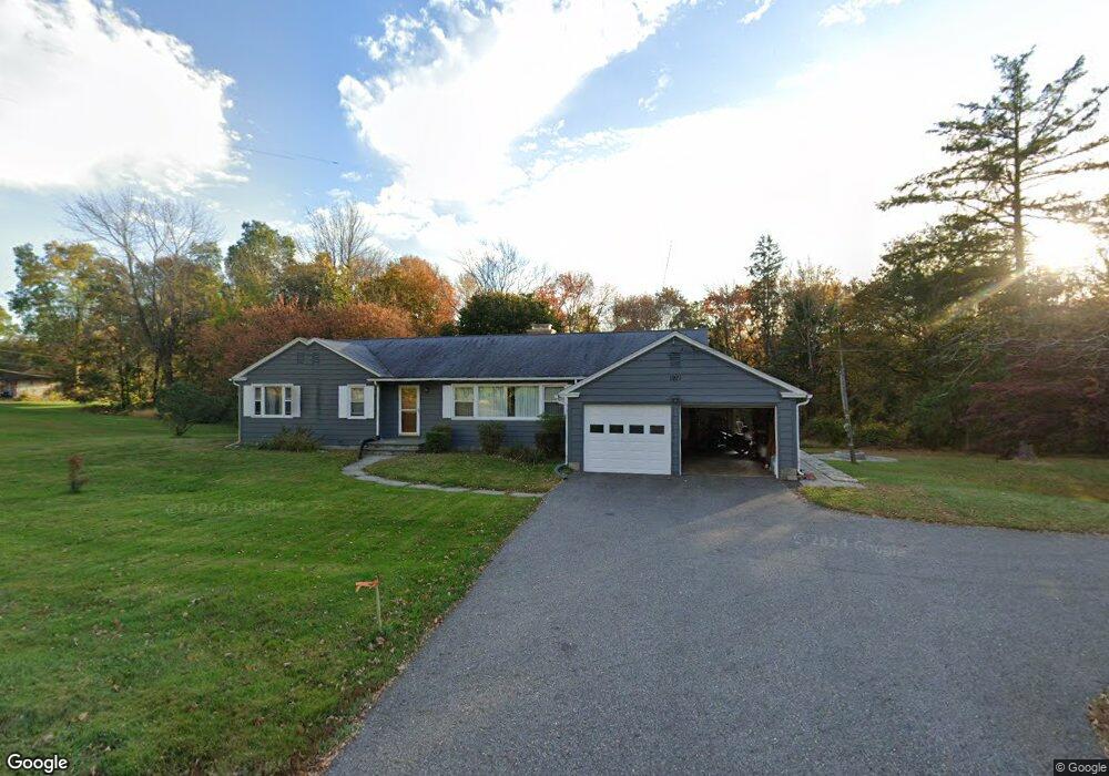
1921 Main St Coventry, CT 06238
Estimated Value: $373,154 - $423,000
3
Beds
2
Baths
1,576
Sq Ft
$254/Sq Ft
Est. Value
About This Home
This home is located at 1921 Main St, Coventry, CT 06238 and is currently estimated at $399,789, approximately $253 per square foot. 1921 Main St is a home located in Tolland County with nearby schools including George Hersey Robertson School, Coventry Grammar School, and Capt. Nathan Hale School.
Ownership History
Date
Name
Owned For
Owner Type
Purchase Details
Closed on
Jul 16, 2003
Sold by
Dufour Robert and Dufour Jessica
Bought by
Beauchamp Lisa
Current Estimated Value
Home Financials for this Owner
Home Financials are based on the most recent Mortgage that was taken out on this home.
Original Mortgage
$190,000
Outstanding Balance
$81,265
Interest Rate
5.34%
Estimated Equity
$318,524
Purchase Details
Closed on
Apr 13, 1998
Sold by
Leach Howard
Bought by
Dufour Robert and Dufour Jessica
Purchase Details
Closed on
Aug 8, 1994
Sold by
Ledoyt Herman
Bought by
Leach Howard
Create a Home Valuation Report for This Property
The Home Valuation Report is an in-depth analysis detailing your home's value as well as a comparison with similar homes in the area
Home Values in the Area
Average Home Value in this Area
Purchase History
| Date | Buyer | Sale Price | Title Company |
|---|---|---|---|
| Beauchamp Lisa | $215,000 | -- | |
| Dufour Robert | $112,000 | -- | |
| Leach Howard | $122,300 | -- | |
| Beauchamp Lisa | $215,000 | -- | |
| Dufour Robert | $112,000 | -- | |
| Leach Howard | $122,300 | -- |
Source: Public Records
Mortgage History
| Date | Status | Borrower | Loan Amount |
|---|---|---|---|
| Open | Leach Howard | $190,000 | |
| Closed | Leach Howard | $190,000 | |
| Previous Owner | Leach Howard | $10,000 |
Source: Public Records
Tax History
| Year | Tax Paid | Tax Assessment Tax Assessment Total Assessment is a certain percentage of the fair market value that is determined by local assessors to be the total taxable value of land and additions on the property. | Land | Improvement |
|---|---|---|---|---|
| 2025 | $5,700 | $239,900 | $47,800 | $192,100 |
| 2024 | $5,090 | $152,800 | $41,500 | $111,300 |
| 2023 | $4,850 | $152,800 | $41,500 | $111,300 |
| 2022 | $4,760 | $152,800 | $41,500 | $111,300 |
| 2021 | $4,760 | $152,800 | $41,500 | $111,300 |
| 2020 | $4,763 | $152,800 | $41,500 | $111,300 |
| 2019 | $4,927 | $153,000 | $41,500 | $111,500 |
| 2018 | $4,434 | $137,700 | $41,500 | $96,200 |
| 2017 | $4,406 | $137,700 | $41,500 | $96,200 |
| 2016 | $4,296 | $137,700 | $41,500 | $96,200 |
| 2015 | $4,296 | $137,700 | $41,500 | $96,200 |
| 2014 | $4,290 | $150,700 | $51,500 | $99,200 |
Source: Public Records
Map
Nearby Homes
- 152 Cheney Ln
- 0 Woodland Rd
- 0 Daly Rd Unit 24146464
- 2478 Main St
- 498 Root Rd
- 198 Forest Rd
- 27 Fox Trail
- 55 Whites Hill Rd
- 17 Ireland Dr
- 0 Hinkel Mae Dr
- 864 Boston Turnpike
- 550 High St
- 499 Woodmont Dr
- 149 Hillyndale Rd
- 16 Westgate Ln
- 0 Skinner Hill Rd Unit 24077239
- 103 S Street Extension
- 31 Wyllys Farm Rd
- 106 S Street Extension
- 37 Wyllys Farm Rd
- 1943 Main St
- 1899 Main St
- 1900 Main St
- 1955 Main St
- 1922 Main St
- 52 Hemlock Point Dr
- 1944 Main St
- 77 Ripley Hill Rd
- 31 Hemlock Point Dr
- 51 Hemlock Point Dr
- 1827 Main St
- 81 Ripley Hill Rd
- 71 Hemlock Point Dr
- 2011 Main St
- 45 Birch Bend Rd
- 85 Ripley Hill Rd
- 120 Hemlock Point Dr
- 2018 Main St
- 109 Hemlock Point Dr
- 134 Hemlock Point Dr
Your Personal Tour Guide
Ask me questions while you tour the home.