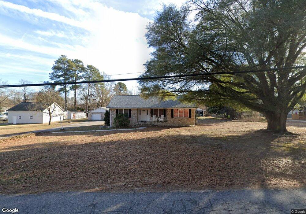
1921 Point of Rocks Rd Chester, VA 23836
Bermuda Hundred NeighborhoodEstimated Value: $351,000 - $416,213
2
Beds
2
Baths
2,940
Sq Ft
$130/Sq Ft
Est. Value
About This Home
This home is located at 1921 Point of Rocks Rd, Chester, VA 23836 and is currently estimated at $382,803, approximately $130 per square foot. 1921 Point of Rocks Rd is a home located in Chesterfield County with nearby schools including Enon Elementary School, Elizabeth Davis Middle School, and Thomas Dale High School - Main Campus.
Ownership History
Date
Name
Owned For
Owner Type
Purchase Details
Closed on
May 29, 2004
Sold by
Smith Larry
Bought by
Norton Allen
Current Estimated Value
Home Financials for this Owner
Home Financials are based on the most recent Mortgage that was taken out on this home.
Original Mortgage
$140,760
Outstanding Balance
$70,281
Interest Rate
6.32%
Mortgage Type
New Conventional
Estimated Equity
$312,522
Purchase Details
Closed on
Oct 17, 1997
Sold by
Rainwater Charles E
Bought by
Smith Larry C and Smith Kathy L
Home Financials for this Owner
Home Financials are based on the most recent Mortgage that was taken out on this home.
Original Mortgage
$83,500
Interest Rate
7.46%
Mortgage Type
New Conventional
Create a Home Valuation Report for This Property
The Home Valuation Report is an in-depth analysis detailing your home's value as well as a comparison with similar homes in the area
Home Values in the Area
Average Home Value in this Area
Purchase History
| Date | Buyer | Sale Price | Title Company |
|---|---|---|---|
| Norton Allen | $175,950 | -- | |
| Smith Larry C | $100,000 | -- |
Source: Public Records
Mortgage History
| Date | Status | Borrower | Loan Amount |
|---|---|---|---|
| Open | Norton Allen | $140,760 | |
| Previous Owner | Smith Larry C | $83,500 |
Source: Public Records
Tax History Compared to Growth
Tax History
| Year | Tax Paid | Tax Assessment Tax Assessment Total Assessment is a certain percentage of the fair market value that is determined by local assessors to be the total taxable value of land and additions on the property. | Land | Improvement |
|---|---|---|---|---|
| 2025 | $3,398 | $379,000 | $59,000 | $320,000 |
| 2024 | $3,398 | $350,300 | $57,000 | $293,300 |
| 2023 | $2,665 | $292,900 | $53,000 | $239,900 |
| 2022 | $2,548 | $277,000 | $48,000 | $229,000 |
| 2021 | $2,543 | $260,700 | $45,000 | $215,700 |
| 2020 | $2,112 | $222,300 | $43,000 | $179,300 |
| 2019 | $2,040 | $214,700 | $42,000 | $172,700 |
| 2018 | $1,909 | $200,900 | $39,000 | $161,900 |
| 2017 | $1,929 | $200,900 | $39,000 | $161,900 |
| 2016 | $1,844 | $192,100 | $39,000 | $153,100 |
| 2015 | $1,849 | $190,000 | $39,000 | $151,000 |
| 2014 | $1,772 | $182,000 | $39,000 | $143,000 |
Source: Public Records
Map
Nearby Homes
- 2111 Point of Rocks Rd
- 14807 Spruce Ave
- 1603 S Esther Ct
- 14706 Gimbel Dr
- 1801 Galley Place
- 14600 Cornwall Ln
- 14510 Rivermont Rd
- 14422 Rivermont Rd
- 2106 E Hundred Rd
- 2100 E Hundred Rd
- 14612 Jefferson Ave
- 301 Beacon Ridge Dr Unit 109
- 1637 Forest Glenn Cir
- 1509 Enon Church Rd
- 1505 Enon Church Rd
- NEUVILLE Plan at Anchor Point
- PINE Plan at Anchor Point
- CABRAL Plan at Anchor Point
- DELMAR Plan at Anchor Point
- ESSEX Plan at Anchor Point
- 1925 Point of Rocks Rd
- 1917 Point of Rocks Rd
- 1922 Point of Rocks Rd
- 15404 Maranatha Ave
- 1918 Point of Rocks Rd
- 15412 Maranatha Ave
- 2001 Point of Rocks Rd
- 1908 Point of Rocks Rd
- 15416 Maranatha Ave
- 15407 Maranatha Ave
- 2005 Point of Rocks Rd
- 15420 Maranatha Ave
- 1900 Point of Rocks Rd
- 15415 Maranatha Ave
- 2008 Point of Rocks Rd
- 1930 Point of Rocks Rd
- 2011 Point of Rocks Rd
- 15227 Spruce Ave
- 15419 Maranatha Ave
- 1901 Point of Rocks Rd