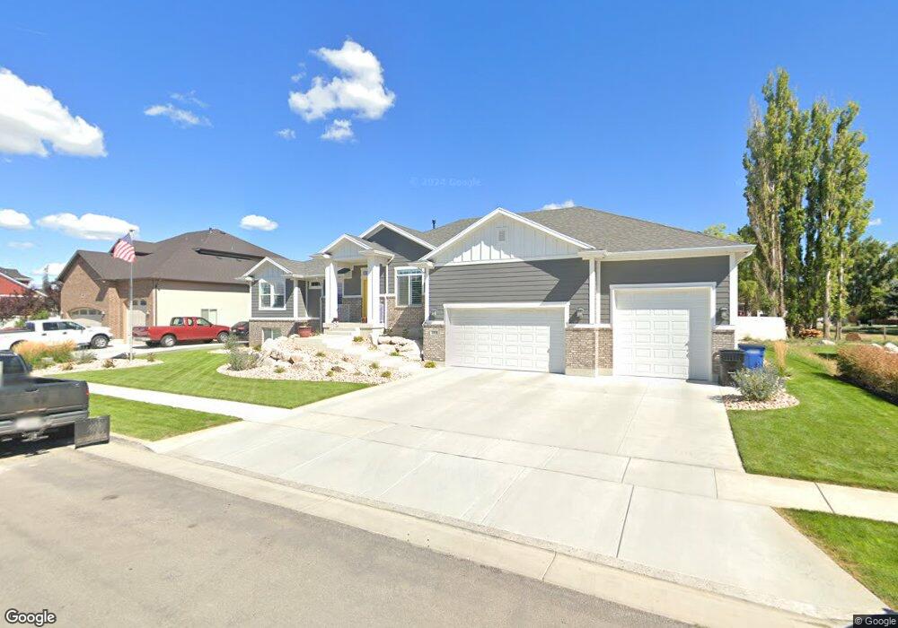
1921 S 3475 W Unit 210 Syracuse, UT 84075
Estimated Value: $707,000 - $839,000
5
Beds
4
Baths
2,008
Sq Ft
$387/Sq Ft
Est. Value
About This Home
This home is located at 1921 S 3475 W Unit 210, Syracuse, UT 84075 and is currently estimated at $777,881, approximately $387 per square foot. 1921 S 3475 W Unit 210 is a home located in Davis County with nearby schools including Buffalo Point School, Syracuse Junior High School, and Syracuse High School.
Ownership History
Date
Name
Owned For
Owner Type
Purchase Details
Closed on
Jul 1, 2025
Sold by
Pullum Jerrad M and Pullum Deborah A
Bought by
Jerrad M And Deborah A Pullum Revocable Livin and Pullum
Current Estimated Value
Purchase Details
Closed on
Sep 16, 2020
Sold by
Pullum Jerrad M and Pullum Deborah A
Bought by
Pullum Jerrad and Pullum Deborah
Home Financials for this Owner
Home Financials are based on the most recent Mortgage that was taken out on this home.
Original Mortgage
$376,700
Interest Rate
2.8%
Mortgage Type
VA
Purchase Details
Closed on
Aug 25, 2014
Sold by
Castle Creek Homes
Bought by
Pullum Jerrad M and Pullum Deborah A
Home Financials for this Owner
Home Financials are based on the most recent Mortgage that was taken out on this home.
Original Mortgage
$370,610
Interest Rate
4.12%
Mortgage Type
Unknown
Create a Home Valuation Report for This Property
The Home Valuation Report is an in-depth analysis detailing your home's value as well as a comparison with similar homes in the area
Home Values in the Area
Average Home Value in this Area
Purchase History
| Date | Buyer | Sale Price | Title Company |
|---|---|---|---|
| Jerrad M And Deborah A Pullum Revocable Livin | -- | None Listed On Document | |
| Pullum Jerrad | -- | Accommodation | |
| Pullum Jerrad M | -- | Mountain View Title |
Source: Public Records
Mortgage History
| Date | Status | Borrower | Loan Amount |
|---|---|---|---|
| Previous Owner | Pullum Jerrad | $376,700 | |
| Previous Owner | Pullum Jerrad M | $370,610 | |
| Previous Owner | Pullum Jerrad M | $295,695 |
Source: Public Records
Tax History Compared to Growth
Tax History
| Year | Tax Paid | Tax Assessment Tax Assessment Total Assessment is a certain percentage of the fair market value that is determined by local assessors to be the total taxable value of land and additions on the property. | Land | Improvement |
|---|---|---|---|---|
| 2025 | $2,545 | $402,050 | $112,924 | $289,126 |
| 2024 | $2,566 | $400,950 | $93,237 | $307,713 |
| 2023 | $2,376 | $682,000 | $138,215 | $543,785 |
| 2022 | $3,152 | $391,050 | $70,968 | $320,082 |
| 2021 | $2,567 | $536,000 | $103,249 | $432,751 |
| 2020 | $2,165 | $463,000 | $85,163 | $377,837 |
| 2019 | $2,302 | $476,000 | $87,995 | $388,005 |
| 2018 | $2,091 | $440,000 | $84,993 | $355,007 |
| 2016 | $1,800 | $210,540 | $34,670 | $175,870 |
| 2015 | $2,834 | $201,685 | $34,670 | $167,015 |
| 2014 | $869 | $63,036 | $63,036 | $0 |
Source: Public Records
Map
Nearby Homes
- 3704 W 2170 S Unit 111
- 3360 W 2280 S
- 2982 S 3000 W
- 2912 S 3000 W
- 1430 Heather Ln
- 3478 Brookshire Dr
- 2961 S 2425 W Unit 1123
- 3867 Rungsted Cir
- 2524 S 3590 W Unit 602
- 2965 S 3000 W
- 2971 S 2425 W Unit 1124
- 2686 S 2440 W Unit 101
- 2635 S 2430 W Unit 114
- 3062 W Solace St
- 2696 2495 S Unit 207
- 2679 W Antelope Dr
- 3951 Baltimore Cir
- 4191 W 1425 S
- 2726 2495 S Unit 205
- 2840 W 1200 S
- 1887 S 3475 W
- 1939 S 3475 W Unit 211
- 1922 S 3475 W Unit 213
- 3417 W 1850 S
- 1930 S 3400 W
- 1940 S 3475 W Unit 212
- 1957 S 3475 W
- 1886 S 3475 W
- 1960 S 3400 W
- 1843 S 3475 W
- 3448 W 1850 S
- 3462 W 1850 S Unit 208
- 3415 W 1850 S
- 1979 S 3475 W
- 1927 S 3525 W Unit 216
- 3484 W 1850 S Unit 207
- 3484 W 1850 S
- 1883 S 3525 W
- 1883 S 3525 W Unit 215
- 1823 S 3475 W