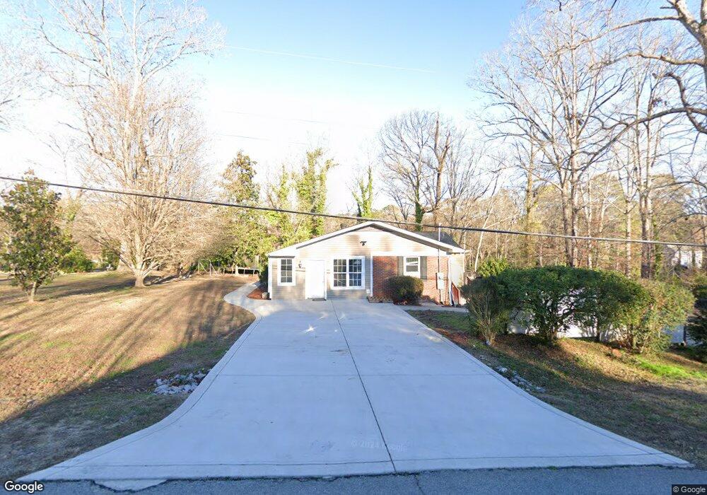
1921 Sutphin Rd Sanford, NC 27330
Estimated Value: $299,881 - $314,000
3
Beds
2
Baths
2,186
Sq Ft
$139/Sq Ft
Est. Value
About This Home
This home is located at 1921 Sutphin Rd, Sanford, NC 27330 and is currently estimated at $304,470, approximately $139 per square foot. 1921 Sutphin Rd is a home located in Lee County with nearby schools including J.R. Ingram Jr. Elementary School, West Lee Middle School, and Lee County High School.
Ownership History
Date
Name
Owned For
Owner Type
Purchase Details
Closed on
Sep 28, 2006
Sold by
Mcbryde Russell W and Centino Martha L
Bought by
Centeno Marta L
Current Estimated Value
Home Financials for this Owner
Home Financials are based on the most recent Mortgage that was taken out on this home.
Original Mortgage
$121,125
Outstanding Balance
$72,278
Interest Rate
6.46%
Mortgage Type
New Conventional
Estimated Equity
$232,192
Create a Home Valuation Report for This Property
The Home Valuation Report is an in-depth analysis detailing your home's value as well as a comparison with similar homes in the area
Home Values in the Area
Average Home Value in this Area
Purchase History
| Date | Buyer | Sale Price | Title Company |
|---|---|---|---|
| Centeno Marta L | $127,500 | None Available |
Source: Public Records
Mortgage History
| Date | Status | Borrower | Loan Amount |
|---|---|---|---|
| Open | Centeno Marta L | $121,125 |
Source: Public Records
Tax History Compared to Growth
Tax History
| Year | Tax Paid | Tax Assessment Tax Assessment Total Assessment is a certain percentage of the fair market value that is determined by local assessors to be the total taxable value of land and additions on the property. | Land | Improvement |
|---|---|---|---|---|
| 2025 | $3,170 | $262,000 | $38,000 | $224,000 |
| 2024 | $3,170 | $238,000 | $38,000 | $200,000 |
| 2023 | $3,160 | $238,000 | $38,000 | $200,000 |
| 2022 | $1,970 | $122,200 | $27,500 | $94,700 |
| 2021 | $1,996 | $122,200 | $27,500 | $94,700 |
| 2020 | $1,990 | $122,200 | $27,500 | $94,700 |
| 2019 | $1,950 | $122,200 | $27,500 | $94,700 |
| 2018 | $1,940 | $121,700 | $25,000 | $96,700 |
| 2017 | $1,916 | $121,200 | $25,000 | $96,200 |
| 2016 | $1,891 | $121,200 | $25,000 | $96,200 |
| 2014 | $1,800 | $121,200 | $25,000 | $96,200 |
Source: Public Records
Map
Nearby Homes
- 2018 Sutphin Rd
- 2400 Carbonton Rd
- 0 Carbonton Rd Unit 100529193
- 0 Carbonton Rd Unit 749750
- 0 Carbonton Rd Unit 24371434
- 3003 Carbonton Rd
- 2305 Weatherwood Ct
- 2313 Weatherwood Ct
- 2313 Grassmere Ct
- 0 Lot A Carbonton Rd
- 2600 Taton Ct
- 2043 Plantation Dr
- 2712 Pebblebrook Dr
- 162 Hickory Grove Dr
- 503 N Franklin Dr
- 1701 Portico Cir
- 0 Mcleod Dr
- 1705 Lord Ashley Dr
- 0 Cool Springs Rd Unit 744558
- 1917 Sutphin Rd
- 2001 Sutphin Rd
- Tract 2 Sutphin Dr
- 0 Sutphin Dr
- 2010 Markham Dr
- 1922 Sutphin Dr
- 1913 Sutphin Rd
- 1913 Sutphin Dr
- 1922 Sutphin Rd
- 1918 Sutphin Rd
- 2102 Markham Dr
- 2005 Sutphin Rd
- 2002 Sutphin Rd
- 1914 Sutphin Rd
- 2006 Sutphin Rd
- 2013 S Shoreline Dr
- 2009 Sutphin Rd
- 2106 Markham Dr
- 1910 Sutphin Rd
- 1910 Sutphin Dr