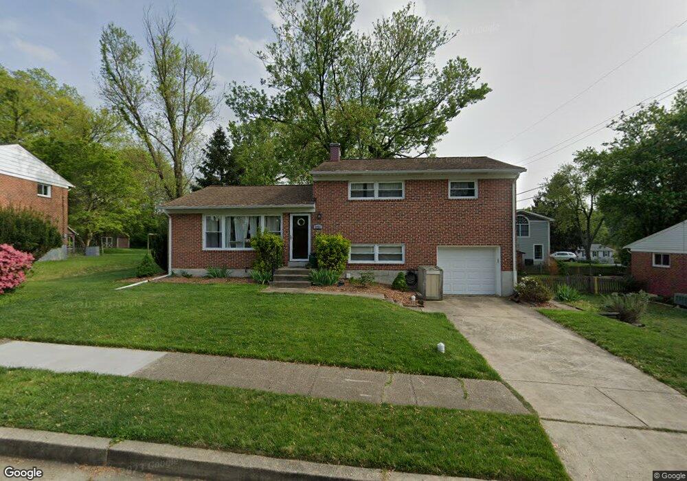
1921 Tadcaster Rd Catonsville, MD 21228
Estimated Value: $511,000 - $546,000
3
Beds
2
Baths
1,698
Sq Ft
$312/Sq Ft
Est. Value
About This Home
This home is located at 1921 Tadcaster Rd, Catonsville, MD 21228 and is currently estimated at $529,235, approximately $311 per square foot. 1921 Tadcaster Rd is a home located in Baltimore County with nearby schools including Westchester Elementary School, Catonsville Middle School, and Catonsville High School.
Ownership History
Date
Name
Owned For
Owner Type
Purchase Details
Closed on
Sep 21, 2010
Sold by
Grisso Paul W and Grisso Paul W
Bought by
Brandt James C
Current Estimated Value
Home Financials for this Owner
Home Financials are based on the most recent Mortgage that was taken out on this home.
Original Mortgage
$315,748
Outstanding Balance
$209,659
Interest Rate
4.55%
Mortgage Type
FHA
Estimated Equity
$319,576
Purchase Details
Closed on
Oct 31, 1961
Sold by
Heagney Gerald F
Bought by
Grisso Paul W
Create a Home Valuation Report for This Property
The Home Valuation Report is an in-depth analysis detailing your home's value as well as a comparison with similar homes in the area
Home Values in the Area
Average Home Value in this Area
Purchase History
| Date | Buyer | Sale Price | Title Company |
|---|---|---|---|
| Brandt James C | $320,000 | -- | |
| Grisso Paul W | $18,000 | -- |
Source: Public Records
Mortgage History
| Date | Status | Borrower | Loan Amount |
|---|---|---|---|
| Open | Brandt James C | $315,748 |
Source: Public Records
Tax History Compared to Growth
Tax History
| Year | Tax Paid | Tax Assessment Tax Assessment Total Assessment is a certain percentage of the fair market value that is determined by local assessors to be the total taxable value of land and additions on the property. | Land | Improvement |
|---|---|---|---|---|
| 2025 | $5,026 | $368,333 | -- | -- |
| 2024 | $5,026 | $347,100 | $129,700 | $217,400 |
| 2023 | $2,394 | $335,667 | $0 | $0 |
| 2022 | $4,533 | $324,233 | $0 | $0 |
| 2021 | $4,212 | $312,800 | $129,700 | $183,100 |
| 2020 | $4,212 | $300,967 | $0 | $0 |
| 2019 | $4,102 | $289,133 | $0 | $0 |
| 2018 | $3,933 | $277,300 | $93,700 | $183,600 |
| 2017 | $3,692 | $269,467 | $0 | $0 |
| 2016 | $3,761 | $261,633 | $0 | $0 |
| 2015 | $3,761 | $253,800 | $0 | $0 |
| 2014 | $3,761 | $253,800 | $0 | $0 |
Source: Public Records
Map
Nearby Homes
- 11 Clay Lodge Ln Unit 204
- 19 Clay Lodge Ln Unit 104
- 8 Seminole Ave
- 231 Gralan Rd
- 2110 Edmondson Ave
- 302 Wessling Cir
- 409 Oak Ct
- 311 Radstock Rd
- 2 Park Dr
- 4476 Ilchester Rd
- 4496 Ilchester Rd
- 121 Forest Dr
- 1300 Rice Ave
- 627 Meyers Dr
- 627 Meyers Dr Unit PARCEL 108
- 16 Locust Dr
- 2310 Rockwell Ave
- 2305 Rockwell Ave
- 230 N Beaumont Ave
- 0 Melvin Ave
- 1919 Tadcaster Rd
- 1923 Tadcaster Rd
- 103 S Morerick Ave
- 1917 Tadcaster Rd
- 1908 Logwind Rd
- 1918 Tadcaster Rd
- 1910 Logwind Rd
- 1920 Tadcaster Rd
- 1906 Logwind Rd
- 1916 Tadcaster Rd
- 2001 Tadcaster Rd
- 1915 Tadcaster Rd
- 1904 Logwind Rd
- 110 S Morerick Ave
- 27 S Morerick Ave
- 1914 Tadcaster Rd
- 104 S Morerick Ave
- 2000 Tadcaster Rd
- 1902 Logwind Rd
- 2003 Tadcaster Rd