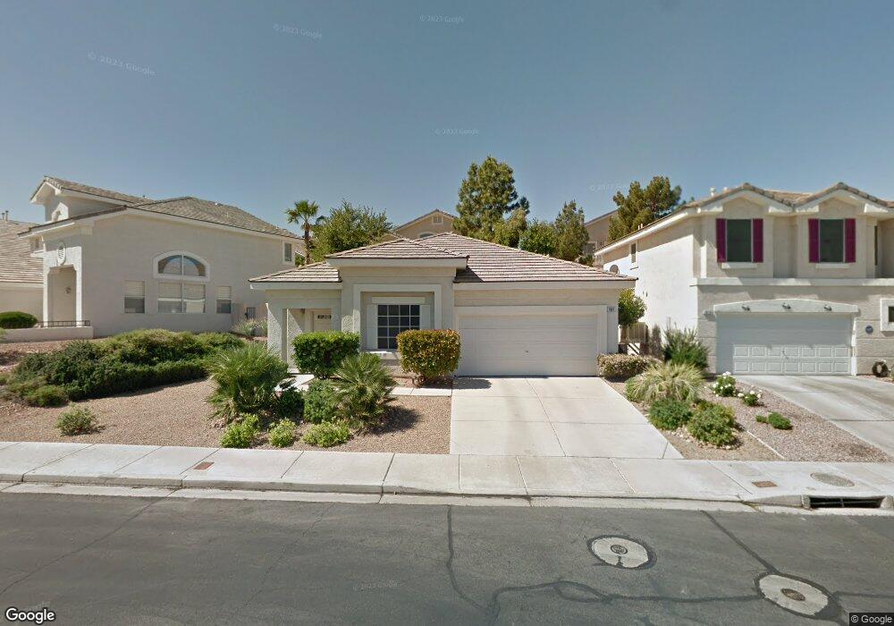
1921 Thunder Ridge Cir Henderson, NV 89012
Green Valley Ranch NeighborhoodEstimated Value: $443,000 - $536,000
3
Beds
2
Baths
1,378
Sq Ft
$348/Sq Ft
Est. Value
About This Home
This home is located at 1921 Thunder Ridge Cir, Henderson, NV 89012 and is currently estimated at $480,176, approximately $348 per square foot. 1921 Thunder Ridge Cir is a home located in Clark County with nearby schools including John Vanderburg Elementary School, Neil C. Twitchell Elementary School, and Bob Miller Middle School.
Ownership History
Date
Name
Owned For
Owner Type
Purchase Details
Closed on
Mar 15, 1999
Sold by
N & N Thunder Ridge Iv
Bought by
Mcdonough Thomas E
Current Estimated Value
Home Financials for this Owner
Home Financials are based on the most recent Mortgage that was taken out on this home.
Original Mortgage
$93,900
Outstanding Balance
$22,629
Interest Rate
6.7%
Estimated Equity
$457,547
Create a Home Valuation Report for This Property
The Home Valuation Report is an in-depth analysis detailing your home's value as well as a comparison with similar homes in the area
Home Values in the Area
Average Home Value in this Area
Purchase History
| Date | Buyer | Sale Price | Title Company |
|---|---|---|---|
| Mcdonough Thomas E | $125,500 | United Title |
Source: Public Records
Mortgage History
| Date | Status | Borrower | Loan Amount |
|---|---|---|---|
| Open | Mcdonough Thomas E | $93,900 |
Source: Public Records
Tax History Compared to Growth
Tax History
| Year | Tax Paid | Tax Assessment Tax Assessment Total Assessment is a certain percentage of the fair market value that is determined by local assessors to be the total taxable value of land and additions on the property. | Land | Improvement |
|---|---|---|---|---|
| 2025 | $1,814 | $99,719 | $44,800 | $54,919 |
| 2024 | $1,761 | $99,719 | $44,800 | $54,919 |
| 2023 | $1,761 | $87,507 | $35,350 | $52,157 |
| 2022 | $1,710 | $80,518 | $32,900 | $47,618 |
| 2021 | $1,661 | $75,111 | $29,750 | $45,361 |
| 2020 | $1,609 | $74,799 | $29,750 | $45,049 |
| 2019 | $1,562 | $70,681 | $26,250 | $44,431 |
| 2018 | $1,517 | $64,471 | $21,700 | $42,771 |
| 2017 | $1,835 | $63,242 | $19,950 | $43,292 |
| 2016 | $1,437 | $57,725 | $14,000 | $43,725 |
| 2015 | $1,433 | $56,474 | $13,300 | $43,174 |
| 2014 | $1,392 | $52,518 | $9,100 | $43,418 |
Source: Public Records
Map
Nearby Homes
- 254 Horizon Pointe Cir
- 261 Horizon Pointe Cir
- 1870 Desert Forest Way
- 338 Pleasant Summit Dr
- 208 Sandpiper Village Way
- 1887 Eagle Flight Ln
- 254 Rockwell Springs Ct
- 259 Rockwell Springs Ct
- 256 Canyon Spirit Dr
- 314 Dazzling Terrace
- 345 Lingering Ln
- 20 Staghorn St
- 1798 Lakewood Dr
- 286 Fairmeadow St
- 2004 Poppywood Ave
- 2035 Poppywood Ave
- 2005 Summerside Ct
- 229 Misty Garden St
- 1861 Windward Ct
- 335 Rose Petal Ct
- 1919 Thunder Ridge Cir
- 1925 Thunder Ridge Cir
- 1925 Thunder Ridge Cir Unit n/a
- 256 Horizon Pointe Cir
- 254 Horizon Pointe Cir
- 1917 Thunder Ridge Cir
- 1929 Thunder Ridge Cir
- 252 Horizon Pointe Cir
- 1922 Thunder Ridge Cir
- 1918 Thunder Ridge Cir
- 1915 Thunder Ridge Cir
- 1924 Thunder Ridge Cir
- 1931 Thunder Ridge Cir
- 260 Horizon Pointe Cir
- 1916 Thunder Ridge Cir
- 1926 Thunder Ridge Cir
- 250 Horizon Pointe Cir
- 1928 Thunder Ridge Cir
- 1914 Thunder Ridge Cir
- 262 Horizon Pointe Cir