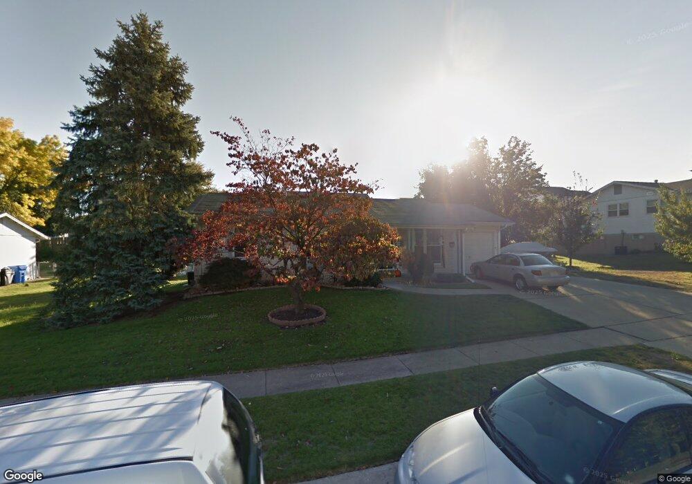
1922 Croftdale Dr Florissant, MO 63031
Estimated Value: $176,839 - $187,000
3
Beds
1
Bath
950
Sq Ft
$191/Sq Ft
Est. Value
About This Home
This home is located at 1922 Croftdale Dr, Florissant, MO 63031 and is currently estimated at $181,460, approximately $191 per square foot. 1922 Croftdale Dr is a home located in St. Louis County with nearby schools including Russell Elementary School, West Middle School, and Hazelwood West High School.
Ownership History
Date
Name
Owned For
Owner Type
Purchase Details
Closed on
Jun 14, 2014
Sold by
Marks Paul
Bought by
Marks Diane
Current Estimated Value
Purchase Details
Closed on
May 25, 2004
Sold by
Hufty Rory M
Bought by
Marks Paul D and Marks Diane E
Home Financials for this Owner
Home Financials are based on the most recent Mortgage that was taken out on this home.
Original Mortgage
$99,120
Interest Rate
5.93%
Mortgage Type
Purchase Money Mortgage
Purchase Details
Closed on
Jun 13, 2001
Sold by
Raftery Dennis P
Bought by
Hufty Rory M
Home Financials for this Owner
Home Financials are based on the most recent Mortgage that was taken out on this home.
Original Mortgage
$98,708
Interest Rate
7.1%
Mortgage Type
FHA
Purchase Details
Closed on
Apr 10, 2001
Sold by
Raftery Andrea L
Bought by
Raftery Dennis P
Create a Home Valuation Report for This Property
The Home Valuation Report is an in-depth analysis detailing your home's value as well as a comparison with similar homes in the area
Home Values in the Area
Average Home Value in this Area
Purchase History
| Date | Buyer | Sale Price | Title Company |
|---|---|---|---|
| Marks Diane | -- | None Available | |
| Marks Paul D | -- | -- | |
| Hufty Rory M | $99,500 | -- | |
| Hufty Rory M | -- | -- | |
| Raftery Dennis P | -- | -- |
Source: Public Records
Mortgage History
| Date | Status | Borrower | Loan Amount |
|---|---|---|---|
| Closed | Marks Paul D | $99,120 | |
| Previous Owner | Hufty Rory M | $98,708 | |
| Closed | Marks Paul D | $12,390 |
Source: Public Records
Tax History Compared to Growth
Tax History
| Year | Tax Paid | Tax Assessment Tax Assessment Total Assessment is a certain percentage of the fair market value that is determined by local assessors to be the total taxable value of land and additions on the property. | Land | Improvement |
|---|---|---|---|---|
| 2025 | $2,331 | $27,800 | $6,100 | $21,700 |
| 2024 | $2,331 | $26,020 | $3,140 | $22,880 |
| 2023 | $2,331 | $26,020 | $3,140 | $22,880 |
| 2022 | $2,183 | $21,750 | $4,540 | $17,210 |
| 2021 | $2,127 | $21,750 | $4,540 | $17,210 |
| 2020 | $1,825 | $17,520 | $3,500 | $14,020 |
| 2019 | $1,797 | $17,520 | $3,500 | $14,020 |
| 2018 | $1,749 | $15,680 | $2,950 | $12,730 |
| 2017 | $1,747 | $15,680 | $2,950 | $12,730 |
| 2016 | $1,975 | $17,520 | $2,950 | $14,570 |
| 2015 | $1,934 | $17,520 | $2,950 | $14,570 |
| 2014 | $2,035 | $19,020 | $3,170 | $15,850 |
Source: Public Records
Map
Nearby Homes
- 1815 Flordawn Dr
- 1978 Acorn Trail Dr
- 154 Riverwood Park Dr
- 1035 Rosary Tree Ct
- 5 Seminary Ct
- 1090 Howdershell Rd
- 1790 Tahoe Dr
- 400 Raymond Dr
- 425 Gerald Ave
- 1565 Yaqui Dr
- 1495 Yaqui Dr
- 2 Aspen at Koch Park Manors
- 2316 Fernau Ct
- 2320 Fernau Ct
- 2128 Friendship Ct
- 2317 Fernau Ct
- 2324 Fernau Ct
- 2321 Fernau Ct
- 1625 Charbonier Rd
- 1085 Campion Ln
- 1942 Croftdale Dr
- 1902 Croftdale Dr
- 1973 Timberwood Crossing Dr
- 1969 Timberwood Crossing Dr
- 1977 Timberwood Crossing Dr
- 1941 Croftdale Dr
- 1921 Croftdale Dr
- 1965 Timberwood Crossing Dr
- 1981 Timberwood Crossing Dr
- 1882 Croftdale Dr
- 1962 Croftdale Dr
- 1961 Croftdale Dr
- 1901 Croftdale Dr
- 1961 Timberwood Crossing Dr
- 1920 Flordawn Dr
- 1985 Timberwood Crossing Dr
- 1900 Flordawn Dr
- 1981 Croftdale Dr
- 1968 Timberwood Crossing Dr
- 1972 Timberwood Crossing Dr