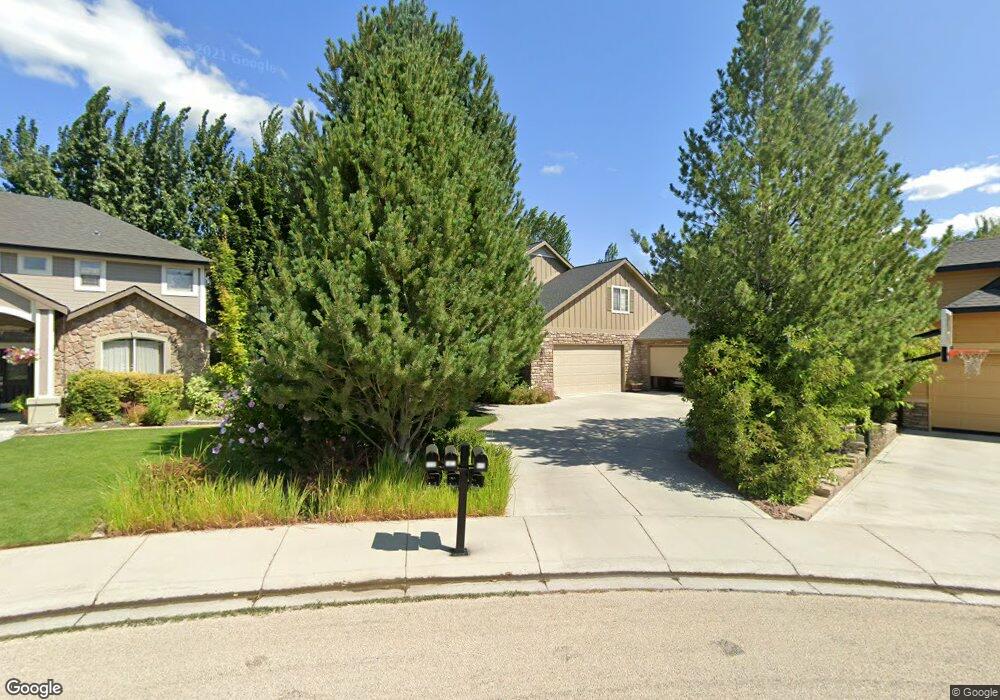
1922 E Bowstring St Meridian, ID 83642
Southeast Meridian NeighborhoodEstimated Value: $711,239 - $743,000
4
Beds
4
Baths
3,179
Sq Ft
$229/Sq Ft
Est. Value
About This Home
This home is located at 1922 E Bowstring St, Meridian, ID 83642 and is currently estimated at $727,560, approximately $228 per square foot. 1922 E Bowstring St is a home located in Ada County with nearby schools including Meridian Elementary School, Lewis & Clark Middle School, and Mountain View High School.
Ownership History
Date
Name
Owned For
Owner Type
Purchase Details
Closed on
Jul 19, 2002
Sold by
Whitney Homes Llc
Bought by
Overton John A and Overton Nora A
Current Estimated Value
Home Financials for this Owner
Home Financials are based on the most recent Mortgage that was taken out on this home.
Original Mortgage
$285,050
Outstanding Balance
$120,667
Interest Rate
6.69%
Mortgage Type
Purchase Money Mortgage
Estimated Equity
$606,893
Purchase Details
Closed on
Feb 1, 2002
Sold by
Woodbridge Community Llc
Bought by
Bass & Groves Investments Llc
Create a Home Valuation Report for This Property
The Home Valuation Report is an in-depth analysis detailing your home's value as well as a comparison with similar homes in the area
Home Values in the Area
Average Home Value in this Area
Purchase History
| Date | Buyer | Sale Price | Title Company |
|---|---|---|---|
| Overton John A | -- | Lawyers Title Insurance Corp | |
| Bass & Groves Investments Llc | -- | Alliance Title & Escrow Corp |
Source: Public Records
Mortgage History
| Date | Status | Borrower | Loan Amount |
|---|---|---|---|
| Open | Overton John A | $285,050 |
Source: Public Records
Tax History
| Year | Tax Paid | Tax Assessment Tax Assessment Total Assessment is a certain percentage of the fair market value that is determined by local assessors to be the total taxable value of land and additions on the property. | Land | Improvement |
|---|---|---|---|---|
| 2025 | $3,097 | $707,200 | -- | -- |
| 2024 | $2,698 | $747,200 | -- | -- |
| 2023 | $2,698 | $627,000 | $0 | $0 |
| 2022 | $3,603 | $803,600 | $0 | $0 |
| 2021 | $3,714 | $648,300 | $0 | $0 |
| 2020 | $3,027 | $463,200 | $0 | $0 |
| 2019 | $4,071 | $476,400 | $0 | $0 |
| 2018 | $3,545 | $403,700 | $0 | $0 |
| 2017 | $3,403 | $375,800 | $0 | $0 |
| 2016 | $3,322 | $353,700 | $0 | $0 |
| 2015 | $3,205 | $342,200 | $0 | $0 |
| 2012 | -- | $268,700 | $0 | $0 |
Source: Public Records
Map
Nearby Homes
- 2244 E Greiner St
- 2222 E Lattice Dr
- 1475 E Franklin Rd
- 907 N Aleppo Way
- 3650 W Dover St
- 3160 E Springwood Dr
- 3070 E Franklin Rd
- 3875 S Corabell Ave
- 324 NE 3rd St
- 783 E Bissett St
- 771 E Bissett St
- 850 N Mirror Creek Way
- 2019 S Locust Grove Lane Lot #4 5
- 2043 S Locust Grove Rd
- tbd S Locust Grove Ln
- 1288 E Sothesby St
- 432 E Pine Ave
- 2479 E Goldstone St
- 2487 E Goldstone St
- 2501 E Goldstone St
- 440 S Tiburon Ave
- 472 S Tiburon Ave
- 1874 E Bowstring St
- 449 S Tiburon Ave
- 481 S Tiburon Ave
- 1850 E Bowstring St
- 496 S Tiburon Ave
- 446 S Trunnel Ave
- 478 S Trunnel Ave
- 507 S Tiburon Ave
- 1832 E Bowstring St
- 520 S Tiburon Ave
- 520 S Tiburon Ave Unit 1
- 506 S Trunnel Ave
- 2056 E Bowstring St
- 531 S Tiburon Ave
- 453 S Thornwood Way
- 437 S Trunnel Ave
- 1820 E Bowstring St
- 542 S Tiburon Ave
Your Personal Tour Guide
Ask me questions while you tour the home.