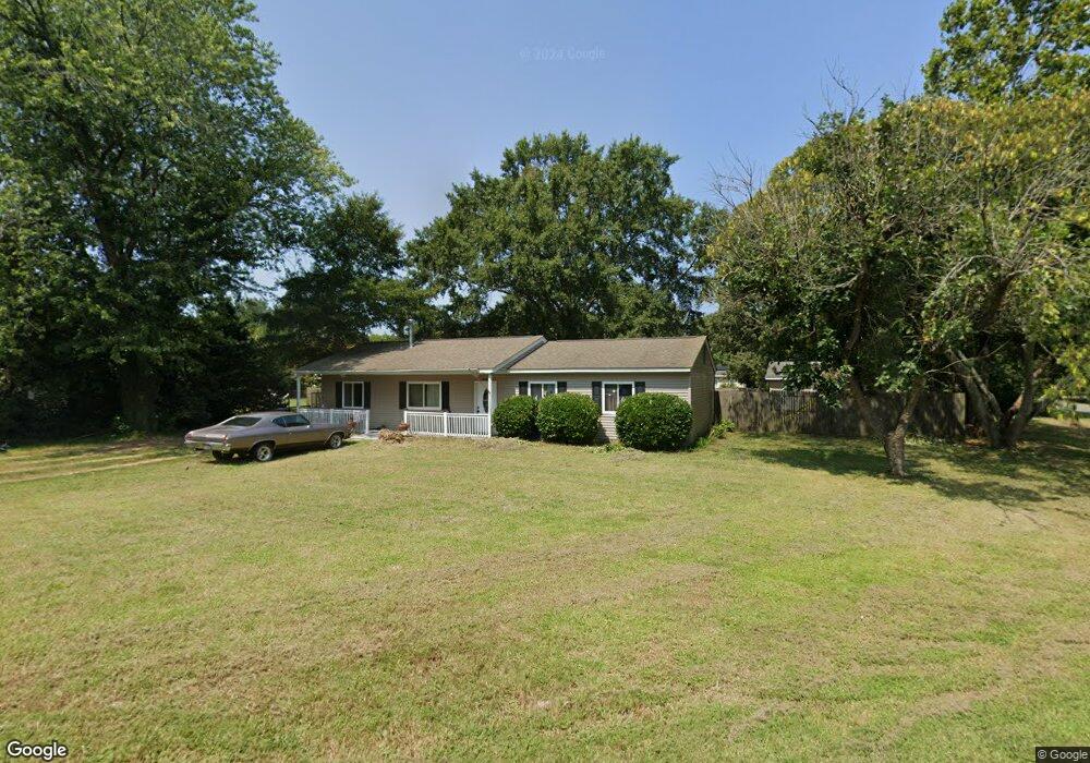
1922 Gloucester Point Dr Unit DR Gloucester Point, VA 23062
Estimated Value: $323,000 - $340,651
3
Beds
2
Baths
1,320
Sq Ft
$252/Sq Ft
Est. Value
About This Home
This home is located at 1922 Gloucester Point Dr Unit DR, Gloucester Point, VA 23062 and is currently estimated at $332,913, approximately $252 per square foot. 1922 Gloucester Point Dr Unit DR is a home located in Gloucester County with nearby schools including Abingdon Elementary School, Page Middle School, and Gloucester High School.
Ownership History
Date
Name
Owned For
Owner Type
Purchase Details
Closed on
Jul 26, 2022
Sold by
Hubbard Steven Anthony and Mccarthy Katherine Marie
Bought by
Wilcox Michael J and Wilcox Kaylea M
Current Estimated Value
Home Financials for this Owner
Home Financials are based on the most recent Mortgage that was taken out on this home.
Original Mortgage
$220,000
Interest Rate
5.81%
Mortgage Type
Construction
Purchase Details
Closed on
Oct 30, 2008
Sold by
Hiott Samuel L
Bought by
Hubbard Steven Anthony and Mccarthy Katherine Marie
Create a Home Valuation Report for This Property
The Home Valuation Report is an in-depth analysis detailing your home's value as well as a comparison with similar homes in the area
Home Values in the Area
Average Home Value in this Area
Purchase History
| Date | Buyer | Sale Price | Title Company |
|---|---|---|---|
| Wilcox Michael J | $276,000 | Fidelity National Title | |
| Hubbard Steven Anthony | $212,000 | Shaffer Title And Escrow |
Source: Public Records
Mortgage History
| Date | Status | Borrower | Loan Amount |
|---|---|---|---|
| Closed | Wilcox Michael J | $220,000 |
Source: Public Records
Tax History
| Year | Tax Paid | Tax Assessment Tax Assessment Total Assessment is a certain percentage of the fair market value that is determined by local assessors to be the total taxable value of land and additions on the property. | Land | Improvement |
|---|---|---|---|---|
| 2025 | $1,940 | $315,910 | $75,890 | $240,020 |
| 2024 | $1,940 | $315,910 | $75,890 | $240,020 |
| 2023 | $1,842 | $315,910 | $75,890 | $240,020 |
| 2022 | $1,566 | $215,930 | $68,170 | $147,760 |
| 2021 | $1,501 | $215,930 | $68,170 | $147,760 |
| 2020 | $1,501 | $215,930 | $68,170 | $147,760 |
| 2019 | $1,453 | $209,010 | $73,340 | $135,670 |
| 2017 | $1,453 | $209,010 | $73,340 | $135,670 |
| 2016 | $1,703 | $245,070 | $77,200 | $167,870 |
| 2015 | $1,666 | $227,300 | $53,000 | $174,300 |
| 2014 | $1,264 | $194,400 | $53,000 | $141,400 |
Source: Public Records
Map
Nearby Homes
- Lot 2 Marshall Ln
- 7763 Jordan Rd
- 7547 Villa Ct
- 7746 Farmwood Rd
- 7699 the Points Place Unit 1002
- 8157 O Carra Dr
- 7971 Laura Ann Ln
- Par A Hayes Rd
- 7848 Guinea Rd
- .51ac George Washington Memorial Hwy
- 000 George Washington Memorial Hwy
- 17 George Washington Memorial Hwy
- 7180 Cooks View Ln
- 8155 Billings Ct
- 2505 Low Ground Rd
- 0000 Cove Rd
- .26+AC Cove Rd
- 2795 George Wash Memorial Hwy
- 2795 George Washington Memorial Hwy
- 8407 Oyster Cove Rd
- 1922 Gloucester Point Dr
- 1912 Gloucester Point Dr
- 1912 Gloucester Point Dr Unit DR
- 7546 Hoefork Ln
- 7532 Hoefork Ln
- 1947 Gloucester Point Dr
- 1937 Gloucester Point Dr
- 1917 Gloucester Point Dr
- 1900 Gloucester Point Dr
- 7566 Hoefork Ln
- 1927 Gloucester Point Dr
- 7520 Hoefork Ln
- 1903 Gloucester Point Dr
- 7576 Hoefork Ln
- 7537 Hoefork Ln
- 1886 Gloucester Point Dr
- 7549 Hoefork Ln
- 7549 Hoefork Ln
- 7549 Hoefork Ln Unit LA
- 1893 Gloucester Point Dr
Your Personal Tour Guide
Ask me questions while you tour the home.