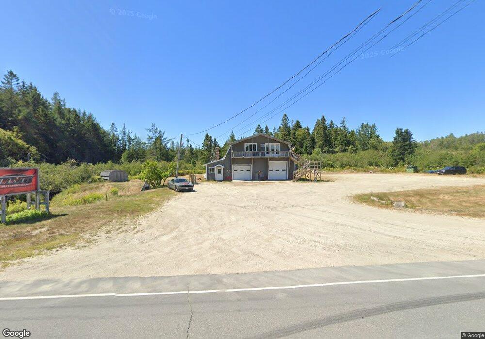
1922 Mason Bay Rd Jonesport, ME 04649
Estimated Value: $202,000 - $364,000
5
Beds
3
Baths
3,450
Sq Ft
$83/Sq Ft
Est. Value
About This Home
This home is located at 1922 Mason Bay Rd, Jonesport, ME 04649 and is currently estimated at $285,326, approximately $82 per square foot. 1922 Mason Bay Rd is a home located in Washington County with nearby schools including Jonesport-Beals High School.
Ownership History
Date
Name
Owned For
Owner Type
Purchase Details
Closed on
Jul 27, 2023
Sold by
Holmes Jill C
Bought by
Holmes Lucas E and Holmes Savannah E
Current Estimated Value
Purchase Details
Closed on
Sep 1, 2022
Sold by
Holmes Eric A and Holmes Jill C
Bought by
Tnt Automotive Inc
Home Financials for this Owner
Home Financials are based on the most recent Mortgage that was taken out on this home.
Original Mortgage
$191,250
Interest Rate
5.54%
Mortgage Type
Commercial
Create a Home Valuation Report for This Property
The Home Valuation Report is an in-depth analysis detailing your home's value as well as a comparison with similar homes in the area
Home Values in the Area
Average Home Value in this Area
Purchase History
| Date | Buyer | Sale Price | Title Company |
|---|---|---|---|
| Holmes Lucas E | -- | None Available | |
| Tnt Automotive Inc | $154,000 | None Available |
Source: Public Records
Mortgage History
| Date | Status | Borrower | Loan Amount |
|---|---|---|---|
| Previous Owner | Tnt Automotive Inc | $191,250 |
Source: Public Records
Tax History Compared to Growth
Tax History
| Year | Tax Paid | Tax Assessment Tax Assessment Total Assessment is a certain percentage of the fair market value that is determined by local assessors to be the total taxable value of land and additions on the property. | Land | Improvement |
|---|---|---|---|---|
| 2024 | $2,884 | $160,400 | $27,100 | $133,300 |
| 2023 | $2,962 | $162,300 | $27,100 | $135,200 |
| 2022 | $2,759 | $162,300 | $27,100 | $135,200 |
| 2021 | $2,773 | $164,100 | $27,100 | $137,000 |
| 2020 | $2,762 | $164,400 | $27,100 | $137,300 |
| 2019 | $2,326 | $144,000 | $27,100 | $116,900 |
| 2018 | $2,261 | $144,000 | $27,100 | $116,900 |
| 2017 | $2,270 | $145,500 | $27,100 | $118,400 |
| 2015 | $1,946 | $139,000 | $27,100 | $111,900 |
| 2014 | $2,071 | $139,000 | $27,100 | $111,900 |
Source: Public Records
Map
Nearby Homes
- Lot 23 Bay Rd
- 4 Landis Strip
- 8 Landis Strip Rd
- 38 Bay Rd
- 15 N Middle Ground View
- 1461 Mason Bay Rd
- M2L10 Jewett Rd
- 1085 U S
- 916 U S Route 1
- M10L1 Route 1
- 185 Old Us Rt 1
- Lot 3 Looks Point Rd
- 843 & 839 Us-1 Route
- 57 Englishman Bay Rd
- Lots 2&4 Looks Cemetery Rd
- 7 Deerfield Dr
- TBD Station Rd
- 989 Mason Bay Rd
- 960 Mason Bay Rd
- 0 Chambers Point Rd Unit 25 23872992
- 1938 Mason Bay Rd
- 1896 Mason Bay Rd
- 1906 Mason Bay Rd
- 289 Bay Rd
- 11 White Creek Rd
- 00 Masons Bay Rd
- 1876 Mason Bay Rd
- 1945 Mason Bay Rd
- 1856 Mason Bay Rd
- 749 Us Rte 1
- 749 Us Rte 1
- 1850 Mason Bay Rd
- 256 Bay Rd
- 18 Coffin Dr
- 1844 Mason Bay Rd
- 1829 Mason Bay Rd
- 1834 Mason Bay Rd
- 0 Bay Ridge Rd Unit 1262899
- 0 Bay Ridge Rd Unit 1262578
- 191 Roque Bluffs Rd