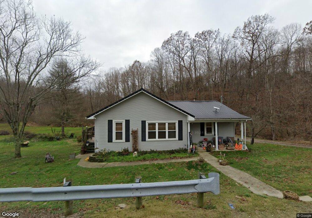
1922 State Route 233 Oak Hill, OH 45656
Estimated Value: $91,000 - $148,802
2
Beds
2
Baths
1,136
Sq Ft
$109/Sq Ft
Est. Value
About This Home
This home is located at 1922 State Route 233, Oak Hill, OH 45656 and is currently estimated at $123,451, approximately $108 per square foot. 1922 State Route 233 is a home located in Jackson County with nearby schools including Oak Hill Elementary School and Oak Hill Middle/High School.
Ownership History
Date
Name
Owned For
Owner Type
Purchase Details
Closed on
Mar 13, 2020
Sold by
Jones Brett A and Jones Carly
Bought by
Bolton Joshua K
Current Estimated Value
Home Financials for this Owner
Home Financials are based on the most recent Mortgage that was taken out on this home.
Original Mortgage
$79,797
Outstanding Balance
$70,537
Interest Rate
3.4%
Mortgage Type
New Conventional
Estimated Equity
$52,914
Purchase Details
Closed on
Mar 18, 2010
Sold by
Spence Diana Sue
Bought by
Howard Stanley and Howard Meredith
Home Financials for this Owner
Home Financials are based on the most recent Mortgage that was taken out on this home.
Original Mortgage
$40,000
Interest Rate
6%
Mortgage Type
Purchase Money Mortgage
Purchase Details
Closed on
Oct 20, 2008
Sold by
Hollback Gerald W and Hollback Delores
Bought by
Spence Phillip Le and Spence Diana Sue
Create a Home Valuation Report for This Property
The Home Valuation Report is an in-depth analysis detailing your home's value as well as a comparison with similar homes in the area
Home Values in the Area
Average Home Value in this Area
Purchase History
| Date | Buyer | Sale Price | Title Company |
|---|---|---|---|
| Bolton Joshua K | $79,000 | Bestitle Agency Inc | |
| Howard Stanley | $25,000 | Attorney | |
| Spence Phillip Le | -- | Attorney |
Source: Public Records
Mortgage History
| Date | Status | Borrower | Loan Amount |
|---|---|---|---|
| Open | Bolton Joshua K | $79,797 | |
| Previous Owner | Howard Stanley | $40,000 |
Source: Public Records
Tax History Compared to Growth
Tax History
| Year | Tax Paid | Tax Assessment Tax Assessment Total Assessment is a certain percentage of the fair market value that is determined by local assessors to be the total taxable value of land and additions on the property. | Land | Improvement |
|---|---|---|---|---|
| 2024 | $1,031 | $32,190 | $6,730 | $25,460 |
| 2023 | $1,031 | $32,190 | $6,730 | $25,460 |
| 2022 | $958 | $23,470 | $5,360 | $18,110 |
| 2021 | $806 | $23,470 | $5,360 | $18,110 |
| 2020 | $813 | $23,470 | $5,360 | $18,110 |
| 2019 | $841 | $23,470 | $5,360 | $18,110 |
| 2018 | $813 | $23,470 | $5,360 | $18,110 |
| 2017 | $776 | $23,470 | $5,360 | $18,110 |
| 2016 | $754 | $22,620 | $6,010 | $16,610 |
| 2015 | $762 | $22,620 | $6,010 | $16,610 |
| 2013 | $730 | $21,700 | $5,900 | $15,800 |
| 2012 | $743 | $21,700 | $5,900 | $15,800 |
Source: Public Records
Map
Nearby Homes
- 413 Gallipolis Rd
- 413 Gallipolis Rd Unit (Clearview Pond)
- 13916 State Route 279
- 349 S Park Ave
- 2006 Ohio 279
- 703 E Main St
- 321 W Main St
- 2080 Cozy Glenn Rd
- 1045 Sardis Rd
- 3240 Gallipolis Rd
- 3252 Sardis Rd
- 10355 Ohio 279
- 15481 State Route 279
- 49 Twp Rd 2974
- 25009 State Route 93
- 25009 Ohio 93
- 1337 Ohio 140
- 424 Dry Ridge Rd
- 9450 Jimes Emory Rd
- 0 Roscoe Rd
- 1967 Ohio 233
- 1967 State Route 233
- 1958 State Route 233
- 2014 State Route 233
- 2022 State Route 233
- 2099 State Route 233
- 2246 Ohio 233
- 2246 State Route 233
- 2284 State Route 233
- 1492 State Route 233
- 3760 Gallia Blackfork Rd
- 4059 Gallia Blackfork Rd
- 4133 Gallia Blackfork Rd
- 2358 State Route 233
- 4048 Gallia Blackfork Rd
- 3675 Gallia Blackfork Rd
- 58 John Jenkins Rd
- 74 John Jenkins Rd
- 1314 State Route 233
- 2513 State Route 233