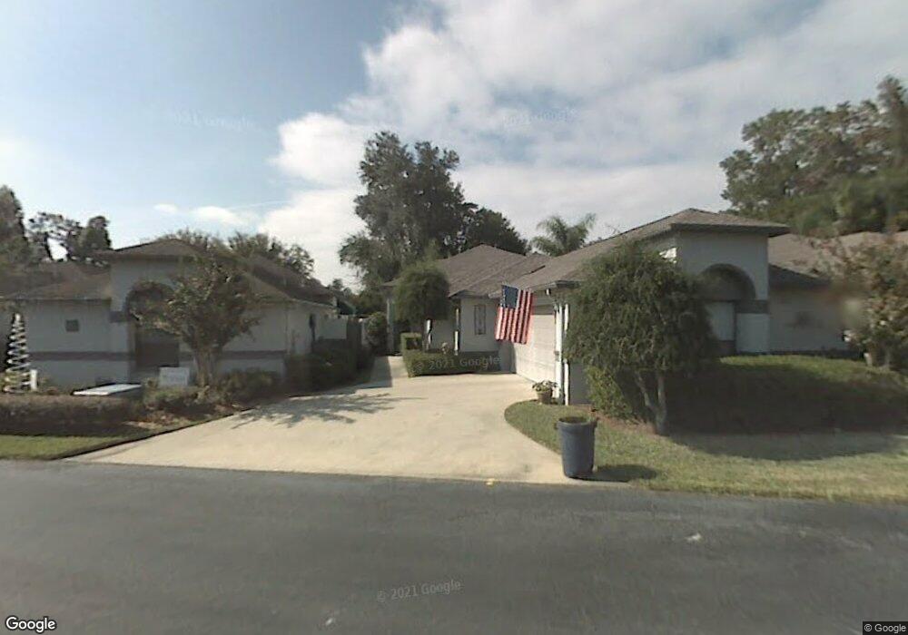
1922 Twin Bridge Cir Ocala, FL 34471
Southeast Ocala NeighborhoodEstimated Value: $377,113 - $452,000
3
Beds
2
Baths
2,245
Sq Ft
$188/Sq Ft
Est. Value
About This Home
This home is located at 1922 Twin Bridge Cir, Ocala, FL 34471 and is currently estimated at $421,528, approximately $187 per square foot. 1922 Twin Bridge Cir is a home located in Marion County with nearby schools including South Ocala Elementary School, Osceola Middle School, and Forest High School.
Ownership History
Date
Name
Owned For
Owner Type
Purchase Details
Closed on
Dec 19, 2018
Sold by
Bledsoe Nancy L
Bought by
Bledsoe Nancy L and Bezzy Jayma L
Current Estimated Value
Purchase Details
Closed on
Mar 1, 2017
Bought by
Bledsoe Nancy L
Purchase Details
Closed on
Oct 1, 2016
Bought by
Bledsoe Nancy L
Purchase Details
Closed on
Sep 20, 2012
Sold by
Bledsoe John
Bought by
Bledsoe Nancy L and Bledsoe John
Purchase Details
Closed on
Nov 21, 2001
Sold by
Kent Richard T and Kent Janet R
Bought by
Bledsoe John
Home Financials for this Owner
Home Financials are based on the most recent Mortgage that was taken out on this home.
Original Mortgage
$140,000
Interest Rate
6.01%
Create a Home Valuation Report for This Property
The Home Valuation Report is an in-depth analysis detailing your home's value as well as a comparison with similar homes in the area
Home Values in the Area
Average Home Value in this Area
Purchase History
| Date | Buyer | Sale Price | Title Company |
|---|---|---|---|
| Bledsoe Nancy L | -- | Attorney | |
| Bledsoe Nancy L | $100 | -- | |
| Bledsoe Nancy L | $100 | -- | |
| Bledsoe Nancy L | -- | Attorney | |
| Bledsoe John | $180,000 | Affiliated Title Of Marion C |
Source: Public Records
Mortgage History
| Date | Status | Borrower | Loan Amount |
|---|---|---|---|
| Previous Owner | Bledsoe John | $140,000 |
Source: Public Records
Tax History Compared to Growth
Tax History
| Year | Tax Paid | Tax Assessment Tax Assessment Total Assessment is a certain percentage of the fair market value that is determined by local assessors to be the total taxable value of land and additions on the property. | Land | Improvement |
|---|---|---|---|---|
| 2024 | $2,204 | $151,582 | -- | -- |
| 2023 | $2,140 | $147,167 | $0 | $0 |
| 2022 | $1,991 | $142,881 | $0 | $0 |
| 2021 | $1,979 | $138,719 | $0 | $0 |
| 2020 | $1,753 | $136,804 | $0 | $0 |
| 2019 | $1,716 | $133,728 | $0 | $0 |
| 2018 | $1,659 | $131,235 | $0 | $0 |
| 2017 | $1,640 | $128,536 | $0 | $0 |
| 2016 | $1,617 | $125,892 | $0 | $0 |
| 2015 | $1,629 | $125,017 | $0 | $0 |
| 2014 | $1,325 | $114,651 | $0 | $0 |
Source: Public Records
Map
Nearby Homes
- 1962 Twin Bridge Cir
- 2021 Twin Bridge Cir
- 2038 SE Twin Bridge Ct
- 1918 SE 17th St
- 1892 SE Clatter Bridge Rd
- 1810 SE 21st Place
- 2243 Laurel Run Dr
- 2321 SE 19th Cir
- 2306 SE 19th Cir
- 2215 SE Spring Hill Ct
- 2301 SE 22nd Loop
- 2310 SE 22nd Loop
- 1631 SE 17th St
- 1621 SE 17th St
- 2442 SE 18th Cir
- 2503 SE 18th Cir
- 2414 SE 17th Cir
- 2412 SE 17th Cir
- 2131 SE 25th St
- 2432 SE 18th Cir
- 1932 Twin Bridge Cir
- 1942 Twin Bridge Cir
- 1902 Twin Bridge Cir
- 1931 Twin Bridge Cir
- 1911 Twin Bridge Cir
- 1952 Twin Bridge Cir
- 1901 Twin Bridge Cir
- 1941 Twin Bridge Cir
- 1951 Twin Bridge Cir
- 1921 SE Twin Bridge Cir
- 1921 Twin Bridge Cir
- 2013 Twin Bridge Ct
- 2000 Twin Bridge Ct
- 1972 Twin Bridge Cir Unit 12
- 1981 Twin Bridge Cir
- 2000 SE Twin Bridge Ct
- 2012 Twin Bridge Cir
- 2008 SE Twin Bridge Ct
- 1991 SE Twin Bridge Cir
- 2001 Twin Bridge Cir Unit 956