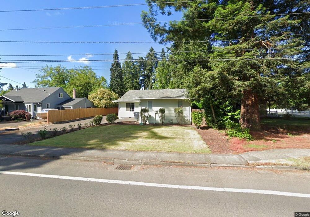
19229 SE River Rd Milwaukie, OR 97267
Estimated Value: $512,588 - $553,000
3
Beds
2
Baths
1,502
Sq Ft
$349/Sq Ft
Est. Value
About This Home
This home is located at 19229 SE River Rd, Milwaukie, OR 97267 and is currently estimated at $524,897, approximately $349 per square foot. 19229 SE River Rd is a home located in Clackamas County with nearby schools including Jennings Lodge Elementary School, Candy Lane Elementary School, and Gardiner Middle School.
Ownership History
Date
Name
Owned For
Owner Type
Purchase Details
Closed on
Apr 23, 2025
Sold by
Dass Fredrick John
Bought by
Dass Family Trust and Dass
Current Estimated Value
Purchase Details
Closed on
Nov 26, 2001
Sold by
Barnett Douglas and Barnett Adeana
Bought by
Dass Fredrick John
Home Financials for this Owner
Home Financials are based on the most recent Mortgage that was taken out on this home.
Original Mortgage
$130,950
Interest Rate
6.63%
Purchase Details
Closed on
Aug 28, 1996
Sold by
Miller Rick A and Miller Melvin C
Bought by
Even William J
Create a Home Valuation Report for This Property
The Home Valuation Report is an in-depth analysis detailing your home's value as well as a comparison with similar homes in the area
Home Values in the Area
Average Home Value in this Area
Purchase History
| Date | Buyer | Sale Price | Title Company |
|---|---|---|---|
| Dass Family Trust | -- | None Listed On Document | |
| Dass Fredrick John | $167,960 | Fidelity National Title Co | |
| Even William J | $74,500 | -- |
Source: Public Records
Mortgage History
| Date | Status | Borrower | Loan Amount |
|---|---|---|---|
| Previous Owner | Dass Fredrick John | $130,950 |
Source: Public Records
Tax History Compared to Growth
Tax History
| Year | Tax Paid | Tax Assessment Tax Assessment Total Assessment is a certain percentage of the fair market value that is determined by local assessors to be the total taxable value of land and additions on the property. | Land | Improvement |
|---|---|---|---|---|
| 2025 | $4,770 | $274,511 | -- | -- |
| 2024 | $4,301 | $266,516 | -- | -- |
| 2023 | $4,301 | $258,754 | $0 | $0 |
| 2022 | $3,942 | $251,218 | $0 | $0 |
| 2021 | $3,777 | $243,901 | $0 | $0 |
| 2020 | $3,669 | $236,798 | $0 | $0 |
| 2019 | $3,596 | $229,901 | $0 | $0 |
| 2018 | $3,405 | $223,205 | $0 | $0 |
| 2017 | $3,319 | $216,704 | $0 | $0 |
| 2016 | $3,245 | $210,392 | $0 | $0 |
| 2015 | $3,118 | $204,264 | $0 | $0 |
| 2014 | $2,981 | $198,315 | $0 | $0 |
Source: Public Records
Map
Nearby Homes
- 19319 SE River Rd
- 19643 SE Jay St
- 19503 SE Kay St
- 19575 River Rd Unit 53
- 19145 Addie St
- 19605 River Rd Unit 122
- 441 W Gloucester St
- 19697 SE Cottonwood St
- 700 Barton Ave Unit 1
- 232 W Hereford St
- 18515 SE River Rd
- 115 E Jersey St
- 117 E Jersey St
- 5227 SE Bandon Ln
- 119 E Jersey St
- 155 W Fairfield St
- 5905 SE Angel Ln
- 5314 SE Jennings Ave
- 175 E Gloucester St
- 0 0 Se Jennings Ave
- 5264 SE Sampson Ct
- 19307 SE River Rd
- 19225 SE River Rd
- 19220 SE River Rd
- 19305 SE River Rd
- 5267 SE Sampson Ct
- 5243 SE Sampson Ct
- 19315 SE River Rd
- 19275 SE River Rd
- 19229 SE River Rd
- 19298 SE River Rd
- 5245 SE Sampson Ct
- 5244 SE Castle Rock Ct
- 19401 SE River Rd
- 5226 SE Castle Rock Lot 3 Ct
- 5208 SE Castle Rock Ct
- 5208 SE Castle Rock Ct Unit 4
- 5272 SE Castle Rock Ct
- 5272 SE Castle Rock Ct Unit 1
- 19490 SE Kay St