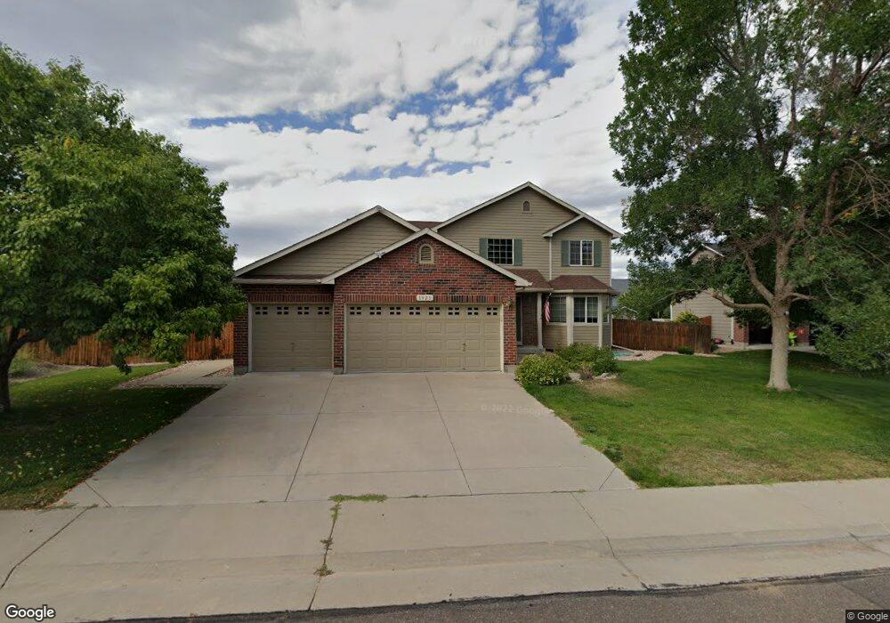
1923 E 144th Dr Thornton, CO 80602
Quail Valley NeighborhoodEstimated Value: $543,942 - $595,000
3
Beds
3
Baths
1,545
Sq Ft
$369/Sq Ft
Est. Value
About This Home
This home is located at 1923 E 144th Dr, Thornton, CO 80602 and is currently estimated at $570,486, approximately $369 per square foot. 1923 E 144th Dr is a home located in Adams County with nearby schools including Silver Creek Elementary School, Rocky Top Middle School, and Mountain Range High School.
Ownership History
Date
Name
Owned For
Owner Type
Purchase Details
Closed on
Jun 28, 2023
Sold by
Nudelman Mark E
Bought by
Moncada Rudy Ernesto Olav
Current Estimated Value
Home Financials for this Owner
Home Financials are based on the most recent Mortgage that was taken out on this home.
Original Mortgage
$512,000
Outstanding Balance
$495,547
Interest Rate
6%
Mortgage Type
Seller Take Back
Estimated Equity
$74,939
Purchase Details
Closed on
Nov 26, 2003
Sold by
Melody Homes Inc
Bought by
Nudelman Mark E and Nudelman Connie S
Home Financials for this Owner
Home Financials are based on the most recent Mortgage that was taken out on this home.
Original Mortgage
$205,841
Interest Rate
6.06%
Mortgage Type
Unknown
Create a Home Valuation Report for This Property
The Home Valuation Report is an in-depth analysis detailing your home's value as well as a comparison with similar homes in the area
Home Values in the Area
Average Home Value in this Area
Purchase History
| Date | Buyer | Sale Price | Title Company |
|---|---|---|---|
| Moncada Rudy Ernesto Olav | $572,000 | First American Title | |
| Nudelman Mark E | $257,301 | Land Title Guarantee Company |
Source: Public Records
Mortgage History
| Date | Status | Borrower | Loan Amount |
|---|---|---|---|
| Open | Moncada Rudy Ernesto Olav | $512,000 | |
| Previous Owner | Nudelman Mark E | $205,841 | |
| Closed | Nudelman Mark E | $38,595 |
Source: Public Records
Tax History
| Year | Tax Paid | Tax Assessment Tax Assessment Total Assessment is a certain percentage of the fair market value that is determined by local assessors to be the total taxable value of land and additions on the property. | Land | Improvement |
|---|---|---|---|---|
| 2025 | $3,432 | $36,310 | $8,700 | $27,610 |
| 2024 | $3,432 | $33,380 | $8,000 | $25,380 |
| 2023 | $3,397 | $36,870 | $7,510 | $29,360 |
| 2022 | $2,997 | $27,210 | $7,710 | $19,500 |
| 2021 | $3,098 | $27,210 | $7,710 | $19,500 |
| 2020 | $3,157 | $28,300 | $7,720 | $20,580 |
| 2019 | $3,164 | $28,300 | $7,720 | $20,580 |
| 2018 | $2,999 | $26,060 | $7,560 | $18,500 |
| 2017 | $2,727 | $26,060 | $7,560 | $18,500 |
| 2016 | $2,063 | $19,200 | $4,540 | $14,660 |
| 2015 | $2,060 | $19,200 | $4,540 | $14,660 |
| 2014 | -- | $17,950 | $3,980 | $13,970 |
Source: Public Records
Map
Nearby Homes
- 1936 E 144th Dr
- 14628 Vine St
- 14747 Race St
- 14729 Vine St
- 14725 Gaylord St
- 1976 E 148th Dr
- 1981 E 141st Ave
- 2705 E 148th Dr
- 15004 Vine St
- 14985 Elizabeth St
- 3075 E 141st Place
- 3347 E 142nd Dr
- 14447 Madison St
- 13867 Fillmore St
- 13963 Cook St
- 13845 Adams Cir
- 15193 St Paul St
- 2670 E 136th Place
- 3122 E 152nd Cir
- 15274 Clayton St
- 1905 E 144th Dr
- 1941 E 144th Dr
- 1926 E 144th Way
- 1918 E 144 Dr
- 1908 E 144th Way
- 1944 E 144th Way
- 1918 E 144th Dr
- 1954 E 144th Dr
- 1887 E 144th Dr
- 1900 E 144th Dr
- 2008 E 144th Dr
- 1972 E 144th Dr
- 2026 E 144th Dr
- 14427 Williams St
- 14443 Williams St
- 1990 E 144th Dr
- 1882 E 144th Dr
- 1911 E 144th Way
- 1869 E 144th Dr
- 2044 E 144th Dr