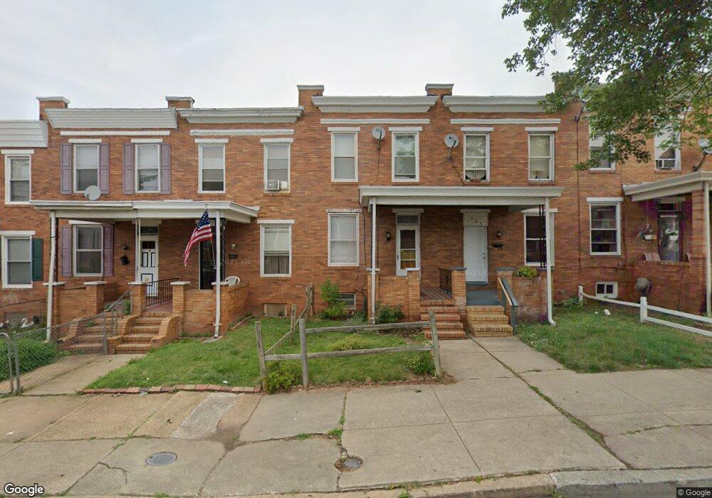
1923 Grinnalds Ave Baltimore, MD 21230
Morrell Park NeighborhoodEstimated Value: $112,890 - $151,000
Studio
1
Bath
1,116
Sq Ft
$118/Sq Ft
Est. Value
About This Home
This home is located at 1923 Grinnalds Ave, Baltimore, MD 21230 and is currently estimated at $131,945, approximately $118 per square foot. 1923 Grinnalds Ave is a home located in Baltimore City with nearby schools including Morrell Park Elementary/Middle School, Booker T. Washington Middle School, and Digital Harbor High School.
Ownership History
Date
Name
Owned For
Owner Type
Purchase Details
Closed on
May 23, 2006
Sold by
Carl F Souder Wf
Bought by
Klaus Johnathan N
Current Estimated Value
Home Financials for this Owner
Home Financials are based on the most recent Mortgage that was taken out on this home.
Original Mortgage
$100,000
Outstanding Balance
$79,173
Interest Rate
6.4%
Mortgage Type
Purchase Money Mortgage
Estimated Equity
$52,772
Create a Home Valuation Report for This Property
The Home Valuation Report is an in-depth analysis detailing your home's value as well as a comparison with similar homes in the area
Home Values in the Area
Average Home Value in this Area
Purchase History
| Date | Buyer | Sale Price | Title Company |
|---|---|---|---|
| Klaus Johnathan N | $125,000 | -- |
Source: Public Records
Mortgage History
| Date | Status | Borrower | Loan Amount |
|---|---|---|---|
| Open | Klaus Johnathan N | $100,000 | |
| Closed | Klaus Johnathan N | $12,500 |
Source: Public Records
Tax History
| Year | Tax Paid | Tax Assessment Tax Assessment Total Assessment is a certain percentage of the fair market value that is determined by local assessors to be the total taxable value of land and additions on the property. | Land | Improvement |
|---|---|---|---|---|
| 2025 | $1,194 | $68,400 | -- | -- |
| 2024 | $1,194 | $61,800 | -- | -- |
| 2023 | $1,181 | $55,200 | $12,000 | $43,200 |
| 2022 | $1,183 | $55,200 | $12,000 | $43,200 |
| 2021 | $1,303 | $55,200 | $12,000 | $43,200 |
| 2020 | $1,075 | $50,100 | $12,000 | $38,100 |
| 2019 | $1,069 | $50,100 | $12,000 | $38,100 |
| 2018 | $1,087 | $50,100 | $12,000 | $38,100 |
| 2017 | $1,419 | $64,000 | $0 | $0 |
| 2016 | $1,871 | $64,000 | $0 | $0 |
| 2015 | $1,871 | $64,000 | $0 | $0 |
| 2014 | $1,871 | $107,700 | $0 | $0 |
Source: Public Records
Map
Nearby Homes
- 1933 Griffis Ave
- 1933 Grinnalds Ave
- 1935 Grinnalds Ave
- 1913 Harman Ave
- 2453 Washington Blvd
- 2006 Grinnalds Ave
- 2039 Grinnalds Ave
- 2506 Washington Blvd
- 2315 Washington Blvd
- 1703 - 1707 1/2 Spence St
- 1707 Harman Ave
- 1704 Harman Ave
- 1701 Spence St
- 2305 Herkimer St
- 1637 Spence St
- 2104 Whistler Ave
- 2000 Hollins Ferry Rd
- 1918 Parksley Ave
- 0 Harman Ave
- 2036 Deering Ave
- 1925 Grinnalds Ave
- 1921 Grinnalds Ave
- 1927 Grinnalds Ave
- 1929 Grinnalds Ave
- 1917 Grinnalds Ave
- 1915 Grinnalds Ave
- 1913 Grinnalds Ave
- 1911 Grinnalds Ave
- 1937 Grinnalds Ave
- 1909 Grinnalds Ave
- 1920 Griffis Ave
- 1922 Griffis Ave
- 1924 Griffis Ave
- 1918 Griffis Ave
- 1916 Griffis Ave
- 1907 Grinnalds Ave
- 1928 Griffis Ave
- 1914 Griffis Ave
- 1 Grinnalds Ave
- 1912 Griffis Ave
Your Personal Tour Guide
Ask me questions while you tour the home.