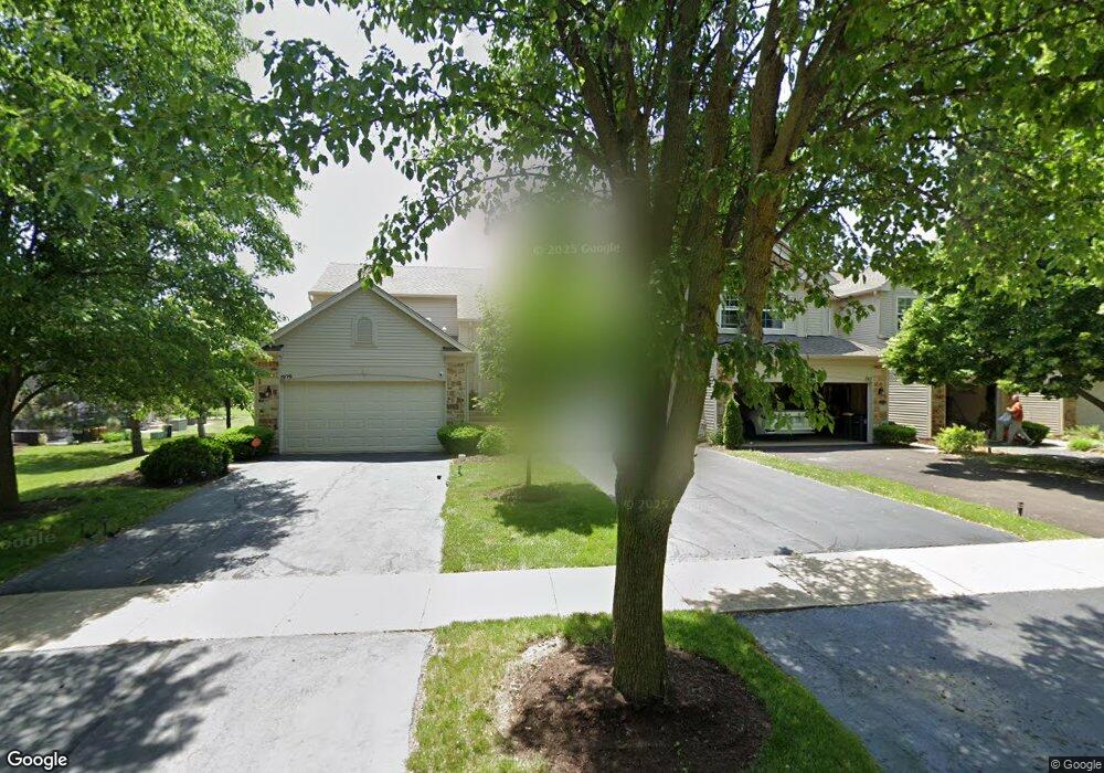
1923 Keating Dr Unit 2 Aurora, IL 60503
Far Southeast NeighborhoodEstimated Value: $284,367 - $326,000
2
Beds
2
Baths
1,572
Sq Ft
$192/Sq Ft
Est. Value
About This Home
This home is located at 1923 Keating Dr Unit 2, Aurora, IL 60503 and is currently estimated at $301,122, approximately $191 per square foot. 1923 Keating Dr Unit 2 is a home located in Kendall County with nearby schools including The Wheatlands Elementary School, Bednarcik Jr. High School, and Oswego East High School.
Ownership History
Date
Name
Owned For
Owner Type
Purchase Details
Closed on
Nov 17, 2005
Sold by
Foley Gail R and Preston Gail R
Bought by
Foley Gail R and Foley Deboris
Current Estimated Value
Purchase Details
Closed on
Apr 24, 2003
Sold by
Mfllc Wheatland
Bought by
Preston Gail R
Home Financials for this Owner
Home Financials are based on the most recent Mortgage that was taken out on this home.
Original Mortgage
$161,542
Outstanding Balance
$70,009
Interest Rate
5.87%
Mortgage Type
FHA
Estimated Equity
$231,113
Create a Home Valuation Report for This Property
The Home Valuation Report is an in-depth analysis detailing your home's value as well as a comparison with similar homes in the area
Home Values in the Area
Average Home Value in this Area
Purchase History
| Date | Buyer | Sale Price | Title Company |
|---|---|---|---|
| Foley Gail R | -- | -- | |
| Preston Gail R | $167,000 | -- |
Source: Public Records
Mortgage History
| Date | Status | Borrower | Loan Amount |
|---|---|---|---|
| Open | Preston Gail R | $161,542 |
Source: Public Records
Tax History
| Year | Tax Paid | Tax Assessment Tax Assessment Total Assessment is a certain percentage of the fair market value that is determined by local assessors to be the total taxable value of land and additions on the property. | Land | Improvement |
|---|---|---|---|---|
| 2024 | $5,563 | $73,609 | $12,421 | $61,188 |
| 2023 | $4,909 | $65,141 | $10,992 | $54,149 |
| 2022 | $4,909 | $59,762 | $10,084 | $49,678 |
| 2021 | $4,530 | $54,329 | $9,167 | $45,162 |
| 2020 | $4,584 | $54,329 | $9,167 | $45,162 |
| 2019 | $4,792 | $55,251 | $9,167 | $46,084 |
| 2018 | $4,337 | $50,255 | $8,338 | $41,917 |
| 2017 | $4,169 | $46,318 | $7,685 | $38,633 |
| 2016 | $4,548 | $43,903 | $7,284 | $36,619 |
| 2015 | $4,460 | $41,418 | $6,872 | $34,546 |
| 2014 | -- | $40,212 | $6,672 | $33,540 |
| 2013 | -- | $40,618 | $6,739 | $33,879 |
Source: Public Records
Map
Nearby Homes
- 1875 Keating Dr
- 1874 Keating Dr
- 1871 Keating Dr
- 1868 Keating Dr
- 1859 Keating Dr
- 1855 Keating Dr
- 1830 Canyon Creek Dr
- 1850 Wisteria Dr Unit 343
- 1900 Canyon Creek Dr
- 1715 Baler Ave
- 1738 Baler Ave
- 1733 Baler Ave
- 1853 Baler Ave
- 1959 Misty Ridge Ct Unit 15
- 2100 Hammel Ave
- 1740 Baler Ave
- 1966 Congrove Dr
- 1745 Baler Ave
- 1733 Stable Ln
- 2013 Lyndhurst Ln Unit 2
- 1917 Keating Dr Unit 3
- 1905 Keating Dr Unit 5
- 1929 Keating Dr Unit 1
- 1917 Keating Dr Unit 1917
- 1911 Keating Dr Unit 4
- 1839 Wisteria Dr Unit 3
- 1843 Wisteria Dr Unit 62
- 1831 Wisteria Dr Unit 285
- 1847 Wisteria Dr Unit 281
- 1830 Misty Ridge Ln Unit 3
- 1830 Misty Ridge Ln
- 1822 Misty Ridge Ln Unit 1
- 1834 Misty Ridge Ln Unit 4
- 1826 Misty Ridge Ln Unit 2
- 1904 Sedgewood Ave Unit 4
- 1892 Sedgewood Ave Unit 1
- 1908 Sedgewood Ave Unit 5
- 1900 Sedgewood Ave Unit 3
- 1842 Misty Ridge Ln Unit 2
- 1838 Misty Ridge Ln Unit 1
Your Personal Tour Guide
Ask me questions while you tour the home.