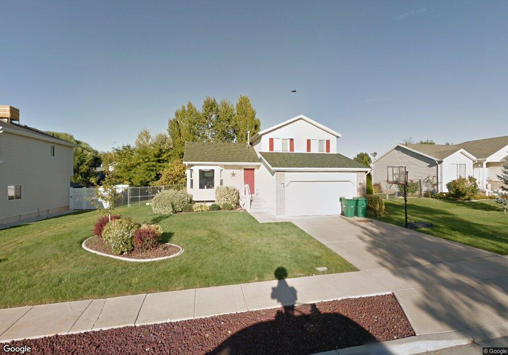
1923 N 150 W Layton, UT 84041
Estimated Value: $433,347 - $477,000
3
Beds
1
Bath
1,362
Sq Ft
$332/Sq Ft
Est. Value
About This Home
This home is located at 1923 N 150 W, Layton, UT 84041 and is currently estimated at $452,837, approximately $332 per square foot. 1923 N 150 W is a home located in Davis County.
Ownership History
Date
Name
Owned For
Owner Type
Purchase Details
Closed on
Aug 27, 1997
Sold by
The Adams Company
Bought by
Hogan Chad C and Hogan Cindy C
Current Estimated Value
Home Financials for this Owner
Home Financials are based on the most recent Mortgage that was taken out on this home.
Original Mortgage
$128,732
Outstanding Balance
$19,109
Interest Rate
7.43%
Mortgage Type
FHA
Estimated Equity
$433,728
Create a Home Valuation Report for This Property
The Home Valuation Report is an in-depth analysis detailing your home's value as well as a comparison with similar homes in the area
Home Values in the Area
Average Home Value in this Area
Purchase History
| Date | Buyer | Sale Price | Title Company |
|---|---|---|---|
| Hogan Chad C | -- | Backman Stewart Title Servic |
Source: Public Records
Mortgage History
| Date | Status | Borrower | Loan Amount |
|---|---|---|---|
| Open | Hogan Chad C | $128,732 |
Source: Public Records
Tax History Compared to Growth
Tax History
| Year | Tax Paid | Tax Assessment Tax Assessment Total Assessment is a certain percentage of the fair market value that is determined by local assessors to be the total taxable value of land and additions on the property. | Land | Improvement |
|---|---|---|---|---|
| 2025 | $2,070 | $217,250 | $101,220 | $116,030 |
| 2024 | $1,982 | $209,550 | $117,989 | $91,561 |
| 2023 | $1,974 | $368,000 | $140,713 | $227,287 |
| 2022 | $2,038 | $206,250 | $74,266 | $131,984 |
| 2021 | $1,908 | $288,000 | $103,826 | $184,174 |
| 2020 | $1,719 | $249,000 | $87,509 | $161,491 |
| 2019 | $1,664 | $236,000 | $83,247 | $152,753 |
| 2018 | $1,517 | $216,000 | $83,247 | $132,753 |
| 2016 | $1,405 | $103,235 | $26,501 | $76,734 |
| 2015 | $1,325 | $92,400 | $26,501 | $65,899 |
| 2014 | $1,229 | $87,617 | $26,501 | $61,116 |
| 2013 | -- | $98,590 | $26,884 | $71,706 |
Source: Public Records
Map
Nearby Homes