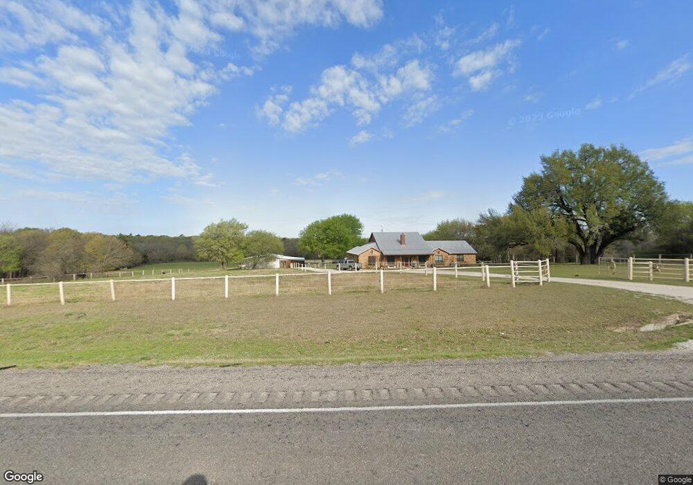
1923 N Fm 51 Decatur, TX 76234
Estimated Value: $697,000 - $855,000
4
Beds
3
Baths
3,432
Sq Ft
$229/Sq Ft
Est. Value
About This Home
This home is located at 1923 N Fm 51, Decatur, TX 76234 and is currently estimated at $786,940, approximately $229 per square foot. 1923 N Fm 51 is a home located in Wise County with nearby schools including Decatur High School and Victory Christian Academy.
Ownership History
Date
Name
Owned For
Owner Type
Purchase Details
Closed on
Jan 27, 2015
Sold by
Brazeau Samuel
Bought by
Peck Brayden
Current Estimated Value
Home Financials for this Owner
Home Financials are based on the most recent Mortgage that was taken out on this home.
Original Mortgage
$351,000
Outstanding Balance
$269,533
Interest Rate
3.83%
Mortgage Type
New Conventional
Estimated Equity
$517,407
Purchase Details
Closed on
Sep 2, 2004
Sold by
Flanagan Jimmy and Flanagan Kathryn
Bought by
Peck Brayden
Purchase Details
Closed on
Oct 23, 2001
Sold by
Bishop Scott
Bought by
Peck Brayden
Purchase Details
Closed on
Jan 31, 1997
Bought by
Peck Brayden
Create a Home Valuation Report for This Property
The Home Valuation Report is an in-depth analysis detailing your home's value as well as a comparison with similar homes in the area
Home Values in the Area
Average Home Value in this Area
Purchase History
| Date | Buyer | Sale Price | Title Company |
|---|---|---|---|
| Peck Brayden | $351,000 | None Available | |
| Peck Brayden | -- | -- | |
| Peck Brayden | -- | -- | |
| Peck Brayden | -- | -- |
Source: Public Records
Mortgage History
| Date | Status | Borrower | Loan Amount |
|---|---|---|---|
| Open | Peck Brayden | $351,000 |
Source: Public Records
Tax History Compared to Growth
Tax History
| Year | Tax Paid | Tax Assessment Tax Assessment Total Assessment is a certain percentage of the fair market value that is determined by local assessors to be the total taxable value of land and additions on the property. | Land | Improvement |
|---|---|---|---|---|
| 2025 | $10,150 | $833,378 | $260,293 | $573,085 |
| 2024 | $10,150 | $833,378 | $260,293 | $573,085 |
| 2023 | $10,029 | $830,143 | $260,293 | $569,850 |
| 2022 | $11,032 | $718,965 | $225,386 | $493,579 |
| 2021 | $9,474 | $591,010 | $169,790 | $421,220 |
| 2020 | $8,865 | $549,470 | $149,810 | $399,660 |
| 2019 | $9,305 | $541,510 | $149,810 | $391,700 |
| 2018 | $9,118 | $513,690 | $128,370 | $385,320 |
| 2017 | $8,240 | $464,190 | $104,120 | $360,070 |
| 2016 | $7,379 | $414,690 | $82,820 | $331,870 |
| 2015 | -- | $405,890 | $75,130 | $330,760 |
| 2014 | -- | $298,560 | $9,770 | $288,790 |
Source: Public Records
Map
Nearby Homes
- Lot 12 Cedar Springs Estates
- TBD E Hwy 380 Hwy
- 362 Decatur Cemetery Rd
- 2811 N Trinity St
- 3092 N Trinity St
- 307 E Vernon St
- 114 Sondra Lin Blvd
- 903 N Miller St
- 602 N Cates St
- 802 N Church St
- 700 N Church St
- 1952 Old Decatur Rd
- 304 Cyndilu Ln
- 506 E Main St
- TBD Farm To Market 51
- 130 Nicholas Way
- 165 Quail Ridge Ct
- 305 E Shoemaker St
- 175 Quail Ridge Ct
- 1 S Martin Extension
- 1903 N Fm 51
- 115 County Road 2112
- Lot 1 Pr 2218
- 1893 N Fm 51
- 170 County Road 2112
- 260 Private Road 2219
- 1946 N Fm 51
- 1946 N Fm 51
- 0 S Fm 51 Unit 20392889
- 0 S Fm 51 Unit 11203506
- 1891 N Fm 51
- 1990 N Fm 51
- 628 Greenwood Rd
- 624 Greenwood Rd
- 622 Greenwood Rd
- 618 Greenwood Rd
- 2519 County Road 2224
- 1960 N Fm 51
- 620 Old Greenwood Rd
- 1846 N Fm 51