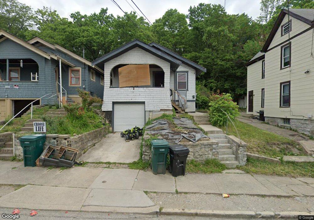
1923 State Ave Cincinnati, OH 45204
South Fairmount NeighborhoodEstimated Value: $68,000 - $87,000
2
Beds
1
Bath
792
Sq Ft
$98/Sq Ft
Est. Value
About This Home
This home is located at 1923 State Ave, Cincinnati, OH 45204 and is currently estimated at $77,339, approximately $97 per square foot. 1923 State Ave is a home located in Hamilton County with nearby schools including Oyler School, Robert A. Taft Information Technology High School, and Gilbert A. Dater High School.
Ownership History
Date
Name
Owned For
Owner Type
Purchase Details
Closed on
Feb 10, 2023
Sold by
Goodin Gods Eyes Llc
Bought by
Goodin Sandie J
Current Estimated Value
Purchase Details
Closed on
Oct 26, 2018
Sold by
Goodin Sandie J
Bought by
Goodin Gods Eyes Llc
Purchase Details
Closed on
Mar 22, 2011
Sold by
Fannie Mae
Bought by
Goodin Sandie J
Purchase Details
Closed on
Jan 12, 2011
Sold by
Maiden David
Bought by
Fannie Mae
Purchase Details
Closed on
Jun 21, 1994
Sold by
Lynn Pauline
Bought by
Maiden David
Create a Home Valuation Report for This Property
The Home Valuation Report is an in-depth analysis detailing your home's value as well as a comparison with similar homes in the area
Home Values in the Area
Average Home Value in this Area
Purchase History
| Date | Buyer | Sale Price | Title Company |
|---|---|---|---|
| Goodin Sandie J | -- | -- | |
| Goodin Gods Eyes Llc | -- | None Available | |
| Goodin Sandie J | $3,000 | Nova Title Agency Inc | |
| Fannie Mae | $14,000 | Attorney | |
| Maiden David | -- | -- |
Source: Public Records
Mortgage History
| Date | Status | Borrower | Loan Amount |
|---|---|---|---|
| Closed | Maiden David | $0 |
Source: Public Records
Tax History Compared to Growth
Tax History
| Year | Tax Paid | Tax Assessment Tax Assessment Total Assessment is a certain percentage of the fair market value that is determined by local assessors to be the total taxable value of land and additions on the property. | Land | Improvement |
|---|---|---|---|---|
| 2024 | $816 | $12,744 | $1,579 | $11,165 |
| 2023 | $967 | $12,744 | $1,579 | $11,165 |
| 2022 | $462 | $6,426 | $1,274 | $5,152 |
| 2021 | $667 | $6,426 | $1,274 | $5,152 |
| 2020 | $669 | $6,426 | $1,274 | $5,152 |
| 2019 | $496 | $6,426 | $1,274 | $5,152 |
| 2018 | $7 | $3,854 | $1,274 | $2,580 |
| 2017 | $6 | $3,854 | $1,274 | $2,580 |
| 2016 | $84 | $1,030 | $711 | $319 |
| 2015 | $76 | $1,030 | $711 | $319 |
| 2014 | $76 | $1,030 | $711 | $319 |
| 2013 | $78 | $1,051 | $725 | $326 |
Source: Public Records
Map
Nearby Homes
- 1900 State Ave
- 1708 State Ave
- 2182 Grand Ave
- 2691 Lehman Rd
- 2680 Lehman Rd
- 1641 Westwood Ave
- 2281 Northside Ave
- 2165 Clara St
- 2169 Clara St
- 2173 Clara St
- 1699 Westwood Ave
- 1724 Esmonde St
- 1599 Tremont St
- 1730 Esmonde St
- 1741 Westwood Ave
- 1132 Dayton St
- 1757 Westwood Ave
- 1115 Dayton St
- 1113 Bank St
- 1723 Montrose St